Farafangana
Farafangana is a city (commune urbaine) on the south-east coast of Madagascar and capital of the Atsimo-Atsinanana region.
Farafangana | |
|---|---|
City | |
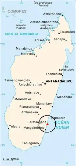 Location of Farafangana | |
| Country | Madagascar |
| Region | Atsimo-Atsinanana |
| Area | |
| • Total | 27.0 km2 (10.4 sq mi) |
| Elevation | 1 m (3 ft) |
| Population (2018 census) | |
| • Total | 34,676 |
| • Density | 1,300/km2 (3,300/sq mi) |
| Time zone | UTC+3 (EAT) |
| postal code | 309 |
| Climate | Af |
| Website | www |
Location
Farafangana is the capital of the region Atsimo-Atsinanana located approximately 400 kilometres south of the capital Antananarivo. It is at the southern end of the Canal des Pangalanes,[1] with the mouth of the Manampatrana River located on the north side of the town. It is 106km south of Manakara, about 2.5 hours travel time away.[2]
Settlements located to the north include Lokandambo, Manambotra, Ambahikarabo and Amboahangimamy, with Ambalolo to the west. To the south are Antananabo, Manambotra Atsimo and Marosondry.[3]
Economy
There is an airport in Farafangana (Farafangana Airport). One of the main crops in the region is pepper.[4]
Education
Farafangana has a university.[5]
Tourism
The Manombo Reserve is located at 25 km to Farafangana.[6]
Roads
- National Road RN 12 from Irondro/Mananjary to Vangaindrano in the South.
Sports
- Dato Farafangana FC is the local football club.
See also
References
- Madagascar & Comoros, p. 232 (Lonely Planet, 2008)
- Madagascar 2014-2015 Petit Futé, p. 249 (2013)
- "Redirect to /World/MA/02/Farafangana.HTML".
- (in French) www.commerce.gov.mg Archived 2013-03-24 at the Wayback Machine
- centre universitaire à Farafangana
- "travalmadagascar.org". Archived from the original on 2020-03-27. Retrieved 2013-03-25.
Capital: Farafangana | ||
| Befotaka Sud (6) - 307 |  | |
| Farafangana (30) - 309 |
| |
| Midongy-Atsimo (6) - 318 | ||
| Vangaindrano (28) - 320 | ||
| Vondrozo (16) - 322 | ||
5 districts; 86 communes | ||