Farmer, North Carolina
Farmer is an unincorporated community in Randolph County, North Carolina, United States.
Farmer, North Carolina | |
|---|---|
 Location of Farmer in North Carolina  Farmer, North Carolina (the United States) | |
| Coordinates: 35°39′12″N 79°58′37″W | |
| Country | United States |
| State | North Carolina |
| County | Randolph |
| Elevation | 538 ft (164 m) |
| Time zone | UTC-5 (Eastern (EST)) |
| • Summer (DST) | UTC-4 (EDT) |
| Area code | 336 |
| GNIS feature ID | 1011180[1] |
| Other name | Former[1] |
It is located off NC 49, southwest of the highway's intersection with U.S. 64 in Asheboro.
Very little is known about the place, since it is an unincorporated community
There is no flag here, because i don't know.
References
- U.S. Geological Survey Geographic Names Information System: Farmer, North Carolina. Retrieved on 2008-05-04.
Municipalities and communities of Randolph County, North Carolina, United States | ||
|---|---|---|
| Cities | 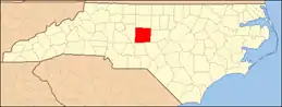 | |
| Towns | ||
| Unincorporated communities | ||
| Footnotes | ‡This populated place also has portions in an adjacent county or counties | |
This article is issued from Wikipedia. The text is licensed under Creative Commons - Attribution - Sharealike. Additional terms may apply for the media files.