Galdames
Galdames (Basque pronunciation: [ɡaldames̺]) is a valley, town and municipality located in the province of Biscay, in the autonomous community of Basque Country, northern Spain.
Galdames | |
|---|---|
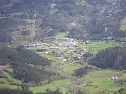 View from Serantes | |
 Coat of arms | |
 Galdames Location of Galdames within the Basque Country | |
| Coordinates: 43°15′18″N 3°5′47″W | |
| Country | Spain |
| Autonomous community | Basque Country |
| Province | Biscay |
| Comarca | Enkarterri |
| Government | |
| • Alcalde | Carlos Avellanal Villanueva (EAJ-PNV) |
| Area | |
| • Total | 44.36 km2 (17.13 sq mi) |
| Elevation | 166 m (545 ft) |
| Population (2018)[1] | |
| • Total | 829 |
| • Density | 19/km2 (48/sq mi) |
| Demonym | galdamestarra |
| Time zone | UTC+1 (CET) |
| • Summer (DST) | UTC+2 (CEST) |
| Postal code | 48191 |
| Official language(s) | Basque, Spanish |
| Website | Official website |
Main sights are Santa Maria Magdalena and Arenaza caves, both situated in Triano mountain range and the latter containing stalactites and rest of mining operations. Medieval Tower of Loizaga is located in Concejuelo ward, nowadays site of a museum of classic automobiles.[2]
Neighborhoods
Galdames is administratively divided into 8 neighborhoods or wards:[3]
- Atxuriaga (La Aceña).
- Concejuelo.
- Humaran.
- Larrea.
- Montellano.
- San Esteban Galdames.
- San Pedro Galdames.
- Txabarri.
History
The town of Galdames was first mentioned in a document dating to 1214. During the Middle Ages, Galdames was the home of various important lords and their families. The towers of the local Loizaga, Atxurriaga and Larrea people bear witness to this.
The Council of Galdames claimed the right to be a member of the Lordship of Biscay, which it received in 1672. In 1740 the council separated from the Lordship of Biscay before rejoining in 1800.
During the First Carlist War, the followers of Baldomero Espartero burned the forests surrounding San Pedro Galdames. From the 19th to mid-20th centuries, the town prospered due to the mineral wealth located beneath the valley.
In 1946, a group of Maquis returned from the Cantabrian mountains to Bizkaia and constructed a sheltered in the cave of Uraiaga and the surrounding mines.[4]
Demography
| 1897 | 1900 | 1910 | 1920 | 1930 | 1940 | 1950 | 1960 | 1970 | 1981 | 1991 | 2001 | 2006 |
|---|---|---|---|---|---|---|---|---|---|---|---|---|
| 2,310 | 2,886 | 3,856 | 3,854 | 3,335 | 3,022 | 2,312 | 1,892 | 1,249 | 812 | 799 | 799 | 813 |
References
- Municipal Register of Spain 2018. National Statistics Institute.
- Ainhoa Arozamena & Manu Castaño. "Auñamendi Encyclopedia: Galdames" (in Spanish). Eusko Ikaskuntza. Retrieved 27 June 2010.
- Euskaltzaindia. "Euskal Onomastikaren Datutegia (EODA): Galdames" (in Basque). Euskaltzaindia. Retrieved 27 June 2010.
- Makiak Boluetan (1946)
