Gar County
Gar County (Tibetan: སྒར་རྫོང་།, Wylie: sgar rdzong, ZYPY: Gar Zong; simplified Chinese: 噶尔县; traditional Chinese: 噶爾縣; pinyin: Gá'ěr Xiàn),[lower-alpha 1] formerly Senge Tsangpo County,[2] is a district (county) in the Ngari Prefecture[3] of the western Tibet Autonomous Region of China. The main town is Shiquanhe, also called "Gar", on account of being the county seat, and "Ali", on account of being the seat of Ngari Prefecture.[4][lower-alpha 2]
Gar County
噶尔县 • སྒར་རྫོང་། Senge Tsangpo County | |
|---|---|
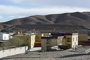 PLA emblem on the hill near Shiquanhe | |
.png.webp) Location of Gar County within Tibet Autonomous Region | |
| Coordinates (Gar County government): 32°29′32″N 80°05′48″E | |
| Country | People's Republic of China |
| Autonomous region | Tibet |
| Prefecture | Ngari Prefecture |
| Seat | Shiquanhe (Gar) |
Geography
Main rivers in the county include Sênggê Zangbo and Gar Zangbo.
| Climate data for Shiquanhe (1981–2010 normals) | |||||||||||||
|---|---|---|---|---|---|---|---|---|---|---|---|---|---|
| Month | Jan | Feb | Mar | Apr | May | Jun | Jul | Aug | Sep | Oct | Nov | Dec | Year |
| Record high °C (°F) | 6.4 (43.5) |
9.5 (49.1) |
14.5 (58.1) |
15.7 (60.3) |
20.5 (68.9) |
25.2 (77.4) |
32.1 (89.8) |
26.4 (79.5) |
23.7 (74.7) |
16.7 (62.1) |
12.7 (54.9) |
7.1 (44.8) |
32.1 (89.8) |
| Average high °C (°F) | −4.1 (24.6) |
−2.0 (28.4) |
2.3 (36.1) |
7.4 (45.3) |
12.6 (54.7) |
18.1 (64.6) |
21.5 (70.7) |
20.5 (68.9) |
16.3 (61.3) |
8.2 (46.8) |
2.9 (37.2) |
−1.6 (29.1) |
8.5 (47.3) |
| Daily mean °C (°F) | −12.0 (10.4) |
−9.2 (15.4) |
−4.8 (23.4) |
0.1 (32.2) |
5.1 (41.2) |
10.7 (51.3) |
14.4 (57.9) |
13.8 (56.8) |
9.3 (48.7) |
0.5 (32.9) |
−5.7 (21.7) |
−10.1 (13.8) |
1.0 (33.8) |
| Average low °C (°F) | −19.7 (−3.5) |
−16.9 (1.6) |
−12.6 (9.3) |
−7.9 (17.8) |
−2.7 (27.1) |
3.1 (37.6) |
7.7 (45.9) |
7.5 (45.5) |
2.0 (35.6) |
−8.0 (17.6) |
−14.8 (5.4) |
−18.2 (−0.8) |
−6.7 (19.9) |
| Record low °C (°F) | −36.6 (−33.9) |
−30.2 (−22.4) |
−25.3 (−13.5) |
−17.9 (−0.2) |
−11.2 (11.8) |
−6.6 (20.1) |
−0.6 (30.9) |
−0.4 (31.3) |
−10.0 (14.0) |
−17.0 (1.4) |
−23.5 (−10.3) |
−32.9 (−27.2) |
−36.6 (−33.9) |
| Average precipitation mm (inches) | 1.6 (0.06) |
1.2 (0.05) |
1.4 (0.06) |
1.3 (0.05) |
2.9 (0.11) |
3.7 (0.15) |
21.4 (0.84) |
23.8 (0.94) |
5.7 (0.22) |
2.0 (0.08) |
0.3 (0.01) |
1.1 (0.04) |
66.4 (2.61) |
| Average relative humidity (%) | 36 | 33 | 31 | 29 | 30 | 31 | 39 | 43 | 36 | 27 | 24 | 31 | 33 |
| Source: China Meteorological Administration[5][6] | |||||||||||||
Transport
Notes
- An alternative spelling is Gaer County.[1]
- "Ali" is a Chinese spelling for Ngari.
References
- China's National Population in the 2000 Census. Publishing House of Minority Nationalities. 2003. ISBN 978-7-105-05425-1.
- Dorje, Gyurme (1999), Footprint Tibet Handbook with Bhutan (2nd ed.), Bath: Footprint Handbooks, p. 355, ISBN 0-8442-2190-2 – via archive.org
- "Scenery of Burang County in Ngari Prefecture, Tibet". Xinhua News Agency. 2020-12-08.
- Buckley, M. (2012). Tibet. Bradt Guides. Bradt Travel Guides. p. 334. ISBN 978-1-84162-382-5.
- 中国气象数据网 - WeatherBk Data (in Chinese (China)). China Meteorological Administration. Retrieved 2020-04-16.
- "55228: Shiquanhe (China)". ogimet.com. OGIMET. 27 March 2022. Retrieved 28 March 2022.
External links
- Gar County, OpenStreetMap, retrieved 18 September 2022.
| County-level divisions |  | |
|---|---|---|
| Towns and villages | ||
| Geography | ||
| Landmarks | ||
This article is issued from Wikipedia. The text is licensed under Creative Commons - Attribution - Sharealike. Additional terms may apply for the media files.