Kokshetau
Kokshetau (Kazakh: Көкшетау, romanized: Kökşetau; [kɵkʂʲetɑw] (![]() listen), lit. 'Blueish Mountain/Smoky-Blue Mountain'; Russian: Кокшета́у, IPA: [kəkʂɛtaʊ]), formerly known as Kokchetav (Russian: Кокчета́в, [kəktɕʲetav]; the official name between 1868 and 1993) is a lakeside city in northern Kazakhstan and the capital of Akmola Region, which stretches along the southern shore of Lake Kopa, lying in the north of Kokshetau Hills, a northern subsystem of the Kokshetau Uplands (Saryarka) and the southern edge of the Ishim Plain. It is named after the Mount Kokshe. Earlier, it was the administrative center of Kokshetau Region, which was abolished in 1997. It is also situated at the junction of the Trans-Kazakhstan and South Siberian railways. Kokshetau lies at an elevation of approximately 234 m (768 ft) above sea level.
listen), lit. 'Blueish Mountain/Smoky-Blue Mountain'; Russian: Кокшета́у, IPA: [kəkʂɛtaʊ]), formerly known as Kokchetav (Russian: Кокчета́в, [kəktɕʲetav]; the official name between 1868 and 1993) is a lakeside city in northern Kazakhstan and the capital of Akmola Region, which stretches along the southern shore of Lake Kopa, lying in the north of Kokshetau Hills, a northern subsystem of the Kokshetau Uplands (Saryarka) and the southern edge of the Ishim Plain. It is named after the Mount Kokshe. Earlier, it was the administrative center of Kokshetau Region, which was abolished in 1997. It is also situated at the junction of the Trans-Kazakhstan and South Siberian railways. Kokshetau lies at an elevation of approximately 234 m (768 ft) above sea level.
Kokshetau
| |
|---|---|
| Official Cyrillic transcription(s) | |
| • Kazakh Cyrillic | Көкшетау |
| • Russian Cyrillic | Кокшета́у |
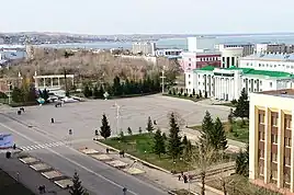
Skyline of Kokshetau with the city's central Ablai Khan Square in the foreground Historical center of Kokshetau | |
 Coat of arms | |
| Nickname: | |
| Anthem: none | |
 Kokshetau Location of Kokshetau in Kazakhstan  Kokshetau Kokshetau (Asia) | |
| Coordinates: 53°17′N 69°23′E | |
| Country | |
| Region | Akmola Region |
| Founded | 19th century (29 April 1824) |
| City status since | 1895 |
| Government | |
| • Akim (mayor) | Bauyrzhan Gaisa[1][2] |
| Area | |
| • City and administrative centre of Akmola Region | 234 km2 (90 sq mi) |
| • Urban | 425 km2 (164 sq mi) |
| Elevation | 234 m (768 ft) |
| Population | |
| • City and administrative centre of Akmola Region | 150,649 |
| • Rank | 18th in Kazakhstan 1st in Akmola Region |
| • Density | 624/km2 (1,620/sq mi) |
| • Urban | 165,153 |
| Demonym(s) | Көкшетаулық (kk) Кокшетауцы (ru) Кокшетауец (ru, male) Кокшетаука (ru, female) |
| Demographics (2022 est.)[5] | |
| • Kazakhs | 59.34% |
| • Russians | 28.38% |
| • Ukrainians | 2.75% |
| • Tatars | 2.22% |
| • Germans | 1.98% |
| • Poles | 1.35% |
| • Ingush | 1.06% |
| • Other | 2.92% |
| Time zone | UTC+06:00 (ALMT) |
| Postal code | 020000–020010 |
| Area code | +7-7162 |
| Vehicle registration | 03 (region) (before 2012: C – on older plates) |
| Sister cities | Waukesha, Wisconsin |
| Climate | BSk |
| Highways | |
| International airports | Kokshetau (KOV) |
| Major railway stations | |
| KATO ID | 111010000[6] |
| Website | www.kokshetau.kz |

It has 150,649 inhabitants (2022 est.), up from 123,389 (1999 census), while Akmola Region had a total population of 738,587 (2019 est.), down from 1,061,820 (1989 census), making it the tenth most populous region in Kazakhstan.[7] The city's history has been influenced by people of many nations and religions. Kokshetau retains multiethnic population, with 59% ethnic Kazakhs (up from 36%), the rest being mostly 28% ethnic Russians (down from 42%) and other ethnic groups such as Ukrainians, Tatars and Germans. Kokshetau City Administration (area of 425 km2 [164 sq mi]), with a population of roughly 165,153 residents, includes one settlement administration (which consists of the work settlement of Stantsyonny) and the Krasnoyarsk rural district, which includes two rural settlements (the villages of Krasny Yar and Kyzyl-Zhuldyz).
The city is considered to have been founded in 1824 as a military fortress, while it was granted city status in 1895. It was the centre of Kokshetau Region, which was abolished in 1997. It is well known for its nature and tourist sites, such as Burabay and Zerendi, among others. The city's main football team is FC Okzhetpes. Kokshetau is about 185 km (115 mi) from Petropavl, 300 km (190 mi) northwest of the national capital Astana along the A1, 318 km (198 mi) from Omsk along the A13, and 384 km (239 mi) from Kostanay. The city is served by Kokshetau Airport (KOV).
Kokshetau is an important economic, educational, and cultural centre of the Akmola Region. Attractions in and around Kokshetau include Akmola Regional Museum of History and Local Lore, Bukpa Hill, Kokshetau City Park, Kokshetau City History Museum, Museum of Literature and Art. The northwest entrance to Burabay National Park (Kazakh: Burabai memlekettık ūlttyq tabiği parkı) and Burabay spa town is a little over 43 miles (70 km) from Kokshetau. Kokshetau was awarded the title Kazakhstan City of Culture for the year 2021.[8]
Names and etymology
- English: Kokshetau
- Kazakh: Көкшетау, romanized: Kökşetau [kɵkʂʲetɑw] (
 listen)
 - Russian: Кокшета́у, romanized: Kokshetau Russian pronunciation: [kəkʂɛtaʊ]
The name Kokshetau (Kazakh: Kökşetau; pronounced [køkɕetɑw]) is of Kazakh origin literally meaning a (lit. 'smoky-blue mountain'), kokshe / "көкше", meaning (lit. 'blueish') and tau / "тау", meaning (lit. 'mountain') — the name of always turning blue, as if in a deep haze of mountains, thus "Blueish Mountain/Smoky-Blue Mountain" in English. That is how from ancient times Kazakhs were calling the highest mountain in Akmola Region "Mount Kokshe" (947 m), located 60 miles away from the city.
Following the collapse of the Soviet Union, Kazakhstan declared its independence on 16 December 1991 (Kazakhstan Independence Day), and on 7 October 1993, by the Resolution of the Presidium of the Supreme Council of the Republic of Kazakhstan, the city of Kokchetav (Russian: Кокчета́в, IPA: [koktɕɪˈtav]) was renamed to the more Kazakh sounding Kokshetau as part of the government's campaign to apply Kazakh names to cities, but the city's airport still retains KOV as its IATA code. In Russian it became known as Kokshetau.
Chronology of name changes
Historically, several names in various languages have identified Kokshetau.
- Stanitsa Kokchetavskaya (1827–1868; which is a romanized back-transliteration from Russian name in Cyrillic: стани́ца Кокчетавская; Kazakh: Көкшетау бекінісі, lit. 'The village of Kokshetau')
- Kokchetav (1868–1993; in publications dating from the Soviet period, the city name was occasionally spelled in English as "Kokchetav", which is a back-transliteration from post-revolution Russian name in Cyrillic: Кокчета́в, Russian name in Cyrillic script (1868-1918): Кокчѣтавъ; Kazakh name in Yañalif script (1929-1940): Kɵkşetau, Kazakh name in Cyrillic script (after 1940): Көкшетау)
- Kokshetau (since 1993; which is a romanized back-transliteration from Russian name in Cyrillic: Кокшета́у; Kazakh name in Cyrillic script: Көкшетау, Kazakh name in Latin script (new version before 2021): Kókshetaý, Kazakh name in Latin script (latest version of the Kazakh Latin alphabet after 2021): Kökşetau)
Physical geography and geology
Location

Kokshetau is located in the country of Kazakhstan and lies in the northern portion of Akmola Region. The city is located on the border of the West Siberian Plain, on the southeastern shore of Lake Kopa, at an altitude of 234 meters above sea level, in the Kokshetau Mountains, north part of the Kokshetau Hills, the foothills of which surround the city from the south and west. It covers an area of 234 km2 (90 sq mi). It is located about 300 kilometres (190 mi) north-west of the national capital of Astana.
The city lay along low hills and by a kidney-shaped lake. There are numerous hills in the vicinity of the city (Bukpa Hill). The city is located in the flat part of the interfluve of the Kylshakty river, flowing in the eastern part of the city, and the Shagalaly river, flowing from the western side of the city. The city has several parks and gardens. Also, within the city limits can be found small forests, mostly consisting of birches and pine plantations. The Kokshetau area is known for its two national parks, Burabay and Kokshetau.
Time
The time offset from the UTC used by Kokshetau is 6 hours after UTC, or UTC+6:00 (ALMT). This is also used by most of Kazakhstan. This time apply throughout the year as Kazakhstan does not observe Daylight saving time (DST).
Administrative districts and microdistricts

Kokshetau is divided into seven administrative districts.
- Listed alphabetically
- Aul
- Beybitshilik
- Bostandyk
- Bukpa
- Kokshe
- Sary-Arka
- Zhaylau
Districts
Traditionally, Kokshetau was divided into seventeen administrative microdistricts (Kazakh: шағын аудан) that today have no administrative function:
 | ||
| English name | Kazakh name | Russian name |
|---|---|---|
| City Centre | Қала орталығы | Центр города |
| Barmashino | Бармашино | Бармашино |
| Abylai Khan Avenue | Абылай хан даңғылы | Проспект Абылай-хана |
| Regional hospital | Облыстық аурухана | Областная больница |
| Birlik | Бірлік | Бирлик |
| Saryarka | Сарыарқа | Сарыарка |
| Sunkar | Сұнқар | Сункар |
| Koktem | Көктем | Коктем |
| Vasilkov | Васильков | Васильковский |
| Town of builders | Құрылысшылар қаласы | Городок строителей |
| Railway Station | Вокзал | Вокзал |
| Jubilee | Юбилейный | Юбилейный |
| Khassenov Market | Хасен базары | Хасеновский рынок |
| Central | Орталық | Центральный |
| Zhaylau | Жайлау | Жайлау |
| Shanghai | Шанхай | Шанхай |
Administrative-Territorial Division
Kokshetau is the capital of the Akmola Region. Kokshetau city administration (Kazakh: Kökşetau qalasy äkımdıgı, Russian: Городская администрация Кокшетау) (area of 425 km2 [164 sq mi]), with a population of roughly 165 153 residents, includes one settlement administration and the Krasnoyarsk rural district, which includes two rural settlements. On the eastern side of Abai Qunanbaiuly Street sits the Akmola Regional Akimat, in a modern cream and brown-toned building. Kokshetau was the centre of a region covering seventy-eight thousand square kilometres of the Virgin Lands; it administered 15 agricultural districts and connected 4 other towns, 116 state farms, and 25 collective farms, and that region encompassed a population of more than 600,000.
| No. | Populated place | Population | KATO ID |
|---|---|---|---|
| 1 | selo of Krasny Yar | 111033100 | |
| 2 | p.g.t of Stantsyonny | 111037100 | |
| 3 | selo of Kyzylzhulduz | 111033300 |
List of akims (mayors) of Kokshetau (1992–present)
The Akim (Kazakh: әкім, äkım) of Kokshetau is the chief authority in the city of Kokshetau. The position was established in 1992.
| Name | Took office | Left office | |
|---|---|---|---|
| 1 | Aidar Murzin | 1992 | 1996 |
| 2 | Kairbek Kusainov | 1996 | 1997 |
| 3 | Kamaltin Mukhamedzhanov | 1997 | 1998 |
| 4 | Valery Nabitovsky | 1998 | 1999 |
| 5 | Askar Khassen | 1999 | 2001 |
| 6 | Erkesh Bayakhmetov | 2001 | 2003 |
| 7 | Dauren Adilbekov | 2004 | 2004 |
| 8 | Rashit Akimov | 2004 | 2007 |
| 9 | Andrey Nikishov | 2007 | 2008 |
| 10 | Bakhyt Saparov | 2008 | 2010 |
| 11 | Munarbek Batyrkhanov | 2010 | 2013 |
| 12 | Zharkyn Zhumagulov | 2013 | 2014 |
| 13 | Zhomart Nurgaliev | 2014 | 2014 |
| 14 | Ermek Marzhikpaev | 2015 | 2019 |
| 15 | Amangeldy Smailov | 2019 | 2021 |
| 16 | Bauyrzhan Gaisa | 2021 | Present |
Climate
According to the Köppen climate classification, Kokshetau lies in a cold semi-arid climate zone (Köppen climate classification: BSk) with extreme continental influences. The city has an extreme continental climate with long, very cold, frigid, snowy, dry winters and warm, dry, sunny summers (featuring occasional brief rain showers). Winter is frosty and long (more than 5 months). In spring, prevails clear and dry weather, with a large number of sunny days. Autumn begins in August or September, and the weather is observed from clear at the beginning of the season, to cloudy in October–November. The average annual temperature in Kokshetau is 3.6 °C (38.5 °F). Summer temperatures occasionally reach 35 °C (95 °F) while −30 to −35 °C (−22 to −31 °F) is not unusual between mid-December and early March.
The warmest month is July with daily mean temperature near 20.5 °C (68.9 °F), and the coldest month is January, with a daily mean of −14 °C (7 °F). Snow and ice are dominant during the winter season. July is the wettest month (averaging 68.5 mm (2.7 in) of precipitation) while March is the driest (averaging 10.5 mm (0.4 in) of precipitation). Yearly precipitation amounts to 313 mm (12.3 in). Typically, the city's Lake Kopa and rivers of Kylshakty and Shagalaly are frozen over between the second week of November and the beginning of April.
| Climate data for Kokshetau (1991–2020, extremes 1925–present) | |||||||||||||
|---|---|---|---|---|---|---|---|---|---|---|---|---|---|
| Month | Jan | Feb | Mar | Apr | May | Jun | Jul | Aug | Sep | Oct | Nov | Dec | Year |
| Record high °C (°F) | 4.0 (39.2) |
6.6 (43.9) |
18.7 (65.7) |
30.3 (86.5) |
35.5 (95.9) |
40.1 (104.2) |
39.2 (102.6) |
37.7 (99.9) |
35.0 (95.0) |
25.0 (77.0) |
16.5 (61.7) |
6.0 (42.8) |
40.1 (104.2) |
| Average high °C (°F) | −10.3 (13.5) |
−8.8 (16.2) |
−1.2 (29.8) |
10.5 (50.9) |
19.6 (67.3) |
24.3 (75.7) |
25.2 (77.4) |
23.6 (74.5) |
17.3 (63.1) |
9.1 (48.4) |
−2.2 (28.0) |
−8.1 (17.4) |
8.3 (46.9) |
| Daily mean °C (°F) | −14.3 (6.3) |
−13.2 (8.2) |
−5.7 (21.7) |
5.1 (41.2) |
13.5 (56.3) |
18.6 (65.5) |
19.6 (67.3) |
17.8 (64.0) |
11.8 (53.2) |
4.7 (40.5) |
−5.6 (21.9) |
−11.7 (10.9) |
3.4 (38.1) |
| Average low °C (°F) | −18.8 (−1.8) |
−18.0 (−0.4) |
−10.5 (13.1) |
−0.2 (31.6) |
6.9 (44.4) |
12.1 (53.8) |
13.8 (56.8) |
12.0 (53.6) |
6.4 (43.5) |
0.6 (33.1) |
−9.2 (15.4) |
−15.7 (3.7) |
−1.7 (28.9) |
| Record low °C (°F) | −42.2 (−44.0) |
−42.0 (−43.6) |
−45.0 (−49.0) |
−26.1 (−15.0) |
−8.9 (16.0) |
−5.7 (21.7) |
2.0 (35.6) |
−2.2 (28.0) |
−10.5 (13.1) |
−26.0 (−14.8) |
−42.6 (−44.7) |
−44.0 (−47.2) |
−45.0 (−49.0) |
| Average precipitation mm (inches) | 13 (0.5) |
11 (0.4) |
13 (0.5) |
20 (0.8) |
27 (1.1) |
42 (1.7) |
69 (2.7) |
43 (1.7) |
23 (0.9) |
22 (0.9) |
19 (0.7) |
15 (0.6) |
317 (12.5) |
| Average precipitation days (≥ 0.1 mm) | 3.7 | 3.4 | 3.0 | 4.2 | 6.5 | 6.5 | 8.5 | 7.3 | 5.5 | 6.2 | 4.3 | 3.3 | 62.4 |
| Mean monthly sunshine hours | 89 | 127 | 196 | 227 | 277 | 306 | 313 | 250 | 190 | 118 | 88 | 75 | 2,256 |
| Source 1: Pogoda.ru.net[9] | |||||||||||||
| Source 2: NOAA (sun and precipitation days 1961–1990)[10] | |||||||||||||
History
Omsk Oblast 1827–1838
∟ part of the Russian Empire
∟ part of the Russian Empire
Siberian Kirghiz Oblast 1854–1868
∟ part of the Russian Empire
∟ part of the Russian Empire
Alash Autonomy 1917–1918
Kirghiz Territory 1919–1920
∟ part of the Russian SFSR
Kirghiz ASSR 1920–1922
∟ autonomous part of the Russian SFSR
∟ part of the Russian SFSR in the USSR
∟ part of the Russian SFSR in the USSR
Soviet Kazakhstan 1936–1991
∟ constituent republic of the Soviet Union
Kazakhstan 1991–present
Kokshetau past incorporates all the main stages and turning points of the history of Kazakhstan. For many centuries, nomadic Kazakh tribes lived on the territory of the former Kokshetau Region. The territory of Kokshetau was part of the Middle Horde, the clans of the tribal union of the Argyns that occupied vast regions of Northern and Central Kazakhstan.[11] In the 18th – 19th centuries, the headquarters of famous khans, such as Abylai Khan, Kasym Khan, Kenesary Khan, were located on the land of Kokshetau Region.
As Russia's hand stretched southwards, Kokshetau was initially founded on 29 April 1824 as an administrative outpost at the foot of the southern side of Mount Kokshe on the shores of Lake Ulken Shabakty.[12] The Middle Horde signed treaties of protection with Russia. The local population strongly opposed the fact that the new settlement was placed in the chosen place. In the summer of 1827, the district order was transferred to the new place where the city of Kokshetau is now located. The settlement began to be called Kokchetav. The construction of the settlement began at the foot of Bukpa Hill, on the southern shores of Lake Kopa, and a picket was set up to protect the district order.[13]
By the middle of 19th-century, the population of the settlement was significantly increasing due to the migration of the peasants from Russia (Povolzhye) and Ukraine who were driven to migrate by starvation and poverty to farm the steppe. In 1868, when the Akmolinsk Oblast was formed, Kokshetau became a district city in this region, which further developed as a center of agricultural and animal husbandry and as a resort town. In 1876, the city lost its military significance. The line and fortress were abolished. In 1895, Kokshetau was granted city status.[14] By that time the population in the town was above 5 thousand people.[15]
In 1928, Kokshetau District was divided into several boroughs and until 1944 Kokshetau's territory was part of Karaganda Region and later part of North Kazakhstan Region. On 16 March 1944, according to the Decree of the Presidium of Supreme Soviet of Kazakh SSR, Kokshetau became the administrative center of the newly created Kokchetav Oblast. Relatively rapid growth and development of Kokshetau took place during the years of development of virgin lands, especially in the second half of the 1950s.[16] In the spring of 1997, Kokshetau Oblast was abolished, the city was deprived of the status of a regional center. On 8 April 1999, after Akmola and North Kazakhstan regions were reorganized, Kokshetau became the center of Akmola Region.[17]
_-_1890_(panoramic_view%252C_Aqmola_Region%252C_Kazakhstan).jpg.webp) A 19th-century panorama view looking into the city of Kokshetau before rebuilding as seen from the Bukpa Hill Lookout. The Lake Kopa is visible to the left, and the St George's Church to the right.
A 19th-century panorama view looking into the city of Kokshetau before rebuilding as seen from the Bukpa Hill Lookout. The Lake Kopa is visible to the left, and the St George's Church to the right. General plan of Kokchetav stanitsa, 19th century
 Map of Kokchetav uezd in the late 19th century
 A 19th-century view of the city
 An 1880 image of Bukpa Hill in the background
.jpg.webp) Market Square (modern-day Abylai Khan Square) in the late 19th early 20th century
Market Square (modern-day Abylai Khan Square) in the late 19th early 20th century%252C_Kazakhstan.jpg.webp) 1916: Military hospital in Kokchetav
1916: Military hospital in Kokchetav
Demographics
| Year | Pop. | ±% |
|---|---|---|
| 2010 | 136,100 | — |
| 2011 | 137,217 | +0.8% |
| 2012 | 136,835 | −0.3% |
| 2013 | 139,063 | +1.6% |
| 2014 | 140,847 | +1.3% |
| 2015 | 142,411 | +1.1% |
| 2016 | 145,795 | +2.4% |
| 2017 | 145,531 | −0.2% |
| 2018 | 145,789 | +0.2% |
| 2019 | 145,161 | −0.4% |
| 2020 | 146,104 | +0.6% |
| 2021 | 148,550 | +1.7% |
| 2022 | 150,649 | +1.4% |
| Source: Population size may be affected by changes in administrative divisions. Kokshetau, Kazakhstan: Historical statistics – Population[18] | ||
Kokshetau is the eighteenth-largest city in Kazakhstan. Kokshetau is an ethnically and culturally diverse city. Kokshetau ranks fourth in terms of population in Northern Kazakhstan, ranking after Pavlodar, Kostanay and Petropavl. It has changed its demographics, nowadays having more ethnic Kazakhs in a city that formerly had a Slavic majority. It is the only regional center in Northern Kazakhstan where Kazakhs make up the majority. Despite Kokshetau's Kazakh majority, Russian is the dominant language in the city. It is also common to find the Kazakh being spoken in the city, mainly by Kazakhs and other Turkic people. Residents of Kokshetau are referred to as "көкшетаулықтар" (kökşetaulyqtar) in Kazakh and "кокшета́уцы" (kokshetautsy) in Russian.
Histogram of population evolution of Kokshetau from 1959.
| 1897 | 1959 | 1970 | 1979 | 1989 | 1991 | 1999 | 2004 | 2005 | 2006 | 2007 | 2008 | 2009 |
|---|---|---|---|---|---|---|---|---|---|---|---|---|
| 4,962 | 52,909 | 80,564 | 103,162 | 136,757 | 143,300 | 123,389 | 123,640 | 125,455 | 127,317 | 129,244 | 131,215 | 135,106 |
| 2010 | 2011 | 2012 | 2013 | 2014 | 2015 | 2016 | 2017 | 2018 | 2019 | 2020 | 2021 | 2022 |
| 136,100 | 137,217 | 136,835 | 139,063 | 140,847 | 142,411 | 145,795 | 145,531 | 145,789 | 145,161 | 146,104 | 148,550 | 150,649 |
Note: 2020 and 2018 are population estimates; 1897 is the Russian Imperial Census; 1959, 1970, 1979 and 1989 are the Soviet Census.
Ethnic and national composition
As of January 2022, the population of Kokshetau is 150,649, and the extended urbanized area has 165,153 inhabitants.
Historically, Kokshetau was ethnically diverse. As of the 2020 Census, ethnic Kazakhs made up (~58%) of the city population, representing an increase from 36% in 1999. The ethnic makeup of the city's population as of year 2020 was:[19]
|
|
In 1989, Kokshetau had a population of 136,757. The ethnic mix was about 18.5% Kazakh, 54.5% Russian and 27.0% other ethnic groups.
| Ethnicity | Number | Percentage |
|---|---|---|
| Russians | 74,481 | 54.5% |
| Kazakhs | 25,300 | 18.5% |
| Others | 36,976 | 27.0% |
Religion
.jpg.webp) Presbyterian Worship Centre
Presbyterian Worship Centre
Kokshetau is one of the most religiously diverse cities of Kazakhstan. Islam (primarily Sunni Islam) is the predominant religion within Kokshetau, with 56.65% of residents identifying as Muslims in the 2009 Census. There were 83,436 Muslims reported in the 2009 census. Kokshetau's first Mosque was established by Ablay (Abilkhair) Gabbas in 1846.
Other religions practiced are Christianity (primarily Russian Orthodox, Roman Catholicism, and Protestantism).[21] Christianity is Kokshetau's second largest religion. There were 60,168 Christians reported in the 2009 census. Much of Kokshetau's civic life and civil society is secular in the sense that it has no religious character.
Kokshetau has a mosque constructed in the beginning of the 20th century and a Russian Orthodox Church temple of Archangel Michael. The Kokshetau and Akmola diocese is located in the Church of the Resurrection in the city. In 1997, a Roman Catholic Church was built in neo-Gothic style using red bricks. A new mosque for 1,200 people named after Nauan Hazrat opened in 2015.
Mosques:
- Nauan Hazrat Mosque (capacity 1,200—1,400), located at the corner of Momishuly and Auelbekov streets. It is the largest mosque in Akmola Region.
- Zhakiya Kazhi Mosque
Russian Orthodox churches:
- Church of the Resurrection, Kokshetau (capacity 1,500), (ROC)
- Church of the Holy Archangel Michael, Kokshetau, (ROC)
- St George's Church, Kokshetau. Kokshetau's first Christian Church.
Roman Catholic churches:
Culture
Theatres
Kokshetau has a strong theater culture.
- From the central Abylai Khan Square, pedestrianised Kanysh Satbayev Street runs south a couple of blocks to the Palace of Culture (opened in 1977), which also incorporates Akmola Regional Russian Drama Theater
- Akmola Regional Kazakh Music and Drama Theatre named after Shahhmet Kussainov (opened in 1996)
- Children's puppet theater "Altyn Saka" (opened in 2022)
Philharmonic
- Akmola Regional Philharmonic named after Ükılı Ybyrai was founded in 1956.
Museums
- Akmola Regional Museum of History and Local Lore (opened in 1920) offers a display of minerals and semi-precious stones in the foyer, and rooms on the ground floor devoted to palaeontology and to World War II, the latter focused on displays related to local war heroes.
- Kokshetau City History Museum (KCHM; opened as Valerian Kuybyshev’s Memorial Museum in 1949),[22] located at the a street on a hillside. The wooden house of the museum is where Valerian Kuybyshev, one of the Revolution’s most famous heroes, had grown up. The house is surrounded by trees, with a stable or coach-house at the back and a particular memorial tree planted by his mother in 1903 in memory of Valerian’s brother, accidentally shot and killed by a friend. This little museum initially was dedicated to a really tough revolutionary. As a boy Valerian Kuybyshev had started taking part in the anti-tsarist movement and then in the days of the Bolshevik struggle had led troops against the White Guards in the Civil War, he was one of those revolutionaries in the true spirit of the Revolution. There were also Amangeldi Imanov and Alibi Dzhangildin who are national heroes of the Central Asian uprising in 1916.
- Museum of Mercy and Courage (opened in 1982)
- Museum of Literature and Art (opened in 1989)
- Museum of the Hero of the Soviet Union Malik Gabdullin (opened in 1993), located at the corner of Auelbekov and Nazarbayev streets, on the eastern side of the town centre, the modern-looking two-storey wooden building. Malik Gabdullin was born in 1915, in a village 30 km away from Kokshetau. When he was made a Hero of the Soviet Union in 1943, the authorities constructed for his family a larger and nicer wooden house adjacent to this, but his pious father donated the wood from this building to efforts to reconstruct the Kokshetau Mosque, when the latter was damaged by fire in 1956.
Cinemas
The first film screening in the city of Kokchetav (now Kokshetau) took place in 1910.
- Cinema Alem (formerly known as the Druzhba Cinema; it was built in 1963, and as of 2023 was still being used as a cinema). It is located in Independence Square and is currently the largest cinema in the city.
Libraries
The city has 12 libraries. In addition to the libraries affiliated with the various universities and schools, the Akmola Regional Universal Scientific Library is a major research library. There are several archives in Kokshetau.
- Akmola Regional Universal Scientific Library (ARUSL) named after Magzhan Zhumabayev. ARUSL was inaugurated in 1946.
Monuments and memorials
- The statue of Shoqan Walikhanov who had been a traveller, scientist, geographer, and one of the first Kazakh democrat, a tall handsome figure in a granite officer's greatcoat. He had been an officer in the tsar's army and was supposed to be a descendent of Genghis Khan himself, no less. His grandfather Abylai Khan had been called the last Khan of the Kazakh Khanate.
- On the west side of the Abylai Khan Square there is a statue of Abylai Khan, depicted squatting regally, his right hand on his hip in a display of relaxed strength. Behind the Kazakh ruler rises a very tall stalk of wheat, on the tip of which a bird is flying.
- In the central park there is also a statue of Vladimir Lenin, standing next to a simple Soviet monument to the Kazakhstnis killed in the Civil War; it was removed from the central square.
- A bust of Talgat Bigeldinov, a pilot who notched up 305 combat missions, shot down seven enemy aircraft and was twice made Hero of the Soviet Union, is followed by a series of polished stones inscribed with he names of the Hero Cities of the Soviet Union. These run for two blocks, ending up at the War Memorial. A young flag-bearing soldier kneels before an eternal flame. Behind him rises peculiar silvery sculpture of a star with a point missing. The portraits of local war heroes are presented on the surrounding wall, in alphabetical order, starting with Talgat Bigeldinov.
- In the centre of the city, just in front of the Akmola Regional Museum of History and Local Lore, an inscription on a wall-like monument records a decree of the Presidium of the Supreme Soviet of the USSR from 1958, awarding Kokshetau Oblast the Order of Lenin by virtue of its success in surpassing the yearly plan for bread production.
- There is also a statue of a young, rathe studently-looking Valerian Kuybyshev, a Bolshevik military commander during the Civil War and key figure behind the first Five-Year Plan, who gave his name to the city of Samara during the Soviet period.
Economy
Kokshetau has traditionally been an important commercial center in northern Kazakhstan, but after the collapse of the Soviet Union most of the old manufacturing lines, whose markets included the entire Soviet Union, either stopped working or had to greatly reduce their operations. The collapse of the Soviet Union also meant the collapse of Kazakhstan's industrial base.
Nevertheless, the city continues to be an important regional center for the Akmola Region, acting as a commercial hub for the surrounding areas in the region. In recent years, the city has started attracting more investment from various corporations. Kokshetau Oblast had really started developing as the machine factories and other industries grew, and the numerous rest homes, sanatoria, and holiday spots were set up.
Large industrial enterprises of Kokshetau include: gold mining enterprise JSC "Altyntau Kokshetau"; JSC "Tynys" – the production of medical products, weighing equipment, water meters, aircraft units and assemblies, polyethylene pipes; machine-building plant OJSC "KamAZ-Engineering"; JSC "Kokshetau Mineral Waters".[23] Food factories supply Kokshetau and Akmola Region with sausages, semi-finished meat products, bread, dairy products, and confectionery. The city also has a gold recovery factory and a new ceramic brick factory.
From Ekibastuz to Kokshetau runs an overhead power line designed for a transmission voltage of 1,150 kV, the Ekibastuz-Kokshetau powerline.[24] Kokshetau's retail business is growing with several newly built malls and shopping centres.
Healthcare
Local hospitals include the Avicenna Medical Centre, Viamedis Rehabilitation Centre among many others.[25]
Media
Kokshetau is the center of television and radio broadcasting in Akmola Region. All major Kazakhstani newspapers are active in Kokshetau. There are local TV stations, the Internet, and print media. The city has a developed telecommunications system.
Newspapers
Kokshetau's first newspaper was the weekly Tselinnyy kray, established in 1920, which would change its name to the Akmolinskaya Pravda in 1992. In the city, there are some popular urban newspapers. Akmolinskaya Pravda, Stepnoy mayak and Kokshetau are Russian-language media headquartered in the city. Akmolinskaya Pravda is the oldest newspaper of the city.
- Regional socio-political newspaper "Akmolinskaya Pravda" is a long-running daily local paper, with local and regional coverage.
- Republican newspaper "Bukpa"
- Regional newspaper "Arka Azhary"
- Regional newspaper "Stepnoy mayak"
TV and radio
Kokshetau television networks:
- Local television news is covered by TV channel Kazakhstan–Kokshetau
- Balapan
- Cartoon Network
- Channel One Eurasia
- Channel 31
- Disney Channel
- Euronews
- Gakku TV
- Khabar 24
- MTV
- Nickelodeon
- Qazsport
Kokshetau radio stations:
- "Kazakh Radio": 101.0 FM
- "Russian Radio Asia": 102.0 FM
- "Autoradio Kazakhstan": 102.5 FM
- "Shalkar Radio": 103.7 FM
- "Europe Plus Kazakhstan": 104.2 FM
- "Energy FM": 104.8 FM
- "Radio NS": 105.7 FM
- "Zhuldyz FM": 106.1 FM
- "Radio Dacha": 106.5 FM
- "People's Radio": 107.0 FM
- "Tengri FM": 107.6 FM
Transport
 Main entrance to Kokshetau Railway Station, designed by V. Utebekov as viewed from vokzal alañy, 1992
 Façade of terminal building and apron area of the Kokshetau Airport (IATA/ICAO: KOV/UACK) near Akkol
 A full cloverleaf interchange near Kokshetau
Partly due to its location, Kokshetau is a major transport hub on the highway and rail networks.
City transport
The city transport in Kokshetau consists of a network of buses, minibuses (marshrutka) and taxis that are available 24 hours a day. Public transport in Kokshetau is heavily privatized and mostly handled by private operators. In the square between the bus and railway stations gather a range of taxis and minibuses offering to take you to Astana or Petropavl. Buses in the city cost ₸80-₸120.
Railway
The city is an important railroad hub in the northern part of Kazakhstan. Kokshetau Railway station is served by the Kazakhstan Railways, which links Petropavl to Almaty. The first train pulled into the Kokshetau Railway station on 2 June 1922. Railways are Kokshetau's one of the main modes of intracity and suburban transportation. Kazakhstan Railways (who manage the station) provide freight and passenger traffic to and from Kokshetau.
There are two railway stations in the city: Kokshetau-1 and Kokshetau-2. The main railway station Kokshetau-1 station is located 1.3 km (0.81 mi) north-east from the centre of Kokshetau and includes a main building (built in 1981) and some other technical buildings. Kokshetau-1 station is the city's main station and a major stop for numerous passenger trains traveling between Petropavl and the other regions of Kazakhstan each day.[30] The popular Tulpar-Talgo service to Almaty takes sixteen hours. It sits at the eastern end of the long Abai Qunanbaiuly Street, Kokshetau's central thoroughfare. A tall concrete clock tower guides you to it.
Among the trains passing Kokshetau-1 station are the daily services between Almaty and Petropavl, Kyzylorda and Petropavl, and Karaganda and Kostanay. There are also less frequent trains passing northwards on to various Russian destinations, including Moscow, Yekaterinburg and Omsk, and local electric train services to Ereymentau and Astana.
Intercity buses
Kokshetau Central Bus Terminal (Kökşetau avtobeketı), which opened in 1981, serves the city of Kokshetau. The bus station is on the Vernadsky Street 8 across the road from Kokshetau Railway Station. It links the city with the villages in Akmola Region and other cities in Kazakhstan and the neighboring countries. Frequent schedules of bus routes connect Kokshetau to Astana, Petropavl,[31] Zerenda, Burabay, Karaganda, Pavlodar, Kostanay, Omsk, Yekaterinburg, Tobolsk, Tyumen and Kurgan. Many of these are cross-country services operating from north to south, for which Kokshetau provides interchange facilities.
Air travel
Kokshetau and surrounding communities are served by one commercial international airport: Kokshetau International Airport (IATA: KOV, ICAO: UACK), which is the seventeenth-busiest airport (2019) by passenger traffic in Kazakhstan. It is located 12.5 km (7.8 mi) north-east from the centre of city, on the route to Omsk, and used to be the headquarters of now-defunct Air Kokshetau.[32][33] The airport has a capacity of handling 200 passengers per hour. The Kokshetau International Airport, which opened in 1945, was significantly upgraded in 2013 with a new 2850-metre runway capable of accommodating all aircraft types without any restrictions.[34][35] In 2013, the airport received its first scheduled flight after the renovation to Moscow, Russia. The airport can be reached by car, public transport, or taxi. Seasonal flights to Frankfurt am Main, were available in 2004 but have been cancelled since. It serves mostly domestic flights. SCAT Airlines fly to and from Almaty, Aktau and Turkistan as well as FlyArystan operates three weekly flights to Almaty.[36][37] The former largest carrier of the Kokshetau Airport — Air Kokshetau — is not serving any regular destinations as of 2021.
Highways
The main roads to/from Kokshetau are:
- The city is served by the A1, which begins in Petropavl (189 km [117 mi]) and leads to Astana (292 km [181 mi]) passing Kokshetau, Shchuchinsk and Makinsk.[38] European route
 intersect in Kokshetau;
 - The A13, which connects Kokshetau to Omsk (Russia). Kokshetau is located a couple of hours' drive south of Russia's Siberian border;
Other major roads passing through Kokshetau include:
- The R11 highway connects Kokshetau to Kostanay (via the M36);[39]
- The R12 highway connects Kokshetau to Atbasar
Architecture
 Historical building (1904) in the centre of Kokshetau.
 Panorama to the historical center of Kokshetau.
 Soviet-style residential area buildings in Kokshetau.
Squares
- The city centres on a large and bare Abylai Khan Square, at the intersection of Abai Qunanbaiuly and Kanysh Satbayev streets.
- Independence Square
Old Town
West of the centre many attractive single-storey log-built houses survive, usually featuring painted wooden shutters. A couple of particularly fine examples, both enjoying official recognition as historical monuments, are the whitewashed wooden cottage at 22 Kenesary Khan Kasymuly Street, at the corner of Abai Qunanbaiuly Street, with intricate carving at the base of the roof, and the cottage at 33 Felix Dzerzhinsky Street. The latter sits opposite a small Kokshetau City History Museum (32 Kanay-bi Street), itself housed in a single-storey wooden building.
Landmarks
The city is full of numerous buildings and monuments that reflect its rich and diverse history. The architecture of Kokshetau has been shaped through its history by the progression of historical eras. Many buildings of Kokshetau are ranged from a different number of architectural styles.
Historical architecture
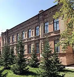
The architecture of the city dates back to 19th century, the city had numerous wooden buildings with elaborate decor. Kokshetau is the home of a unique architectural tradition and community with number of historical buildings in city. There are a number of two-story wooden houses in the city built mostly in the middle of the 20th century as temporary habitations. Among other notable buildings are the mansions of the merchant Andrei Vasilievich Sokolov (late of the 19th century - beginning of the 20th century), the Akmola Regional Museum of History and Local Lore (beginning of the 20th century).
Soviet-era architecture
Industrialization in Kokshetau started in the late 1920s. The city's 3,000-worker Soviet construction trust built some of the large, gray, faceless apartment buildings that were so typical of Soviet society and still stand, often in disrepair, today. The apartments housed the trust's own construction workers, among others, in units of one to three rooms. The city’s apartment houses are called “Khrushchyovka” and “Stalinka” due to the peculiarities of architectural approaches in their construction.
Contemporary architecture
When the Iron Curtain was falling, but the Soviet Union still was intact, five citizens from the city paid a visit to Waukesha. Among them was then mayor of the city, Askar Khassen, who took the idea of building more single homes in Kokshetau, as comfortable as the homes in the US. On the hilly outskirts of Kokshetau, someone may find the fingerprint of Waukesha County. There are big, expensive, single-family homes. They're inching up the hills. In Kokshetau, the locals have a name for this high-priced neighborhood of single-family homes, "Small America" or "Khassen's Cottages". Prominently located at the opening of this housing development are tall brick pillars, a sign outlining location of lots, and a decorative brick wall, all reminiscent of the gated entries seen in some Waukesha County subdivisions.
When the Soviet Union crumbled and Kazakhstan became an independent country in 1991, the city's construction trust-turned-business began to put a face on their buildings.
Education
 One of the first schools in the city.
Kokshetau is a regional centre of education and has a large number of educational establishments, including universities, professional colleges and gymnasiums (high schools). Primary and secondary schools in Kokshetau include state-run and private institutions.
Pre-university education
Kokshetau has 34 (secondary education) schools, including 6 lyceums and 6 gymnasiums.
- Kokshetau Nazarbayev Intellectual School of Physics and Mathematics (NIS Kokshetau PhM) was established in 2009, as a branch of the Nazarbayev Intellectual Schools (NIS), a network of schools in Kazakhstan.[40][41]
- Kokshetau Bilim-Innovation Public Lyceum (former “Kazakh-Turkish Lyceum”) for gifted children.[42][43]
Institutions of higher education
The city is currently home to the following state higher educational institutions:
- Kokshetau State University (which is named after Shokan Ualikhanov), established 1962 — offers opportunities to study undergraduate, graduate and PhD programs in most fields. It is the biggest university in Kokshetau with 7,047 students and 499 academic staff.
- Kokshetau University (named after Abay Myrzakhmet), established 2000.
- Kokshetau Technical Institute of the Ministry of Emergency Situations of the Republic of Kazakhstan
- Kokshetau Academy of Economics and Management
A number of other non-state-funded institutions for further education operate in the city.
Sport
.jpg.webp) Okzhetpes Stadium is an outdoor stadium that is home to the FC Okzhetpes, 2005.
Okzhetpes Stadium is an outdoor stadium that is home to the FC Okzhetpes, 2005.
Sport has always been important in Kokshetau. Football and ice hockey are by far the most popular sports in the city. Kokshetau has many parks that provide excellent pitches for impromptu games. The city is home to the FC Okzhetpes football club, based in the Okzhetpes Stadium, and which has a capacity of 4,500, which participates in the Kazakhstan Premier League, the top division of football in Kazakhstan. In 2015 and 2018, they finished first place in the Kazakhstan First Division. A number of well-known athletes, both world and Olympics champions, are associated with the city.
Burabay Sports Complex serves as home arena to the ice hockey club Arlan Kokshetau, which competes in the Kazakhstan Hockey Championship.[44] Arlan Kokshetau hockey players were the champions of Kazakhstan in the season 2017/2018. Arlan Kokshetau players also became the first team from Kazakhstan to win IIHF Continental Cup in the season 2018/2019.[45][46] The city has an ice rink for winter sports. Several sports clubs are active in the city:
| Club | Sport | Current league | Founded | Stadium | Championships |
|---|---|---|---|---|---|
| Arlan Kokshetau | Ice Hockey | Kazakhstan Hockey Championship | 2009 |
Burabay Sports Complex[47] | 1 |
| FC Okzhetpes Kokshetau | Football | Kazakhstan Premier League | 1957 |
Okzhetpes Stadium | 0 |
Parks and recreation
Kokshetau is home to a large number of parks and recreation areas.
- Central Park, the city's largest and oldest park, established in 1957. It features a few run-down fairground rides, and discos on summer weekend evenings. From the park, the pedestrianised Bauyrzhan Momyshuly Street runs south.
- Revolution Fighters Park
Elikti
Elikti is a ski resort near Kokshetau, located on the slopes of Mount Elikti, at the elevation of 500 metres above sea level. The resort area is about 25 kilometres (16 mi) of Kokshetau city by the P11 road on the way from Kokshetau to Ruzayevka. It is popular for its mild climate, a large quantity of sunny days and a great amount of snow through the winter. Visitors can buy or rent any necessary skiing and snowboarding equipment.[48]
Recreation around Kokshetau
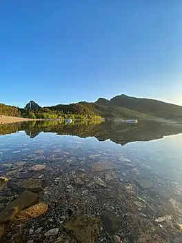
Around Kokshetau, there are numerous nearby freshwater lakes such as Lake Burabay, Lake Ulken Shabakty, Lake Kishi Shabakty, Lake Aiyrtau and the Lake Zerendi, which are popular among Kokshetau residents for recreation, swimming and watersports and can be quickly reached by car.


 Lake Kishi Shabakty
 Lake Aiyrtau
In art, literature, and popular culture
- The city was marked by the ethnographer and publicist Grigory Potanin, who visited it in the 1890s.
- Anastasia Tsvetayeva dedicated to the city the story in her famous and one of the best-known work Old Age and Youth, 1967 (Russian: Starost i molodost').
- The city was depicted and documented from a South African writer and leftist Alex La Guma's perspective in his book A Soviet Journey (1978), who visited it the in the late 1960s.
International relations
Twin towns – Sister cities
Kokshetau is twinned with:
Partner cities
Kokshetau has an official co-operation agreements (yntymaqtastyq turaly kelısım) with:
- Krasnoyarsk, Russian Federation (2022)[49]
Notable people
- Lazzate Maralbayeva (born 1951), French painter and architect
- Daryn Zhunussov (born 1991), ice dancer
- Bakhytzhan Kanapyanov (born 1951), poet and publisher
- Timur Dosmagambetov (born 1989), footballer
- Sultan Abilgazy (born 1997), footballer
- Anna Nurmukhambetova (born 1993), weightlifter
- Vedat Albayrak (born 1993), judoka
- Vladimir Niederhaus (born 1967), football official
- Alexandr Chervyakov (born 1980), biathlete
- Yevgeniy Gidich (born 1996), professional racing cyclist
- Gleb Brussenskiy (born 2000), professional cyclist
- Nikolay Kuibyshev (1893-1938), military leader
- Nikolay Ivanov (born 1971), cross-country skier
- Yevgeniya Voloshenko (born 1979), cross-country skier
- Mariya Grabovetskaya (born 1987), weightlifter
- Tatyana Osipova (born 1987), cross-country skier
- Mykhailo Burch (born 1960), footballer
- Yekaterina Babshuk (born 1991), footballer
- Pavel Dubitskiy (born 1982), athlete
- Sergey Kopytov (born 1965), weightlifter
- Anton Kuksin (born 1995), footballer
- Yevgeniy Meleshenko (born 1981), hurdler
- Nikolay Ozhegin (born 1971), judoka
- Yaroslava Yakushina (born 1993), boxer
See also
References and sources
- References
- Supported unanimously
- "New akim of Kokshetau appointed". 25 March 2021. Retrieved 25 October 2022.
- "Results Of The 2009 National Population Census Of The Republic Of Kazakhstan Analytical Report" (PDF). The Agency On Statistics of the Republic of Kazakhstan.
- "Birth and death rates in January-March 2010-2011". Archived from the original on 26 May 2011. Retrieved 22 October 2009.
- "Population of the Republic of Kazakhstan by individual ethnic groups at the beginning of 2020". Statistics Committee of the Ministry of National Economy of the Republic of Kazakhstan. Retrieved 28 April 2020.
- "KATO base". Statistics Committee of the Ministry of National Economy of the Republic of Kazakhstan. Retrieved 19 June 2017.
- "Cities and towns in Qаzаqstаn". Population Statistics. Retrieved 28 December 2022.
- "Kokshetau Named Cultural Capital of Kazakhstan in 2021". 20 May 2021. Retrieved 21 May 2021.
- "Weather and Climate – Climate of Kokshetau" (in Russian). Weather and Climate. Retrieved 8 November 2021.
- "Kokshetay (Kokshetau) Climate Normals 1961–1990". National Oceanic and Atmospheric Administration. Retrieved 8 November 2021.
- "The population of Kokshetau. Kazakhstan, the city of Kokshetau: population". Retrieved 21 December 2020.
- "Kokshetau: a beautiful 'Blue Mountain'". 14 May 2018. Retrieved 12 September 2022.
- Map of Kazakhstan Akmolinskaya Oblast 1868 Sibir Kirgizy
- "History of the town". Retrieved 21 December 2020.
- "Kokshetau: the area of blue lakes". 23 February 2017. Retrieved 21 December 2020.
- "Akmola region". Retrieved 21 December 2020.
- "Kokshetau city (Kokchetav) in Akmola Region, Kazakhstan". Retrieved 21 December 2020.
- Cities & towns of Kazakhstan
- "Population of the Republic of Kazakhstan by individual ethnic groups at the beginning of 2020". Stat.kz. Retrieved 6 August 2020.
- "Religious composition of the population of Kazakhstan in 2009". Archived from the original on 22 November 2021. Retrieved 22 July 2021.
- "Evangelical Lutheran Archbishop: Religious harmony in Kazakhstan means respecting our faith, respecting others'". 10 August 2018. Retrieved 12 September 2022.
- "Cultural Walk: Museum of Kokshetau's History".
- "Economy". Retrieved 16 January 2023.
- "Kazakhstan restores domestic flights with seven cities". Retrieved 25 October 2022.
- "Kazakh President pays visit to Viamedis Kokshetau clinical and rehabilitation center". Retrieved 2 April 2023.
- "Akimat of the city of Kokshetau". gov.kz.
- "Kokshetau TV".
- "Aqmola News".
- "Akmolinskaya Pravda".
- "North Kazakhstan improves tourism infrastructure". Retrieved 12 September 2022.
- "Electric Passenger Trains Launched from Astana to Karaganda, Kokshetau". Retrieved 12 September 2022.
- "Kazakh Airlines Overview Shows Four Major Airlines Dominating Market". Retrieved 12 September 2022.
- "Benin joins EU aviation blacklist". Retrieved 8 April 2009.
- "Reconstruction of Kokshetau Airport".
- "Government Works to Reform Civil Aviation". Retrieved 12 September 2022.
- "Turkish Airlines Launch Flights From Turkistan". Retrieved 12 September 2022.
- "Number of domestic subsidized flights and new air routes to be increased in Kazakhstan". Retrieved 25 October 2022.
- "Central Asia's Largest Bridge Crossing Unveiled in Pavlodar". Retrieved 12 September 2022.
- "Imantau: pearl of Blue Mountains in North Kazakhstan". Retrieved 12 September 2022.
- "Intellectual schools". Nazarbayev Intellectual Schools. Archived from the original on 13 October 2014. Retrieved 7 October 2014.
- "About School - Kokshetau Nazarbayev Intellectual School of Physics and Mathematics". Retrieved 7 January 2023.
- "International Educational Fund "BILIM-INNOVATION"". Retrieved 16 January 2023.
- "Kokshetau Bilim Innovation Public Lyceum". Retrieved 16 January 2023.
- "Arlan Hockey Club Wins Kazakhstan Cup for Second Consecutive Year". Retrieved 12 September 2022.
- "The Arlan Kokshetau players celebrate and staff celebrate the historic Continental Cup win". Retrieved 14 September 2022.
- "Belfast Giants beaten by Arlan Kokshetau in Continental Cup shootout". Retrieved 14 January 2019.
- ""Burabay" sport complex". Retrieved 28 September 2022.
- "Yelikti ski resort is perfect destination for beginner, expert skiers and snowboarders". Retrieved 12 September 2022.
- "Krasnoyarsk signed a memorandum of cooperation with the city of Kokshetau of the Republic of Kazakhstan". Krasnoyarsk - City Administration. 25 August 2022. Retrieved 27 August 2022.
- Sources
- Bureau of National Statistics: http://www.stat.gov.kz
External links
 Wikimedia Atlas of Kazakhstan
 Kokshetau travel guide from Wikivoyage
- Official web site (in Kazakh, Russian, and English)
- 360° QTVR fullscreen panoramas of the Kokshetau
- Visitaqmola.kz – Tourism website for Akmola Region (in Kazakh, Russian, and English)
 Geographic data related to Kokshetau at OpenStreetMap
| Geography | | |
|---|---|---|
| Transportation | ||
| Religious buildings | ||
| ||
Capital: Kokshetau | ||
| City Administration |  | |
| Districts | ||
| Major cities | ||