Mooroolbark railway station
Mooroolbark railway station is located on the Lilydale line in Victoria, Australia. It serves the eastern Melbourne suburb of Mooroolbark, and opened on 10 October 1887.[4]
Mooroolbark | |||||||||||||||||||||||||||||||||||||||||||||||||||||||||||||||||||||||||||||||||||||||||||||||||||||||||||||||||||||||||||||||||||||
|---|---|---|---|---|---|---|---|---|---|---|---|---|---|---|---|---|---|---|---|---|---|---|---|---|---|---|---|---|---|---|---|---|---|---|---|---|---|---|---|---|---|---|---|---|---|---|---|---|---|---|---|---|---|---|---|---|---|---|---|---|---|---|---|---|---|---|---|---|---|---|---|---|---|---|---|---|---|---|---|---|---|---|---|---|---|---|---|---|---|---|---|---|---|---|---|---|---|---|---|---|---|---|---|---|---|---|---|---|---|---|---|---|---|---|---|---|---|---|---|---|---|---|---|---|---|---|---|---|---|---|---|---|---|
| PTV commuter rail station | |||||||||||||||||||||||||||||||||||||||||||||||||||||||||||||||||||||||||||||||||||||||||||||||||||||||||||||||||||||||||||||||||||||
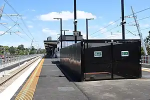 Westbound view from Platform 1 in November 2021 | |||||||||||||||||||||||||||||||||||||||||||||||||||||||||||||||||||||||||||||||||||||||||||||||||||||||||||||||||||||||||||||||||||||
| General information | |||||||||||||||||||||||||||||||||||||||||||||||||||||||||||||||||||||||||||||||||||||||||||||||||||||||||||||||||||||||||||||||||||||
| Location | Brice Avenue, Mooroolbark, Victoria 3138 Shire of Yarra Ranges Australia | ||||||||||||||||||||||||||||||||||||||||||||||||||||||||||||||||||||||||||||||||||||||||||||||||||||||||||||||||||||||||||||||||||||
| Coordinates | 37°47′05″S 145°18′45″E | ||||||||||||||||||||||||||||||||||||||||||||||||||||||||||||||||||||||||||||||||||||||||||||||||||||||||||||||||||||||||||||||||||||
| Owned by | VicTrack | ||||||||||||||||||||||||||||||||||||||||||||||||||||||||||||||||||||||||||||||||||||||||||||||||||||||||||||||||||||||||||||||||||||
| Operated by | Metro Trains | ||||||||||||||||||||||||||||||||||||||||||||||||||||||||||||||||||||||||||||||||||||||||||||||||||||||||||||||||||||||||||||||||||||
| Line(s) | Lilydale | ||||||||||||||||||||||||||||||||||||||||||||||||||||||||||||||||||||||||||||||||||||||||||||||||||||||||||||||||||||||||||||||||||||
| Distance | 34.38 kilometres from Southern Cross | ||||||||||||||||||||||||||||||||||||||||||||||||||||||||||||||||||||||||||||||||||||||||||||||||||||||||||||||||||||||||||||||||||||
| Platforms | 2 (1 island, elevated) | ||||||||||||||||||||||||||||||||||||||||||||||||||||||||||||||||||||||||||||||||||||||||||||||||||||||||||||||||||||||||||||||||||||
| Tracks | 2 | ||||||||||||||||||||||||||||||||||||||||||||||||||||||||||||||||||||||||||||||||||||||||||||||||||||||||||||||||||||||||||||||||||||
| Connections | |||||||||||||||||||||||||||||||||||||||||||||||||||||||||||||||||||||||||||||||||||||||||||||||||||||||||||||||||||||||||||||||||||||
| Construction | |||||||||||||||||||||||||||||||||||||||||||||||||||||||||||||||||||||||||||||||||||||||||||||||||||||||||||||||||||||||||||||||||||||
| Structure type | Elevated | ||||||||||||||||||||||||||||||||||||||||||||||||||||||||||||||||||||||||||||||||||||||||||||||||||||||||||||||||||||||||||||||||||||
| Parking | 364 | ||||||||||||||||||||||||||||||||||||||||||||||||||||||||||||||||||||||||||||||||||||||||||||||||||||||||||||||||||||||||||||||||||||
| Bicycle facilities | 8 | ||||||||||||||||||||||||||||||||||||||||||||||||||||||||||||||||||||||||||||||||||||||||||||||||||||||||||||||||||||||||||||||||||||
| Accessible | Yes—step free access | ||||||||||||||||||||||||||||||||||||||||||||||||||||||||||||||||||||||||||||||||||||||||||||||||||||||||||||||||||||||||||||||||||||
| Other information | |||||||||||||||||||||||||||||||||||||||||||||||||||||||||||||||||||||||||||||||||||||||||||||||||||||||||||||||||||||||||||||||||||||
| Status | Operational, premium station | ||||||||||||||||||||||||||||||||||||||||||||||||||||||||||||||||||||||||||||||||||||||||||||||||||||||||||||||||||||||||||||||||||||
| Station code | MLK | ||||||||||||||||||||||||||||||||||||||||||||||||||||||||||||||||||||||||||||||||||||||||||||||||||||||||||||||||||||||||||||||||||||
| Fare zone | Myki Zone 2 | ||||||||||||||||||||||||||||||||||||||||||||||||||||||||||||||||||||||||||||||||||||||||||||||||||||||||||||||||||||||||||||||||||||
| Website | Public Transport Victoria | ||||||||||||||||||||||||||||||||||||||||||||||||||||||||||||||||||||||||||||||||||||||||||||||||||||||||||||||||||||||||||||||||||||
| History | |||||||||||||||||||||||||||||||||||||||||||||||||||||||||||||||||||||||||||||||||||||||||||||||||||||||||||||||||||||||||||||||||||||
| Opened | 10 October 1887 | ||||||||||||||||||||||||||||||||||||||||||||||||||||||||||||||||||||||||||||||||||||||||||||||||||||||||||||||||||||||||||||||||||||
| Rebuilt | 19 November 2021 (LXRP) | ||||||||||||||||||||||||||||||||||||||||||||||||||||||||||||||||||||||||||||||||||||||||||||||||||||||||||||||||||||||||||||||||||||
| Electrified | November 1925 (1500 V DC overhead) | ||||||||||||||||||||||||||||||||||||||||||||||||||||||||||||||||||||||||||||||||||||||||||||||||||||||||||||||||||||||||||||||||||||
| Passengers | |||||||||||||||||||||||||||||||||||||||||||||||||||||||||||||||||||||||||||||||||||||||||||||||||||||||||||||||||||||||||||||||||||||
| 2005–2006 | 554,752[1] | ||||||||||||||||||||||||||||||||||||||||||||||||||||||||||||||||||||||||||||||||||||||||||||||||||||||||||||||||||||||||||||||||||||
| 2006–2007 | 591,674[1] | ||||||||||||||||||||||||||||||||||||||||||||||||||||||||||||||||||||||||||||||||||||||||||||||||||||||||||||||||||||||||||||||||||||
| 2007–2008 | 669,163[1] | ||||||||||||||||||||||||||||||||||||||||||||||||||||||||||||||||||||||||||||||||||||||||||||||||||||||||||||||||||||||||||||||||||||
| 2008–2009 | 793,851[2] | ||||||||||||||||||||||||||||||||||||||||||||||||||||||||||||||||||||||||||||||||||||||||||||||||||||||||||||||||||||||||||||||||||||
| 2009–2010 | 794,160[2] | ||||||||||||||||||||||||||||||||||||||||||||||||||||||||||||||||||||||||||||||||||||||||||||||||||||||||||||||||||||||||||||||||||||
| 2010–2011 | 797,232[2] | ||||||||||||||||||||||||||||||||||||||||||||||||||||||||||||||||||||||||||||||||||||||||||||||||||||||||||||||||||||||||||||||||||||
| 2011–2012 | 733,013[2] | ||||||||||||||||||||||||||||||||||||||||||||||||||||||||||||||||||||||||||||||||||||||||||||||||||||||||||||||||||||||||||||||||||||
| 2012–2013 | Not measured[2] | ||||||||||||||||||||||||||||||||||||||||||||||||||||||||||||||||||||||||||||||||||||||||||||||||||||||||||||||||||||||||||||||||||||
| 2013–2014 | 644,788[2] | ||||||||||||||||||||||||||||||||||||||||||||||||||||||||||||||||||||||||||||||||||||||||||||||||||||||||||||||||||||||||||||||||||||
| 2014–2015 | 639,963[1] | ||||||||||||||||||||||||||||||||||||||||||||||||||||||||||||||||||||||||||||||||||||||||||||||||||||||||||||||||||||||||||||||||||||
| 2015–2016 | 688,811[2] | ||||||||||||||||||||||||||||||||||||||||||||||||||||||||||||||||||||||||||||||||||||||||||||||||||||||||||||||||||||||||||||||||||||
| 2016–2017 | 652,036[2] | ||||||||||||||||||||||||||||||||||||||||||||||||||||||||||||||||||||||||||||||||||||||||||||||||||||||||||||||||||||||||||||||||||||
| 2017–2018 | 707,345[2] | ||||||||||||||||||||||||||||||||||||||||||||||||||||||||||||||||||||||||||||||||||||||||||||||||||||||||||||||||||||||||||||||||||||
| 2018–2019 | 722,154[2] | ||||||||||||||||||||||||||||||||||||||||||||||||||||||||||||||||||||||||||||||||||||||||||||||||||||||||||||||||||||||||||||||||||||
| 2019–2020 | 568,300[2] | ||||||||||||||||||||||||||||||||||||||||||||||||||||||||||||||||||||||||||||||||||||||||||||||||||||||||||||||||||||||||||||||||||||
| 2020–2021 | 197,000[2] | ||||||||||||||||||||||||||||||||||||||||||||||||||||||||||||||||||||||||||||||||||||||||||||||||||||||||||||||||||||||||||||||||||||
| 2021–2022 | 213,050[3] | ||||||||||||||||||||||||||||||||||||||||||||||||||||||||||||||||||||||||||||||||||||||||||||||||||||||||||||||||||||||||||||||||||||
| Services | |||||||||||||||||||||||||||||||||||||||||||||||||||||||||||||||||||||||||||||||||||||||||||||||||||||||||||||||||||||||||||||||||||||
| |||||||||||||||||||||||||||||||||||||||||||||||||||||||||||||||||||||||||||||||||||||||||||||||||||||||||||||||||||||||||||||||||||||
| |||||||||||||||||||||||||||||||||||||||||||||||||||||||||||||||||||||||||||||||||||||||||||||||||||||||||||||||||||||||||||||||||||||
A crossover is located at the up end of the station, which allows services to terminate and return. Mooroolbark also marks the end of the double track on the Lilydale line.
History
Mooroolbark station opened on 10 October 1887[4] and, like the suburb itself, is named after an Indigenous word meaning 'red earth'.[5] The name came from a cattle run that leased to John Gardiner, with the land stretching from Brushy Creek to Olinda.[5]
In 1949, flashing light signals were provided at the former Manchester Road level crossing, which was located at the up end of the station.[4]
In 1981, a number of sidings at the station were abolished. In 1983, boom barriers were provided at the level crossing.[4] In 1985, the former ground-level Platform 2 was provided, along with new track which allowed down trains to enter the platform.[6][7][8] This was in conjunction with the provision of automatic signalling between Mooroolbark and Lilydale.[8]
In June 2001, Mooroolbark was upgraded to a premium station.[4]
In October 2013, three small shelters were provided at the ends of both former ground level platforms. Platform 1 had shelters at each end, while Platform 2 had one at the down (Lilydale) end. Both platforms also had a raised section installed, reducing the need for a wheelchair ramp to be used.
In 2015, the Level Crossing Removal Authority announced the removal of the Manchester Road level crossing.[9] In 2020, work commenced on the project, with a rail-over-road configuration. The project was scheduled to be completed by 2022, however, on 19 November 2021, the rebuilt station opened to passengers.[10]
Platforms and services
Mooroolbark has one island platform with two faces. It is served by Lilydale line trains.[11]
Platform 1:
- Lilydale line all stations and limited express services to Flinders Street; all stations services to Lilydale; all stations shuttle services to Ringwood
Platform 2:
- Lilydale line all stations services to Lilydale
Transport links
Ventura Bus Lines operates four routes via Mooroolbark station, under contract to Public Transport Victoria:
- 675 : to Chirnside Park Shopping Centre[12]
- 680 : to Lilydale station[13]
- FlexiRide Croydon [14]
- FlexiRide Mooroolbark [15]
Gallery
 Former ground level station forecourt and Platform 1 entrance, March 2015, following a 2014 upgrade
 Westbound view from Platform 2, November 2021
References
- Estimated Annual Patronage by Network Segment Financial Year 2005-2006 to 2018-19 Department of Transport
- Railway station and tram stop patronage in Victoria for 2008-2021 Philip Mallis
- Annual metropolitan train station patronage (station entries) Data Vic
- "Mooroolbark". vicsig.net. Retrieved 6 January 2023.
- "Mooroolbark". Victorian Places. Retrieved 6 January 2023.
- "Ringwood East to Lilydale". Victorian Railways Signalling Diagram No 14’82. www.signaldiagramsandphotos.com. Retrieved 13 May 2016.
- "Ringwood East to Lilydale". The Met Signalling Diagram No 57’85. www.signaldiagramsandphotos.com. Retrieved 13 May 2016.
- Works. Australian Railway Historical Society (Victorian Division). November 1985. p. 344. ISSN 0310-7477.
- "Projects in planning". levelcrossings.vic.gov.au. Archived from the original on 13 January 2016. Retrieved 19 January 2016.
- "Countdown continues: level crossings 48 and 49 gone for good". Level Crossing Removal Project. Retrieved 20 November 2021.
- "Lilydale Line". Public Transport Victoria.
- "675 Chirnside Park - Mooroolbark via Manchester Road". Public Transport Victoria.
- "680 Lilydale - Mooroolbark via Lilydale East Estate & Lakeview Estate". Public Transport Victoria. Retrieved 16 April 2023.
- "FlexiRide Croydon". Public Transport Victoria. Retrieved 16 April 2023.
- "FlexiRide Mooroolbark". Public Transport Victoria. Retrieved 16 April 2023.
External links
- Melway map at street-directory.com.au