Portal:Nevada
The Nevada Portal Panorama of the Ruby Mountains from Lamoille Summit along Nevada State Route 227 (2013)
 The Flag of Nevada Nevada (/nɪˈvædə/ nih-VAD-ə; Spanish: [neˈβaða]) is a state in the Western region of the United States. It is bordered by Oregon to the northwest, Idaho to the northeast, California to the west, Arizona to the southeast, and Utah to the east. Nevada is the 7th-most extensive, the 32nd-most populous, and the 9th-least densely populated of the U.S. states. Nearly three-quarters of Nevada's people live in Clark County, which contains the Las Vegas–Paradise metropolitan area, including three of the state's four largest incorporated cities. Nevada's capital is Carson City. Las Vegas is the largest city in the state. Nevada is officially known as the "Silver State" because of the importance of silver to its history and economy. It is also known as the "Battle Born State" because it achieved statehood during the Civil War (the words "Battle Born" also appear on its state flag); due to the presidency of Abraham Lincoln, the Union benefited immensely from the support of newly awarded statehood by the infusion of the monetary support of nearly $400 million in silver ore generated at the time by the Comstock Lode. It is also known as the "Sagebrush State", for the native plant of the same name; and as the "Sage-hen State". The name means "snowy" in Spanish, referring to Nevada's small overlap with the Sierra Nevada mountain range; however, the rest of Nevada is largely desert and semi-arid, much of it within the Great Basin. Areas south of the Great Basin are within the Mojave Desert, while Lake Tahoe and the Sierra Nevada lie on the western edge. About 86% of the state's land is managed by various jurisdictions of the U.S. federal government, both civilian and military. American Indians of the Paiute, Shoshone, and Washoe tribes inhabit what is now Nevada. The first Europeans to explore the region were Spanish. They called the region Nevada (snowy) because of the snow which covered the mountains in winter, similar to the Sierra Nevada in Spain. The area formed part of Alta California's territory within the Viceroyalty of New Spain, which gained independence as Mexico in 1821. The United States annexed the area in 1848 after its victory in the Mexican–American War, and it was incorporated as part of Utah Territory in 1850. The discovery of silver at the Comstock Lode in 1859 led to a population boom that became an impetus to the creation of Nevada Territory out of western Utah Territory in 1861. Nevada became the 36th state on October 31, 1864, as the second of two states added to the Union during the Civil War (the first being West Virginia). (Full article...)
| ||||||||||||||||||||||||||||||||||||||||||||||||||||||||||||||||||||||||||||||||||||||||||||||||||||||||||||||||||||||||||||||||
 Ruins of the Cook Bank building in Rhyolite, Nevada |
Rhyolite is a ghost town in Nye County, in the U.S. state of Nevada. It is in the Bullfrog Hills, about 120 miles (190 km) northwest of Las Vegas, near the eastern boundary of Death Valley National Park. The town began in early 1905 as one of several mining camps that sprang up after a prospecting discovery in the surrounding hills. During an ensuing gold rush, thousands of gold-seekers, developers, miners and service providers flocked to the Bullfrog Mining District. Many settled in Rhyolite, which lay in a sheltered desert basin near the region's biggest producer, the Montgomery Shoshone Mine.
Industrialist Charles M. Schwab bought the Montgomery Shoshone Mine in 1906 and invested heavily in infrastructure, including piped water, electric lines and railroad transportation, that served the town as well as the mine. By 1907, Rhyolite had electric lights, water mains, telephones, newspapers, a hospital, a school, an opera house, and a stock exchange. Published estimates of the town's peak population vary widely, but scholarly sources generally place it in a range between 3,500 and 5,000 in 1907–08. (Full article...)Selected article -
 Central McDermitt |
McDermitt is an unincorporated community straddling the Nevada–Oregon border, in Humboldt County, Nevada, and Malheur County, Oregon, United States. McDermitt's economy has historically been based on mining, ranching, and farming. The last mining operation closed in 1990, resulting in a steady decline in population.
As of the 2010 census, the combined population was 513. Seventy-five percent of the residents were American Indian, predominantly Northern Paiute of the Fort McDermitt Indian Reservation, whose members include Shoshone people. (Full article...)General images -
 Lake Tahoe on the Nevada–California border (from Nevada)
.jpg.webp) Valley of Fire State Park (from Nevada)
Valley of Fire State Park (from Nevada) Population density map of Nevada (from Nevada)
 Carson City Mint in Carson City. Carson City is an independent city and the capital of Nevada. (from Nevada)
 Red Rock Canyon National Conservation Area, Calico basin (from Nevada)
 Nevada territory in 1861 (from Nevada)
.jpg.webp) The Las Vegas Strip looking South (from Nevada)
The Las Vegas Strip looking South (from Nevada) Sculpture representing a steam locomotive, in Ely, Nevada. Early locomotives played an important part in Nevada's mining industry. (from Nevada)
 Mountains west of Las Vegas in the Mojave Desert (from Nevada)
 Ruins of an early 20th-century mill, Winnemucca Mountain (from History of Nevada)
_at_the_Bruneau_River%252C_about_38.6_miles_north_of_Deeth_in_Elko_County%252C_Nevada.jpg.webp)
 A map that details the federal land in southern Nevada, showing Nellis Air Force Base Complex and Nevada Test Site (from Nevada)
- Population density map of Nevada (from Nevada)
.svg.png.webp) Flag of Nevada, 1905–1915 (from History of Nevada)
Flag of Nevada, 1905–1915 (from History of Nevada) A valley near Pyramid Lake (from Nevada)
 The Nevada State Legislative Building in Carson City (from Nevada)
 East Las Vegas suburbs (from Nevada)
 Map of counties in Nevada by racial plurality, per the 2020 census(from Nevada)Legend
Non-Hispanic White30–40%50–60%60–70%70–80%80–90%
.jpg.webp) Downtown Reno (from Nevada)
Downtown Reno (from Nevada)- A map that details the federal land in southern Nevada, showing Nellis Air Force Base Complex and Nevada Test Site (from Nevada)
.svg.png.webp) Majority/plurality party in each Nevada county (February 2023):Democrat >= 30%Republican >= 30%Republican >= 40%Republican >= 50%Republican >= 60%(from Nevada)
Majority/plurality party in each Nevada county (February 2023):Democrat >= 30%Republican >= 30%Republican >= 40%Republican >= 50%Republican >= 60%(from Nevada)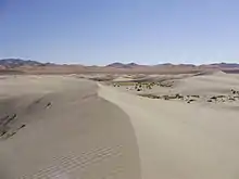 The Winnemucca Sand Dunes, north of Winnemucca (from Nevada)
 Mount Charleston (from Nevada)
- Lake Tahoe on the Nevada–California border (from Nevada)
- Majority/plurality party in each Nevada county (February 2023):Democrat >= 30%Republican >= 30%Republican >= 40%Republican >= 50%Republican >= 60%(from Nevada)

 State route shield (from Nevada)
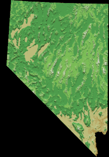 Topographic map of Nevada (from Nevada)
.png.webp) Mexico in 1824. Alta California included today's Nevada. (from Nevada)
Mexico in 1824. Alta California included today's Nevada. (from Nevada) U.S. Route 50, also known as "The Loneliest Road in America" (from Nevada)
 Nevada quarter (from Nevada)
 Ranching in Washoe County (from Nevada)
- Valley of Fire State Park (from Nevada)
.jpg.webp) A burro-drawn wagon hauling lumber and supplies into Goldfield, Nevada, ca.1904. In 1903 only 36 people lived in the new town. By 1908 Goldfield was Nevada's largest city, with over 25,000 inhabitants. (from History of Nevada)
A burro-drawn wagon hauling lumber and supplies into Goldfield, Nevada, ca.1904. In 1903 only 36 people lived in the new town. By 1908 Goldfield was Nevada's largest city, with over 25,000 inhabitants. (from History of Nevada)- Map of counties in Nevada by racial plurality, per the 2020 census(from Nevada)Legend
Non-Hispanic White30–40%50–60%60–70%70–80%80–90%
 The Nevada 1861 territory boundary (blue) changed three times: 1864 statehood shifted eastern border from 39th to 38th meridian, 1866 May 5; east border (pink) moved eastward 53.3 mi (85.8 km), from the 38th to 37th meridian, and 1867 January 18; south boundary (yellow) moved from the 37th parallel north southward to the current boundary (14 Stat. 43) (from History of Nevada)
- State route shield (from Nevada)
 Ethnic origins in Nevada (from Nevada)
- Ethnic origins in Nevada (from Nevada)
- The Las Vegas Strip looking South (from Nevada)
- Sculpture representing a steam locomotive, in Ely, Nevada. Early locomotives played an important part in Nevada's mining industry. (from Nevada)
- Mountains west of Las Vegas in the Mojave Desert (from Nevada)
- Ranching in Washoe County (from Nevada)
- A valley near Pyramid Lake (from Nevada)
- East Las Vegas suburbs (from Nevada)
- Red Rock Canyon National Conservation Area, Calico basin (from Nevada)
 Goldstrike (Post-Betze) Mine in the Carlin Trend, the largest Carlin-type deposit in the world, containing more than 35,000,000 troy ounces (1,100 t) gold (from Nevada)
 Great Basin National Park (from Nevada)
- Topographic map of Nevada (from Nevada)
 The 1931 gambling law helped enable the explosive growth of the Las Vegas area, where the population grew from five thousand in 1930 to over two million by 2013. (from History of Nevada)
- Downtown Reno (from Nevada)
- The Winnemucca Sand Dunes, north of Winnemucca (from Nevada)
- Carson City Mint in Carson City. Carson City is an independent city and the capital of Nevada. (from Nevada)
 Little Finland rock formation in Nevada (from Nevada)
- Nevada territory in 1861 (from Nevada)
 The courthouse of the Supreme Court of Nevada (from Nevada)
- Nevada quarter (from Nevada)
- The Nevada State Legislative Building in Carson City (from Nevada)
- Great Basin National Park (from Nevada)
- Mount Charleston (from Nevada)
- Goldstrike (Post-Betze) Mine in the Carlin Trend, the largest Carlin-type deposit in the world, containing more than 35,000,000 troy ounces (1,100 t) gold (from Nevada)
- Mexico in 1824. Alta California included today's Nevada. (from Nevada)
- U.S. Route 50, also known as "The Loneliest Road in America" (from Nevada)
- Little Finland rock formation in Nevada (from Nevada)
- The courthouse of the Supreme Court of Nevada (from Nevada)
Did you know -
- ... that KQLO, the antecedent of today's KIHM, was established after its founder drove from Nevada to Vermont and found no Catholic radio stations on the trip?
- ... that Pat Lundvall was the first female chair of the Nevada State Athletic Commission, but garnered controversy for some of her decisions relating to mixed martial arts?
- ... that a Nevada radio station named "Sexy" blew into town with a windstorm?
Topics

Largest cities
| Name | Type | County | Population (2020) |
Population (2010) |
Change | Land area (2020) |
Population density | Incorporation date | |
|---|---|---|---|---|---|---|---|---|---|
| sq mi | km2 | ||||||||
| Boulder City | City | Clark | 14,885 | 15,023 | −0.9% | 208.52 | 540.1 | 71.4/sq mi (27.6/km2) | October 1, 1959 |
| Reno | City | Washoe | 264,165 | 225,221 | +17.3% | 108.77 | 281.7 | 2,428.7/sq mi (937.7/km2) | March 16, 1903 |
| Caliente | City | Lincoln | 990 | 1,130 | −12.4% | 1.87 | 4.8 | 529.4/sq mi (204.4/km2) | October 1, 1959 |
| Carlin | City | Elko | 2,050 | 2,368 | −13.4% | 10.44 | 27.0 | 196.4/sq mi (75.8/km2) | October 22, 1925 |
| Carson City | — | None | 58,639 | 55,274 | +6.1% | 144.66 | 374.7 | 405.4/sq mi (156.5/km2) | March 1, 1875 |
| Elko | City | Elko | 20,564 | 18,297 | +12.4% | 17.64 | 45.7 | 1,165.8/sq mi (450.1/km2) | March 14, 1917 |
| Ely | City | White Pine | 3,924 | 4,255 | −7.8% | 7.64 | 19.8 | 513.6/sq mi (198.3/km2) | July 20, 1907 |
| Fallon | City | Churchill | 9,327 | 8,606 | +8.4% | 3.63 | 9.4 | 2,569.4/sq mi (992.1/km2) | December 18, 1908 |
| Fernley | City | Lyon | 22,895 | 19,368 | +18.2% | 122.12 | 316.3 | 187.5/sq mi (72.4/km2) | July 1, 2001 |
| Henderson | City | Clark | 317,610 | 257,729 | +23.2% | 107.73 | 279.0 | 2,948.2/sq mi (1,138.3/km2) | June 8, 1953 |
| Las Vegas | City | Clark | 641,903 | 583,756 | +10.0% | 135.81 | 351.7 | 4,726.5/sq mi (1,824.9/km2) | March 16, 1905 |
Categories
New articles
Rules | Match log | Results page (for watching) | Last updated: 2023-05-17 01:51 (UTC)
Note: The list display can now be customized by each user. See List display personalization for details.
- Abella Danger (edit | talk | history | links | watch | logs | tools) by Thilsebatti (talk · contribs · new pages (14)) started on 2023-05-16, score: 30
- 1878 Nevada gubernatorial election (edit | talk | history | links | watch | logs | tools) by Indylover2010 (talk · contribs · new pages (84)) started on 2023-05-13, score: 40
- Floyd E. Smith (edit | talk | history | links | watch | logs | tools) by Warofdreams (talk · contribs · new pages (44)) started on 2023-05-13, score: 26
- Judge Gordon (edit | talk | history | links | watch | logs | tools) by BD2412 (talk · contribs · new pages (671)) started on 2023-05-11, score: 20
- Christmas Here with You (edit | talk | history | links | watch | logs | tools) by Koavf (talk · contribs · new pages (152)) started on 2023-05-10, score: 34
- Indestructible (Four Tops album) (edit | talk | history | links | watch | logs | tools) by Koavf (talk · contribs · new pages (152)) started on 2023-05-10, score: 26
- Larry Barnes (boxer) (edit | talk | history | links | watch | logs | tools) by AntonioMartin (talk · contribs · new pages (5)) started on 2023-05-09, score: 34
- U2:UV Achtung Baby Live at Sphere (edit | talk | history | links | watch | logs | tools) by Y2kcrazyjoker4 (talk · contribs · new pages (2)) started on 2023-05-07, score: 34
- Henry C. Davis (Nevada politician) (edit | talk | history | links | watch | logs | tools) by Indylover2010 (talk · contribs · new pages (84)) started on 2023-05-06, score: 54
- Fred S. Alward (edit | talk | history | links | watch | logs | tools) by Indylover2010 (talk · contribs · new pages (84)) started on 2023-05-06, score: 47
- List of State Trooper episodes (edit | talk | history | links | watch | logs | tools) by Butlerblog (talk · contribs · new pages (1)) started on 2023-05-05, score: 27
- Judge Gibbons (edit | talk | history | links | watch | logs | tools) by BD2412 (talk · contribs · new pages (671)) started on 2023-05-04, score: 20
- Antioxidants (journal) (edit | talk | history | links | watch | logs | tools) by LeonardoSmi (talk · contribs · new pages (4)) started on 2023-05-02, score: 20
- The Shade Tree (edit | talk | history | links | watch | logs | tools) by Melketon (talk · contribs · new pages (1)) started on 2023-05-02, score: 54
Related portals
WikiProjects
- WikiProject Nevada
- WikiProject United States
Associated Wikimedia
The following Wikimedia Foundation sister projects provide more on this subject:
-
 Commons
Free media repository -
 Wikibooks
Free textbooks and manuals -
 Wikidata
Free knowledge base -
 Wikinews
Free-content news -
 Wikiquote
Collection of quotations -
 Wikisource
Free-content library -
 Wikiversity
Free learning tools -
 Wikivoyage
Free travel guide -
 Wiktionary
Dictionary and thesaurus