Putscheid
Putscheid (Luxembourgish: Pëtschent) is a commune and village in north-eastern Luxembourg. It is part of the canton of Vianden.
Putscheid
Pëtschent | |
|---|---|
 Putscheid chapel | |
 Coat of arms | |
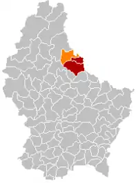 Map of Luxembourg with Putscheid highlighted in orange, and the canton in dark red | |
| Coordinates: 49.959444°N 6.141389°E | |
| Country | |
| Canton | Vianden |
| Area | |
| • Total | 27.13 km2 (10.47 sq mi) |
| • Rank | 33rd of 102 |
| Highest elevation | 542 m (1,778 ft) |
| • Rank | 5th of 102 |
| Lowest elevation | 226 m (741 ft) |
| • Rank | 39th of 102 |
| Population (2018) | |
| • Total | 1,100 |
| • Rank | 99th of 102 |
| • Density | 41/km2 (110/sq mi) |
| • Rank | 61st of 102 |
| Time zone | UTC+1 (CET) |
| • Summer (DST) | UTC+2 (CEST) |
| LAU 2 | LU0000902 |
| Website | putscheid.lu |
As of 2001, the village of Putscheid, which lies in the centre of the commune, has a population of 35. Other villages within the commune include Bivels, Gralingen, Merscheid, Nachtmanderscheid, Stolzembourg, and Weiler.
Population
References
- "Population par canton et commune". statistiques.public.lu. Retrieved 11 January 2022.
{{cite web}}: CS1 maint: url-status (link)
External links
 Media related to Putscheid at Wikimedia Commons
Places adjacent to Putscheid | ||||||||||||||||
|---|---|---|---|---|---|---|---|---|---|---|---|---|---|---|---|---|
| ||||||||||||||||

This article is issued from Wikipedia. The text is licensed under Creative Commons - Attribution - Sharealike. Additional terms may apply for the media files.