Red Cross, North Carolina
Red Cross is a town in Stanly County, North Carolina, United States. The population was 742 as of the 2010 Census.
Red Cross, North Carolina | |
|---|---|
| Coordinates: 35°15′59″N 80°21′44″W | |
| Country | United States |
| State | North Carolina |
| County | Stanly |
| Area | |
| • Total | 3.73 sq mi (9.67 km2) |
| • Land | 3.73 sq mi (9.67 km2) |
| • Water | 0.00 sq mi (0.00 km2) |
| Elevation | 659 ft (201 m) |
| Population (2020) | |
| • Total | 762 |
| • Density | 204.18/sq mi (78.82/km2) |
| Time zone | UTC-5 (Eastern (EST)) |
| • Summer (DST) | UTC-4 (EDT) |
| ZIP code | N/A |
| Area code | 704 |
| FIPS code | 37-55460 |
| GNIS feature ID | 2407184[2] |
| Website | redcross-nc.com |
Geography
Red Cross is located at 35°15′59″N 80°21′44″W.[3]
History
With growth resulting from the expansion of suburban communities around Charlotte, Red Cross incorporated on August 1, 2002. The people wanted to keep their area agricultural and rural to the extent that it was possible.[4]
Demographics
| Census | Pop. | Note | %± |
|---|---|---|---|
| 2010 | 742 | — | |
| 2020 | 762 | 2.7% | |
| U.S. Decennial Census[5] | |||
2020 census
| Race | Number | Percentage |
|---|---|---|
| White (non-Hispanic) | 697 | 91.47% |
| Black or African American (non-Hispanic) | 4 | 0.52% |
| Native American | 2 | 0.26% |
| Other/Mixed | 22 | 2.89% |
| Hispanic or Latino | 37 | 4.86% |
As of the 2020 United States census, there were 762 people, 323 households, and 177 families residing in the town.
References
- "ArcGIS REST Services Directory". United States Census Bureau. Retrieved September 20, 2022.
- "US Board on Geographic Names". United States Geological Survey. 2007-10-25. Retrieved 2008-01-31.
- "US Gazetteer files: 2010, 2000, and 1990". United States Census Bureau. 2011-02-12. Retrieved 2011-04-23.
- "Domain parked by OnlyDomains". redcross-nc.com. Retrieved 2008-11-25.
- "Census of Population and Housing". Census.gov. Retrieved June 4, 2015.
- "Explore Census Data". data.census.gov. Retrieved 2021-12-21.
External links
Municipalities and communities of Stanly County, North Carolina, United States | ||
|---|---|---|
| Cities | 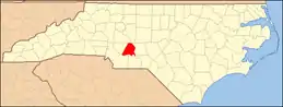 Stanly County map | |
| Towns | ||
| CDPs | ||
| Unincorporated communities | ||
| Footnotes | ‡This populated place also has portions in an adjacent county or counties | |
This article is issued from Wikipedia. The text is licensed under Creative Commons - Attribution - Sharealike. Additional terms may apply for the media files.