San Jorge, Samar
San Jorge, officially the Municipality of San Jorge (Waray: Bungto han San Jorge; Tagalog: Bayan ng San Jorge), is a 4th class municipality in the province of Samar, Philippines. According to the 2020 census, it has a population of 17,579 people.[3]
San Jorge | |
|---|---|
| Municipality of San Jorge | |
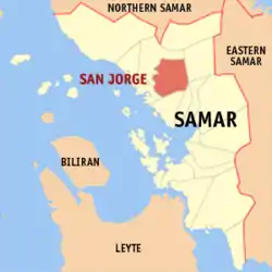 Map of Samar with San Jorge highlighted | |
OpenStreetMap | |
.svg.png.webp) San Jorge Location within the Philippines | |
| Coordinates: 11°59′N 124°49′E | |
| Country | Philippines |
| Region | Eastern Visayas |
| Province | Samar |
| District | 1st district |
| Founded | 1979 |
| Named for | Saint George |
| Barangays | 41 (see Barangays) |
| Government | |
| • Type | Sangguniang Bayan |
| • Mayor | Leoncio U. De Guia |
| • Vice Mayor | Jay G. Bisnar |
| • Representative | Stephen James Tan |
| • Councilors | List |
| • Electorate | 14,153 voters (2022) |
| Area | |
| • Total | 241.20 km2 (93.13 sq mi) |
| Elevation | 168 m (551 ft) |
| Highest elevation | 839 m (2,753 ft) |
| Lowest elevation | 0 m (0 ft) |
| Population (2020 census)[3] | |
| • Total | 17,579 |
| • Density | 73/km2 (190/sq mi) |
| • Households | 3,990 |
| Economy | |
| • Income class | 4th municipal income class |
| • Poverty incidence | 29.58 |
| • Revenue | ₱ 137.4 million (2020) |
| • Assets | ₱ 245.8 million (2020) |
| • Expenditure | ₱ 131.1 million (2020) |
| • Liabilities | ₱ 76.43 million (2020) |
| Service provider | |
| • Electricity | Samar 1 Electric Cooperative (SAMELCO 1) |
| Time zone | UTC+8 (PST) |
| ZIP code | 6723 |
| PSGC | |
| IDD : area code | +63 (0)55 |
| Native languages | Waray Tagalog |
The town is famous for its Blanca Aurora Falls near Barangay Blanca Aurora along the Blanca Aurora river. An inauguration is held every 10 October since 1979.
Due to farming abundancy here in San Jorge, they proclaimed Saint George as their Patron Saint and because it happened that the name were similar to a historical person named George Curn.
History
The community is one of the oldest barangay of municipality of Gandara. Its history can be traced back to the American regime. Even its name San Jorge was in honor of an American soldier by the name of George Curn who happened to own and donate the site where the old barangay was formerly located. The present location is the second site of the barangay. Its old site was located across the Sapinit River where the San Jorge Elementary School is presently nestled.
The municipality of San Jorge was established by virtue of Batas Pambansa Blg. 11 issued on December 6, 1978, upon separation of 29 barangays in Gandara, with a barangay with the same name the seat of government.[5] A plebiscite was held on February 4, 1979.[6]
Geography
Barangays
San Jorge is divided into 41 barangays according to the Assessors Office of the Town, the towns MAP.
- Aurora
- Blanca Aurora
- Buenavista I
- Bulao
- Bungliw
- Cogtoto-og
- Calundan
- Cantaguic
- Canyaki
- Erenas
- Guadalupe
- Hernandez
- Himay
- Janipon
- La Paz
- Libertad
- Lincoro
- Matalud
- Mobo-ob
- Quezon
- Ranera
- Rosalim
- San Isidro
- San Jorge I (Poblacion)
- Sapinit
- Sinit-an
- Tomogbong
- Gayondato
- Puhagan
- Anquiana
- Bay-ang
- Buenavista II
- Cabugao
- Cag-olo-olo
- Guindapunan
- Mabuhay
- Mancol (Poblacion)
- Mombon
- Rawis
- San Jorge II (Poblacion)
- San Juan
Climate
| Climate data for San Jorge, Samar | |||||||||||||
|---|---|---|---|---|---|---|---|---|---|---|---|---|---|
| Month | Jan | Feb | Mar | Apr | May | Jun | Jul | Aug | Sep | Oct | Nov | Dec | Year |
| Average high °C (°F) | 28 (82) |
29 (84) |
29 (84) |
31 (88) |
31 (88) |
30 (86) |
29 (84) |
29 (84) |
29 (84) |
29 (84) |
29 (84) |
28 (82) |
29 (85) |
| Average low °C (°F) | 21 (70) |
21 (70) |
21 (70) |
22 (72) |
24 (75) |
24 (75) |
24 (75) |
25 (77) |
24 (75) |
24 (75) |
23 (73) |
22 (72) |
23 (73) |
| Average precipitation mm (inches) | 72 (2.8) |
52 (2.0) |
65 (2.6) |
62 (2.4) |
87 (3.4) |
129 (5.1) |
153 (6.0) |
124 (4.9) |
147 (5.8) |
157 (6.2) |
139 (5.5) |
117 (4.6) |
1,304 (51.3) |
| Average rainy days | 17.4 | 13.4 | 16.8 | 18.0 | 22.0 | 25.3 | 26.2 | 24.2 | 24.9 | 26.0 | 23.3 | 20.8 | 258.3 |
| Source: Meteoblue[7] | |||||||||||||
Flooding and erosion potential
Two mountainside slope rolling down to the San Jorge National High School and a Gasoline Station were observed to be a potential flood prone areas, developer and planning engineers constructed a Rectangular Culvert alongside the 1 AH 26 Sleeves going to the San Jorge River. With a vast water shed area just below the municipality of San Jose de Buan, San Jorge area is really a drainage area in times of rainy season. In a matter of two consecutive days rain, flood waters automatically rumbles down the slopes going to the lowland areas from Buenavista, Bulao, La Paz, Mombon, San Jorge Proper, Erenas then directly towards the low-lying areas of the town of Gandara then to the town of Pagsanghan and the samar sea finally. Areas like the barangays of Buenavista, Janipon,Bulao, Guindapunan, La Paz, Mombon, and Anquiana could be soaked for a couple of days which usually leads to destruction of standing crops in the lowlands. These are usually rice, corn, vegetables and other crops in the flat lands.
Demographics
| Year | Pop. | ±% p.a. |
|---|---|---|
| 1980 | 9,123 | — |
| 1990 | 10,111 | +1.03% |
| 1995 | 11,935 | +3.16% |
| 2000 | 13,376 | +2.47% |
| 2007 | 14,134 | +0.76% |
| 2010 | 16,340 | +5.42% |
| 2015 | 17,184 | +0.96% |
| 2020 | 17,579 | +0.45% |
| Source: Philippine Statistics Authority [8][9][10][11] | ||
Education
Economy
Infrastructure
- Water Systems
- Japan International Coordination Agency (JICA) constructed a water systems on this town, the source of water was on Tomogbong (284 meters above MeanSeaLevel), there is a Distilled Water Spring uphill the Atigbang proper. The pipelines runs to the town Proper above then Mayor Cristeta Racuyal Corrales a Concrete Reservoir and distribute it back to the barrios. Saint George elevation is 272 meters below Tomogbong (Reference Elevation 1), there is a proposed pipelines that will run from Town Proper to Atigbang Sapinit, Rosalim, Aurora and County 27 November; at Sapinit Primary School elevation is 257 meters below Ref.Point, at Near San Jorge Cemetery elevation is 250 meters below Reference Point 1, approaching Mabuhay elevation higher than passed barrios is elevation 241 meters below Ref. Point 1, at 1 AH (Asian Highway) 26 kilometer Post 777 elevation is 216 meters below Ref. POint and approaching Quezon is 67 meters above MSL.
- There is another planned development and business of the Town of Saint George, it is by supplying the town of Gandera a potable water, the highest elevation that will encounter is 268 meters below Tomogbong and 6 Kilometers distance pipelines.
- Solid Waste Management
- A Garbage truck collects the garbage of the town, it is dumped in the common dumping area in Hinogacan, Gandara, Samar.
- Department of Agriculture (Bio&Seed Farm)
- LaPaz Agricultural micro-Bridge
- LaPaz-Puhagan Dam and Irrigation Canals
- Blanca Farm-to-Market Road Bridge
References
- Municipality of San Jorge | (DILG)
- "2015 Census of Population, Report No. 3 – Population, Land Area, and Population Density" (PDF). Philippine Statistics Authority. Quezon City, Philippines. August 2016. ISSN 0117-1453. Archived (PDF) from the original on May 25, 2021. Retrieved July 16, 2021.
- Census of Population (2020). "Region VIII (Eastern Visayas)". Total Population by Province, City, Municipality and Barangay. PSA. Retrieved 8 July 2021.
- "PSA Releases the 2018 Municipal and City Level Poverty Estimates". Philippine Statistics Authority. 15 December 2021. Retrieved 22 January 2022.
- "Batas Pambansa Blg. 11". The LawPhil Project. Arellano Law Foundation. December 6, 1978. Retrieved March 22, 2023.
- "Proclamation No. 1815, s. 1979". Official Gazette (Philippines). Government of the Philippines. January 29, 1979. Retrieved March 22, 2023.
- "San Jorge: Average Temperatures and Rainfall". Meteoblue. Retrieved 29 February 2020.
- Census of Population (2015). "Region VIII (Eastern Visayas)". Total Population by Province, City, Municipality and Barangay. PSA. Retrieved 20 June 2016.
- Census of Population and Housing (2010). "Region VIII (Eastern Visayas)". Total Population by Province, City, Municipality and Barangay. NSO. Retrieved 29 June 2016.
- Censuses of Population (1903–2007). "Region VIII (Eastern Visayas)". Table 1. Population Enumerated in Various Censuses by Province/Highly Urbanized City: 1903 to 2007. NSO.
- "Province of Samar (Western Samar)". Municipality Population Data. Local Water Utilities Administration Research Division. Retrieved 17 December 2016.
- "Poverty incidence (PI):". Philippine Statistics Authority. Retrieved December 28, 2020.
- Error: Unable to display the reference properly. See the documentation for details.
- Error: Unable to display the reference properly. See the documentation for details.
- Error: Unable to display the reference properly. See the documentation for details.
- Error: Unable to display the reference properly. See the documentation for details.
- Error: Unable to display the reference properly. See the documentation for details.
- "PSA Releases the 2018 Municipal and City Level Poverty Estimates". Philippine Statistics Authority. 15 December 2021. Retrieved 22 January 2022.
External links
- San Jorge Profile at PhilAtlas.com
- Philippine Standard Geographic Code
- Philippine Census Information
- Local Governance Performance Management System
Places adjacent to San Jorge, Samar | ||||||||||||||||
|---|---|---|---|---|---|---|---|---|---|---|---|---|---|---|---|---|
| ||||||||||||||||
| Municipalities | |
|---|---|
| Component cities | |