Wanrong County
Wanrong County (simplified Chinese: 万荣县; traditional Chinese: 萬榮縣; pinyin: Wànróng Xiàn) is a county under the administration of Yuncheng City, in the southwest of Shanxi Province, China, bordering Shaanxi province to the west.
Wanrong
万荣县 | |
|---|---|
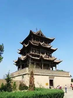 The Qiufeng Tower in Wanrong Houtu Temple | |
 Location in Yuncheng | |
 Wanrong Location of the seat in Shanxi | |
| Coordinates: 35.393°N 110.713°E | |
| Country | People's Republic of China |
| Province | Shanxi |
| Prefecture-level city | Yuncheng |
| Population (2020[1]) | 361,956 |
| Time zone | UTC+8 (China Standard) |
The county's Gushan was credited by the Records of Yicheng County compiled during the Qianlong Era of the Qing as being the actual "Mianshan" mentioned in the legends of Jie Zhitui concerning the origins of the Cold Food Festival, rather than the Mt Mian in Jinzhong Prefecture.[2]
Sui Dynasty Confucian philosopher Wang Tong was born in Longmen County, modern day Tonghua Township.[3]
Climate
| Climate data for Wanrong (1981−2010) | |||||||||||||
|---|---|---|---|---|---|---|---|---|---|---|---|---|---|
| Month | Jan | Feb | Mar | Apr | May | Jun | Jul | Aug | Sep | Oct | Nov | Dec | Year |
| Record high °C (°F) | 13.5 (56.3) |
21.2 (70.2) |
28.0 (82.4) |
36.2 (97.2) |
37.5 (99.5) |
40.8 (105.4) |
40.2 (104.4) |
38.7 (101.7) |
38.7 (101.7) |
31.2 (88.2) |
22.7 (72.9) |
17.2 (63.0) |
40.8 (105.4) |
| Average high °C (°F) | 3.9 (39.0) |
7.8 (46.0) |
13.7 (56.7) |
21.1 (70.0) |
26.3 (79.3) |
30.5 (86.9) |
31.3 (88.3) |
29.5 (85.1) |
24.9 (76.8) |
18.9 (66.0) |
11.6 (52.9) |
5.3 (41.5) |
18.7 (65.7) |
| Daily mean °C (°F) | −2.8 (27.0) |
1.0 (33.8) |
6.9 (44.4) |
14.1 (57.4) |
19.5 (67.1) |
24.3 (75.7) |
25.9 (78.6) |
24.1 (75.4) |
19.1 (66.4) |
12.5 (54.5) |
4.7 (40.5) |
−1.3 (29.7) |
12.3 (54.2) |
| Average low °C (°F) | −8.2 (17.2) |
−4.6 (23.7) |
0.8 (33.4) |
6.8 (44.2) |
12.0 (53.6) |
17.4 (63.3) |
20.5 (68.9) |
19.2 (66.6) |
14.1 (57.4) |
7.1 (44.8) |
−0.6 (30.9) |
−6.3 (20.7) |
6.5 (43.7) |
| Record low °C (°F) | −19.9 (−3.8) |
−21.9 (−7.4) |
−14.6 (5.7) |
−6.2 (20.8) |
−2.0 (28.4) |
7.3 (45.1) |
13.0 (55.4) |
11.1 (52.0) |
1.5 (34.7) |
−7.0 (19.4) |
−16.2 (2.8) |
−19.1 (−2.4) |
−21.9 (−7.4) |
| Average precipitation mm (inches) | 5.4 (0.21) |
8.2 (0.32) |
17.4 (0.69) |
27.7 (1.09) |
49.3 (1.94) |
57.7 (2.27) |
97.6 (3.84) |
98.2 (3.87) |
75.1 (2.96) |
44.1 (1.74) |
16.6 (0.65) |
5.2 (0.20) |
502.5 (19.78) |
| Average relative humidity (%) | 53 | 54 | 56 | 57 | 59 | 59 | 70 | 74 | 74 | 72 | 67 | 57 | 63 |
| Source: China Meteorological Data Service Center[4] | |||||||||||||
References
Citations
- Shānxī: Prefectures, Cities, Districts and Counties
- Lu (2012).
- People's Political Consultative Conference Cultural Weekly:王通的价值———为《山西万荣县通化村史》序
- 中国地面气候标准值月值(1981-2010) (in Simplified Chinese). China Meteorological Data Service Center. Retrieved 24 November 2022.
Bibliography
- Lu, Fengbo (Apr 2012), "An Analysis of Mianshan Mountain, where Jie Zitui Lived in Seclusion", Journal of Yuncheng University, Yuncheng.
This article is issued from Wikipedia. The text is licensed under Creative Commons - Attribution - Sharealike. Additional terms may apply for the media files.