Auburn, Kansas
Auburn is a city in Shawnee County, Kansas, United States. In 2010, 1,227 people lived there.[5]
Auburn, Kansas | |
|---|---|
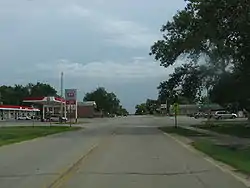 Downtown Auburn (2008) | |
 Location within Shawnee County and Kansas | |
 KDOT map of Shawnee County (legend) | |
| Coordinates: 38°54′24″N 95°49′0″W | |
| Country | United States |
| State | Kansas |
| County | Shawnee |
| Incorporated | 1963 |
| Area | |
| • Total | 0.64 sq mi (1.66 km2) |
| • Land | 0.64 sq mi (1.66 km2) |
| • Water | 0 sq mi (0 km2) |
| Elevation | 1,083 ft (330 m) |
| Population | |
| • Total | 1,227 |
| • Estimate (2016)[3] | 1,212 |
| • Density | 1,900/sq mi (740/km2) |
| Time zone | UTC-6 (CST) |
| • Summer (DST) | UTC-5 (CDT) |
| ZIP code | 66402 |
| Area code | 785 |
| FIPS code | 20-03250 |
| GNIS ID | 0479054[4] |
| Website | auburnks.com |
Geography
Auburn is at 38°54′24″N 95°49′0″W (38.906709, -95.816789).[6] The United States Census Bureau says that the city has a total area of 0.64 square miles (1.66 km2). All of it is land.[1]
Weather
Auburn has hot, humid summers and generally mild to cool winters. The Köppen Climate Classification system says that Auburn has a humid subtropical climate, abbreviated "Cfa" on climate maps.[7]
People
| Historical population | |||
|---|---|---|---|
| Census | Pop. | %± | |
| 1880 | 100 | — | |
| 1970 | 261 | — | |
| 1980 | 890 | 241.0% | |
| 1990 | 908 | 2.0% | |
| 2000 | 1,121 | 23.5% | |
| 2010 | 1,227 | 9.5% | |
| 2016 (est.) | 1,212 | [3] | −1.2% |
| U.S. Decennial Census[8] 2012 Estimate[9] | |||
Auburn is part of the Topeka, Kansas Metropolitan Statistical Area.
Famous people
- Nina E. Allender, artist and women's suffrage activist
References
- "US Gazetteer files 2010". United States Census Bureau. Archived from the original on January 12, 2012. Retrieved 2012-07-06.
- "American FactFinder". United States Census Bureau. Retrieved 2012-07-06.
- "Population and Housing Unit Estimates". Retrieved June 9, 2017.
- "US Board on Geographic Names". United States Geological Survey. 2007-10-25. Retrieved 2008-01-31.
- "2010 City Population and Housing Occupancy Status". U.S. Census Bureau. Archived from the original on July 21, 2011. Retrieved February 18, 2012.
- "US Gazetteer files: 2010, 2000, and 1990". United States Census Bureau. 2011-02-12. Retrieved 2011-04-23.
- Climate Summary for Auburn, Kansas
- "U.S. Decennial Census". Census.gov. Archived from the original on April 26, 2015. Retrieved June 7, 2013.
- "Annual Estimates of the Resident Population: April 1, 2010 to July 1, 2013". Retrieved May 31, 2014.
Other websites
Wikimedia Commons has media related to Auburn, Kansas.
- City
- Schools
- USD 437, local school district
- Maps
- Auburn City Map, KDOT
Municipalities and communities of Shawnee County, Kansas, United States | ||
|---|---|---|
| Cities |
|  Map of Kansas highlighting Shawnee County |
| CDP |
| |
| Unincorporated communities |
| |
| Ghost town |
| |
| Townships |
| |
| Footnotes | ‡This populated place also has portions in an adjacent county or counties | |
This article is issued from Wikipedia. The text is licensed under Creative Commons - Attribution - Sharealike. Additional terms may apply for the media files.