Boulleret
Boulleret is a commune in the Cher department in the Centre-Val de Loire region of France. About 1,396 people lived there in January 2019.
Boulleret | |
|---|---|
 Chateau of Buranlure | |
Location of Boulleret 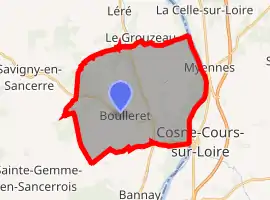 | |
 Boulleret  Boulleret | |
| Coordinates: 47°25′30″N 2°52′24″E | |
| Country | France |
| Region | Centre-Val de Loire |
| Department | Cher |
| Arrondissement | Bourges |
| Canton | Sancerre |
| Intercommunality | CC Pays Fort Sancerrois Val de Loire |
| Government | |
| • Mayor (2020–2026) | Jean-Louis Billaut[1] |
| Area 1 | 32.71 km2 (12.63 sq mi) |
| Population | 1,396 |
| • Density | 43/km2 (110/sq mi) |
| Time zone | UTC+01:00 (CET) |
| • Summer (DST) | UTC+02:00 (CEST) |
| INSEE/Postal code | 18032 /18240 |
| Elevation | 135–203 m (443–666 ft) (avg. 180 m or 590 ft) |
| 1 French Land Register data, which excludes lakes, ponds, glaciers > 1 km2 (0.386 sq mi or 247 acres) and river estuaries. | |
Population
| Year | Pop. | ±% |
|---|---|---|
| 1962 | 1,299 | — |
| 1968 | 1,342 | +3.3% |
| 1975 | 1,345 | +0.2% |
| 1982 | 1,417 | +5.4% |
| 1990 | 1,433 | +1.1% |
| 1999 | 1,421 | −0.8% |
| 2008 | 1,379 | −3.0% |
References
- "Répertoire national des élus: les maires". data.gouv.fr, Plateforme ouverte des données publiques françaises (in French). 2 December 2020.
- "Populations légales 2019". The National Institute of Statistics and Economic Studies. 29 December 2021.
Wikimedia Commons has media related to Boulleret.
| Prefecture | |
|---|---|
| Subprefectures | |
| Other |
|
This article is issued from Wikipedia. The text is licensed under Creative Commons - Attribution - Sharealike. Additional terms may apply for the media files.