Champfromier
Champfromier is a commune. It is found in the region Auvergne-Rhône-Alpes in the Ain department in the east of France.
Champfromier | |
|---|---|
 A general view of Champfromier | |
Location of Champfromier 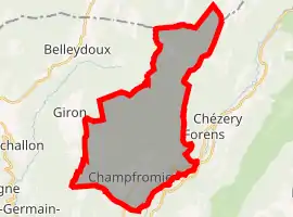 | |
 Champfromier  Champfromier | |
| Coordinates: 46°12′00″N 5°49′00″E | |
| Country | France |
| Region | Auvergne-Rhône-Alpes |
| Department | Ain |
| Arrondissement | Nantua |
| Canton | Valserhône |
| Intercommunality | Pays Bellegardien |
| Government | |
| • Mayor (2014-2020) | Michel de Souza |
| Area 1 | 32.40 km2 (12.51 sq mi) |
| Population | 735 |
| • Density | 23/km2 (59/sq mi) |
| Time zone | UTC+01:00 (CET) |
| • Summer (DST) | UTC+02:00 (CEST) |
| INSEE/Postal code | 01081 /01410 |
| Elevation | 480–1,540 m (1,570–5,050 ft) (avg. 646 m or 2,119 ft) |
| 1 French Land Register data, which excludes lakes, ponds, glaciers > 1 km2 (0.386 sq mi or 247 acres) and river estuaries. | |
Population
| Year | Pop. | ±% |
|---|---|---|
| 2004 | 613 | — |
| 2006 | 606 | −1.1% |
| 2007 | 630 | +4.0% |
| 2008 | 653 | +3.7% |
| 2009 | 676 | +3.5% |
| 2010 | 677 | +0.1% |
| 2011 | 676 | −0.1% |
| 2012 | 696 | +3.0% |
| 2013 | 713 | +2.4% |
| 2014 | 730 | +2.4% |
| 2015 | 735 | +0.7% |
| 2016 | 729 | −0.8% |
References
- "Populations légales 2019". The National Institute of Statistics and Economic Studies. 29 December 2021.
This article is issued from Wikipedia. The text is licensed under Creative Commons - Attribution - Sharealike. Additional terms may apply for the media files.