Chattanooga, Tennessee
Chattanooga is the fourth-largest city in Tennessee, a state in the United States of America. Cities larger than it are Nashville - the capital and largest city of the state; Memphis; and Knoxville. Chattanooga is in the southeast of Tennessee.
Chattanooga, Tennessee | |
|---|---|
 Chattanooga from Lookout Mountain | |
 Flag  Seal | |
| Nickname(s): Scenic City (official), River City | |
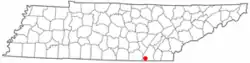 Location within the U.S. State of Tennessee | |
| Coordinates: | |
| Country | United States |
| State | Tennessee |
| Counties | Hamilton, Marion |
| Government | |
| • Mayor | Andy Berke |
| Area | |
| • City | 143.2 sq mi (370.8 km2) |
| • Land | 135.2 sq mi (352.2 km2) |
| • Water | 8.0 sq mi (20.6 km2) |
| Elevation | 676 ft (206 m) |
| Population (2006) | |
| • City | 168,293 (city proper) |
| • Metro | 496,704 |
| Time zone | UTC-5 (EST) |
| • Summer (DST) | UTC-4 (EDT) |
| Area code(s) | 423 |
| FIPS code | 47-14000[1] |
| GNIS feature ID | 1307240[2] |
| Website | http://www.chattanooga.gov |
The first people to live in the Chattanooga area were Native American Indians with sites dating back to the Upper Paleolithic period. The city became a transport hub, which made it a target in the American Civil War.
Geography and climate
The United States Census Bureau say that the city has a total area of 143.2 square miles (370.8 km²). This is made up of 135.2 square miles (350.2 km²) of land, and 8.0 square miles (20.6 km²) of water (5.56% of the total area).
The most well known natural feature near Chattanooga is the Tennessee River and the surrounding highlands. The city is between the southwestern Ridge-and-valley Appalachians and the foot of Walden's Ridge.
References
- "American FactFinder". United States Census Bureau. Retrieved 2008-01-31.
- "US Board on Geographic Names". United States Geological Survey. 2007-10-25. Retrieved 2008-01-31.
Other websites

Authority control | |
|---|---|
| General | |
| National libraries | |
| Other | |