Farmville, Virginia
Farmville, Virginia is a town in the U.S. state of Virginia. It is in Prince Edward and Cumberland counties.
Farmville, Virginia | |
|---|---|
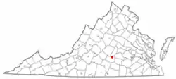 Location of Farmville, Virginia | |
| Coordinates: 37°17′52″N 78°23′45″W | |
| Country | United States |
| State | Virginia |
| Counties | Prince Edward, Cumberland |
| Area | |
| • Total | 7.0 sq mi (18.2 km2) |
| • Land | 7.0 sq mi (18.0 km2) |
| • Water | 0.1 sq mi (0.2 km2) |
| Elevation | 351 ft (107 m) |
| Population (2000) | |
| • Total | 8,216 |
| • Density | 1,200/sq mi (450/km2) |
| Time zone | UTC-5 (Eastern (EST)) |
| • Summer (DST) | UTC-4 (EDT) |
| ZIP codes | 23901, 23909, 23943 |
| Area code(s) | 434 |
| FIPS code | 51-27440[1] |
| GNIS feature ID | 1498477[2] |
| Website | www.farmvilleva.com |
References
- "American FactFinder". United States Census Bureau. Retrieved 2008-01-31.
- "US Board on Geographic Names". United States Geological Survey. 2007-10-25. Retrieved 2008-01-31.

Authority control | |
|---|---|
| General | |
| National libraries | |
| Other | |
This article is issued from Wikipedia. The text is licensed under Creative Commons - Attribution - Sharealike. Additional terms may apply for the media files.