Le Mans
Le Mans is a commune. It is found in the Pays de la Loire region in the Sarthe department in the west of France.[1]
Le Mans | |
|---|---|
 Palais of Comtes du Maine, birth place of Henry II of England | |
_(orn_ext).svg.png.webp) Coat of arms | |
Location of Le Mans 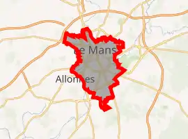 | |
 Le Mans  Le Mans | |
| Coordinates: 48°01′12″N 0°11′56″E | |
| Country | France |
| Region | Pays de la Loire |
| Department | Sarthe |
| Arrondissement | Le Mans |
| Intercommunality | Le Mans |
| Government | |
| • Mayor (2001–2008) | Jean-Claude Boulard |
| Area 1 | 52.81 km2 (20.39 sq mi) |
| Population (2006) | 148,169 |
| • Density | 2,800/km2 (7,300/sq mi) |
| Time zone | UTC+01:00 (CET) |
| • Summer (DST) | UTC+02:00 (CEST) |
| INSEE/Postal code | 72181 /72000 |
| Elevation | 38–134 m (125–440 ft) (avg. 51 m or 167 ft) |
| 1 French Land Register data, which excludes lakes, ponds, glaciers > 1 km2 (0.386 sq mi or 247 acres) and river estuaries. | |
Le Mans is a city in France. It has about 143,000 inhabitants. It takes about one hour to go to Paris by TGV.[2]
Sport
- Le Mans is the start of the seventh stage of the 2011 Tour de France.
- The city is well known for the 24-hour car race of Le Mans.
Sister cities
Le Mans is twinned with:
.svg.png.webp) Bolton, England, United Kingdom
Bolton, England, United Kingdom Haouza, Western Sahara
 Paderborn, North Rhine-Westphalia, Germany
 Rostov-on-Don, Rostov Oblast, Russia
 Suzuka, Japan
 Volos, Greece
 Xianyang, Shaanxi, China
 Alexandria, Egypt
References
- Butler, R. M. (1958). "The Roman Walls of le Mans". The Journal of Roman Studies. 48 (1/2): 33–39. doi:10.2307/298210. JSTOR 298210. S2CID 162544388.
- "Le Mans | History, Geography, & Points of Interest". Encyclopædia Britannica. Retrieved 18 October 2021.
Wikimedia Commons has media related to Le Mans.
|
Authority control | |
|---|---|
| General | |
| National libraries | |
| Other | |
This article is issued from Wikipedia. The text is licensed under Creative Commons - Attribution - Sharealike. Additional terms may apply for the media files.