Monroe County, Wisconsin
Monroe County is a county in the U.S. state of Wisconsin. As of 2000, 40,899 people lived there. Its county seat is Sparta.[2]
Monroe County | |
|---|---|
 Monroe County Courthouse in Sparta | |
 Location within the U.S. state of Wisconsin | |
 Wisconsin's location within the U.S. | |
| Coordinates: 43°57′N 90°37′W | |
| Country | |
| State | |
| Founded | 1854 |
| Named for | James Monroe[1] |
| Seat | Sparta |
| Largest city | Sparta |
| Area | |
| • Total | 908 sq mi (2,350 km2) |
| • Land | 901 sq mi (2,330 km2) |
| • Water | 7.4 sq mi (19 km2) 0.8%% |
| Population (2010) | |
| • Total | 44,673 |
| • Estimate (2019) | 46,253 |
| • Density | 49/sq mi (19/km2) |
| Time zone | UTC−6 (Central) |
| • Summer (DST) | UTC−5 (CDT) |
| Congressional districts | 3rd, 7th |
| Website | www |
Geography
| Historical population | |||
|---|---|---|---|
| Census | Pop. | %± | |
| 1900 | 28,103 | — | |
| 1910 | 28,881 | 2.8% | |
| 1920 | 28,666 | −0.7% | |
| 1930 | 28,739 | 0.3% | |
| 1940 | 30,080 | 4.7% | |
| 1950 | 31,378 | 4.3% | |
| 1960 | 31,241 | −0.4% | |
| 1970 | 31,610 | 1.2% | |
| 1980 | 35,074 | 11.0% | |
| 1990 | 36,633 | 4.4% | |
| 2000 | 40,899 | 11.6% | |
| 2010 | 44,673 | 9.2% | |
| WI Counties 1900-1990 | |||
The county has a total area of 908 square miles (2,351.7 km2). Of this 901 square miles (2,333.6 km2) is land and 8 square miles (20.7 km2) (0.83%) is water.
Cities, villages, and towns
|
|
Unincorporated communities
- Angelo
- Cataract
- Clifton
- Farmers Valley
- Four Corners
- Glendale
- Jacksonville
- Kirby
- Leon
- Norway Ridge
- Oil City
- Portland
- Raymore
- St. Mary's
- Scotts Junction
- Shennington
- Spring Bank Park
- Tunnel City
- Valley Junction
Images
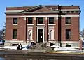 Historic post office in Tomah, Wisconsin
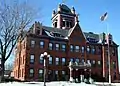 Monroe County Courthouse in Sparta, Wisconsin
References
- Chicago and North Western Railway Company (1908). A History of the Origin of the Place Names Connected with the Chicago & North Western and Chicago, St. Paul, Minneapolis & Omaha Railways. p. 162.
- "Find a County". National Association of Counties. Retrieved 2008-01-31.
Other websites
- Monroe County
- Monroe County Health and Demographic Data Archived 2011-10-02 at the Wayback Machine
Places next to Monroe County, Wisconsin | ||||||||||
|---|---|---|---|---|---|---|---|---|---|---|
| ||||||||||
Madison (capital) | ||
| Topics |
|  |
| Society |
| |
| Regions |
| |
| Major metropolitan areas (pop. over 500,000) |
| |
| Largest cities (pop. over 50,000) | ||
| Smaller cities (pop. 15,000 to 50,000) |
| |
| Largest villages (pop. over 15,000) |
| |
| Counties |
| |
This article is issued from Wikipedia. The text is licensed under Creative Commons - Attribution - Sharealike. Additional terms may apply for the media files.