Randogne
Randogne was a municipality, in the new municipality of Crans-Montana and the district Sierre in the Swiss canton of Valais.
Randogne | |
|---|---|
 Coat of arms | |
Location of Randogne 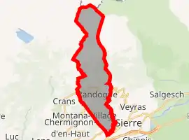 | |
 Randogne Randogne | |
| Coordinates: 46°19′N 7°31′E | |
| Country | Switzerland |
| Canton | Valais |
| District | Sierre |
| Government | |
| • Mayor | Paul-Albert Clivaz |
| Area | |
| • Total | 16.8 km2 (6.5 sq mi) |
| Elevation | 1,220 m (4,000 ft) |
| Highest elevation (Mont Bonvin) | 2,995 m (9,826 ft) |
| Lowest elevation | 540 m (1,770 ft) |
| Population (Dec 2002) | |
| • Total | 3,138 |
| • Density | 190/km2 (480/sq mi) |
| Time zone | UTC+01:00 (Central European Time) |
| • Summer (DST) | UTC+02:00 (Central European Summer Time) |
| Postal code(s) | 3975 |
| SFOS number | 6244 |
| Surrounded by | Icogne, Lenk im Simmental (BE), Lens, Mollens, Montana, Sierre, Venthône |
| Website | www SFSO statistics |
References
- "Arealstatistik Standard - Gemeinden nach 4 Hauptbereichen". Federal Statistical Office. Retrieved 13 January 2019.
This article is issued from Wikipedia. The text is licensed under Creative Commons - Attribution - Sharealike. Additional terms may apply for the media files.