Sierre
Sierre is the capital of the district of Sierre in the canton of Valais in Switzerland.

Sierre seen from Crans-Montana.
Sierre | |
|---|---|
 Coat of arms | |
Location of Sierre 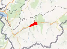 | |
 Sierre Sierre | |
| Coordinates: 46°18′N 7°32′E | |
| Country | Switzerland |
| Canton | Valais |
| District | Sierre |
| Government | |
| • Mayor | Manfred Stucky (CVP/PDC) |
| Area | |
| • Total | 1,918 km2 (741 sq mi) |
| Elevation | 533 m (1,749 ft) |
| Population (2018-12-31)[2] | |
| • Total | 16,790 |
| • Density | 8.8/km2 (23/sq mi) |
| Time zone | UTC+01:00 (Central European Time) |
| • Summer (DST) | UTC+02:00 (Central European Summer Time) |
| Postal code(s) | 3960 |
| SFOS number | 6248 |
| Surrounded by | Chalais, Chandolin, Chermignon, Chippis, Grône, Lens, Montana, Randogne, Saint-Léonard, Saint-Luc, Salgesch, Venthône, Veyras |
| Twin towns | Aubenas (France), Cesenatico (Italy), Delfzijl (Netherlands), Schwarzenbeck (Germany), Zelzate (Belgium) |
| Website | www SFSO statistics |
It has a population of 14,355. It is situated at the language border of the German-speaking upper part of the "Wallis" and the French-speaking "Valais". This city counts as one of the three official bilingual towns in Switzerland. Sierre is starting point for the tourist sites of the Val d'Anniviers including the villages of Vercorin, Chandolin, St-Luc Vissoie, St-Jean Chandolin, Grimentz, Zinal and Ayer. Sierre is connected with Crans-Montana by a cable car.
At the beginning of the 20th century, Sierre became economically important as very early aluminium smelting is enabled by its access to hydroelectricity.
References
- "Arealstatistik Standard - Gemeinden nach 4 Hauptbereichen". Federal Statistical Office. Retrieved 13 January 2019.
- "Ständige Wohnbevölkerung nach Staatsangehörigkeitskategorie Geschlecht und Gemeinde; Provisorische Jahresergebnisse; 2018". Federal Statistical Office. 9 April 2019. Retrieved 11 April 2019.
This article is issued from Wikipedia. The text is licensed under Creative Commons - Attribution - Sharealike. Additional terms may apply for the media files.