Spurgeon, Tennessee
Spurgeon is a census-designated place (CDP) in Sullivan and Washington counties in the U.S. state of Tennessee. The population was 3,957 at the 2010 census.[3]
Spurgeon, Tennessee | |
|---|---|
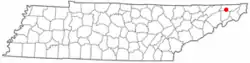 Location of Spurgeon, Tennessee | |
| Coordinates: 36°26′36″N 82°27′41″W | |
| Country | United States |
| State | Tennessee |
| Counties | Washington, Sullivan |
| Area | |
| • Total | 4.2 sq mi (10.9 km2) |
| • Land | 4.1 sq mi (10.7 km2) |
| • Water | 0.1 sq mi (0.3 km2) |
| Elevation | 1,414 ft (431 m) |
| Population (2010) | |
| • Total | 3,957 |
| • Density | 940/sq mi (360/km2) |
| Time zone | UTC-5 (Eastern (EST)) |
| • Summer (DST) | UTC-4 (EDT) |
| Zip codes | 37615 & 37663 |
| FIPS code | 47-70680[1] |
| GNIS feature ID | 1271165[2] |
It is a part of the Johnson City–Kingsport–Bristol, TN-VA Combined Statistical Area – commonly known as the "Tri-Cities" region.
History
During the American Civil War, a small battle known as the Battle of Spurgeon’s Mill happened here.
References
- "U.S. Census website". United States Census Bureau. Retrieved 2008-01-31.
- "US Board on Geographic Names". United States Geological Survey. 2007-10-25. Retrieved 2008-01-31.
- "U.S. Census website". United States Census Bureau. Retrieved 2011-05-14.
Municipalities and communities of Sullivan County, Tennessee, United States | ||
|---|---|---|
| Cities |
| Sullivan County map |
| CDPs |
| |
| Other communities |
| |
| Footnotes | ‡This area also has part of it in an connecting county or counties | |
Municipalities and communities of Washington County, Tennessee, United States | ||
|---|---|---|
County seat: Jonesborough | ||
| Cities |
| Washington County map |
| Town |
| |
| CDPs |
| |
| Other communities |
| |
| Footnotes | ‡This populated place also has portions in an adjacent county or counties | |
| Authority control |
|---|
This article is issued from Wikipedia. The text is licensed under Creative Commons - Attribution - Sharealike. Additional terms may apply for the media files.