Vilters-Wangs
Vilters-Wangs is a municipality in Sarganserland in the canton of St. Gallen in Switzerland.
Vilters-Wangs | |
|---|---|
 | |
 Coat of arms | |
Location of Vilters-Wangs 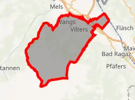 | |
 Vilters-Wangs Vilters-Wangs | |
| Coordinates: 47°1′N 9°27′E | |
| Country | Switzerland |
| Canton | St. Gallen |
| District | Sarganserland |
| Government | |
| • Mayor | Bernhard Lenherr |
| Area | |
| • Total | 32.70 km2 (12.63 sq mi) |
| Elevation | 510 m (1,670 ft) |
| Highest elevation (Schwarze Hörner) | 2,645 m (8,678 ft) |
| Lowest elevation | 483 m (1,585 ft) |
| Population (2018-12-31)[2] | |
| • Total | 4,815 |
| • Density | 150/km2 (380/sq mi) |
| Demonym(s) | Vilterser, Wangser |
| Time zone | UTC+01:00 (Central European Time) |
| • Summer (DST) | UTC+02:00 (Central European Summer Time) |
| Postal code(s) | 7324 Vilters 7323 Wangs |
| SFOS number | 3297 |
| Localities | Vilters, Wangs |
| Surrounded by | Bad Ragaz, Fläsch (GR), Mels Sargans |
| Website | www SFSO statistics |
References
- "Arealstatistik Standard - Gemeinden nach 4 Hauptbereichen". Federal Statistical Office. Retrieved 13 January 2019.
- "Ständige Wohnbevölkerung nach Staatsangehörigkeitskategorie Geschlecht und Gemeinde; Provisorische Jahresergebnisse; 2018". Federal Statistical Office. 9 April 2019. Retrieved 11 April 2019.
Other websites
![]() Media related to Vilters-Wangs at Wikimedia Commons
Media related to Vilters-Wangs at Wikimedia Commons
- Official website (in German)
- Vilters-Wangs in German, French and Italian in the online Historical Dictionary of Switzerland.
| ||
This article is issued from Wikipedia. The text is licensed under Creative Commons - Attribution - Sharealike. Additional terms may apply for the media files.