WaKeeney, Kansas
WaKeeney is a city in Trego County, Kansas, United States.[6] It is also the county seat of Trego County. In 2010 census, 1,862 people lived there.[7]
WaKeeney, Kansas | |
|---|---|
City and County seat | |
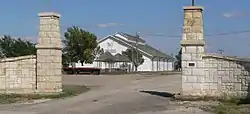 Trego County fairgrounds exhibit building in WaKeeney (2014) | |
 Location within Trego County and Kansas | |
 KDOT map of Trego County (legend) | |
| Coordinates: 39°1′30″N 99°52′46″W | |
| Country | United States |
| State | Kansas |
| County | Trego |
| Founded | 1879 |
| Incorporated | 1880 |
| Area | |
| • Total | 1.71 sq mi (4.43 km2) |
| • Land | 1.71 sq mi (4.43 km2) |
| • Water | 0 sq mi (0 km2) |
| Elevation | 2,447 ft (746 m) |
| Population | |
| • Total | 1,862 |
| • Estimate (2016)[3] | 1,776 |
| • Density | 1,100/sq mi (420/km2) |
| Time zone | UTC-6 (CST) |
| • Summer (DST) | UTC-5 (CDT) |
| ZIP code | 67672 |
| Area code | 785 |
| FIPS code | 20-74450 [4] |
| GNIS ID | 0472517 [5] |
| Website | wakeeney.org |
History
In 1877, James Keeney, a land speculator in Chicago, bought land at the place of modern-day WaKeeney from the Kansas Pacific Railway. He, and business partner Albert Warren, created Warren, Keeney, & Co., surveyed and plotted the site in 1878. They created a colony there in 1879.[8] They named the colony WaKeeney, a portmanteau of their last names.
They said it was "The Queen City of the High Plains", advertising and holding celebrations to attract settlers.[9] The colony grew quickly, but crop failures made settlers leave in 1880 as quickly as they had come. By 1882, all that was left were "five poorly patronized retail stores".[10] Years later, Volga Germans began settling the area.[8]
WaKeeney became the county seat in June 1879. It was incorporated as a city in 1880.[8][9]
Geography
WaKeeney is at 39°01′28″N 99°52′55″W (39.024467, -99.881972)[11] at an elevation of 2,447 feet (746 m).[5] It is in northwestern Kansas at the intersection of Interstate 70 and U.S. Route 283. It is 162 miles (261 km) northwest of Wichita, 281 miles (452 km) east-southeast of Denver, and 284 miles (457 km) west of Kansas City.[12]
WaKeeney is in the High Plains region of the Great Plains. It is about 2 miles (3.2 km) north of Big Creek, a tributary of the Smoky Hill River.[13][14] A small tributary of Big Creek goes south from near the center of the city.[14]
The United States Census Bureau says that the city has a total area of 1.71 square miles (4.43 km2). All of it is land.[1]
Climate
WaKeeney has a humid continental climate (Köppen Dfa). It has hot, humid summers and cold, dry winters. The average temperature is 52.8 °F (11 °C), and the average yearly precipitation is 23.6 inches (600 mm).[15] Snowfall averages 25.2 inches (640 mm) per year.[16] On average, January is the coldest month, and July is both the hottest month and the wettest month. The hottest temperature ever in WaKeeney was 110 °F (43 °C) in 1980; the coldest temperature ever was -25 °F (-32 °C) in 1989.[17]
| Climate data for WaKeeney, Kansas | |||||||||||||
|---|---|---|---|---|---|---|---|---|---|---|---|---|---|
| Month | Jan | Feb | Mar | Apr | May | Jun | Jul | Aug | Sep | Oct | Nov | Dec | Year |
| Record high °F (°C) | 79 (26) |
84 (29) |
90 (32) |
102 (39) |
101 (38) |
110 (43) |
110 (43) |
107 (42) |
104 (40) |
98 (37) |
89 (32) |
79 (26) |
110 (43) |
| Average high °F (°C) | 40 (4) |
46 (8) |
55 (13) |
66 (19) |
75 (24) |
87 (31) |
93 (34) |
91 (33) |
82 (28) |
70 (21) |
53 (12) |
42 (6) |
67 (19) |
| Average low °F (°C) | 16 (−9) |
21 (−6) |
29 (−2) |
39 (4) |
50 (10) |
60 (16) |
65 (18) |
63 (17) |
53 (12) |
41 (5) |
28 (−2) |
19 (−7) |
40 (5) |
| Record low °F (°C) | −14 (−26) |
−14 (−26) |
−9 (−23) |
11 (−12) |
27 (−3) |
39 (4) |
47 (8) |
47 (8) |
24 (−4) |
12 (−11) |
−4 (−20) |
−25 (−32) |
−25 (−32) |
| Average precipitation inches (mm) | 0.68 (17) |
0.77 (20) |
1.87 (47) |
2.17 (55) |
3.62 (92) |
2.57 (65) |
3.64 (92) |
2.95 (75) |
2.02 (51) |
1.33 (34) |
1.33 (34) |
0.66 (17) |
23.61 (599) |
| Average snowfall inches (cm) | 5.5 (14) |
4.9 (12) |
4.9 (12) |
1.8 (4.6) |
0 (0) |
0 (0) |
0 (0) |
0 (0) |
0.3 (0.76) |
0.8 (2.0) |
2.6 (6.6) |
4.5 (11) |
25.3 (62.96) |
| Source: The Weather Channel;[17] National Weather Service[16] | |||||||||||||
People
| Historical population | |||
|---|---|---|---|
| Census | Pop. | %± | |
| 1880 | 418 | — | |
| 1890 | 439 | 5.0% | |
| 1900 | 394 | −10.3% | |
| 1910 | 883 | 124.1% | |
| 1920 | 1,003 | 13.6% | |
| 1930 | 1,408 | 40.4% | |
| 1940 | 1,852 | 31.5% | |
| 1950 | 2,446 | 32.1% | |
| 1960 | 2,808 | 14.8% | |
| 1970 | 2,334 | −16.9% | |
| 1980 | 2,388 | 2.3% | |
| 1990 | 2,161 | −9.5% | |
| 2000 | 1,924 | −11.0% | |
| 2010 | 1,862 | −3.2% | |
| 2016 (est.) | 1,776 | [3] | −4.6% |
| U.S. Decennial Census | |||
Infrastructure
Interstate 70 and U.S. Route 40 run concurrently southeast-northwest just south of WaKeeney. They intersect U.S. Route 283, which goes north-south through WaKeeney. U.S. 283 goes east-west for one mile in downtown WaKeeney. It is concurrent with U.S. Route 40 Business and the old alignment of U.S. 40.[18]
Trego WaKeeney Airport is on the west side of U.S. 283. It is just south of I-70.[19] The airport is publicly owned. It has one concrete runway. It is used for general aviation.[20]
Union Pacific Railroad has one freight railroad, the Kansas Pacific (KP) line, through WaKeeney. It goes east-west through the WaKeeney.[18][21]
Media
The Western Kansas World is the local newspaper. It is published once per week.[22]
K231BG is a translator of radio station KJIL in Copeland, Kansas. It broadcasts from WaKeeney on 94.1 FM. It plays a Contemporary Christian format.[23][24]
WaKeeney is in the Wichita-Hutchinson, Kansas television market.[25]
Famous people
- Charles Harris Garrigues (1903-1974), journalist[26]
- Steve Gotsche (1961- ), former PGA Tour and Nationwide Tour golfer[27]
- Andrew J. Harlan (1815-1907), U.S. Representative from Indiana[28]
- Frank Mechau (1904-1946), painter[29]
- Mike Schreiner (1969- ), Green Party of Ontario leader[30] and Member of Provincial Parliament in the Legislative Assembly of Ontario since 2018 election
- Orrin Upshaw (1874-1937), U.S. Olympic tug of war athlete
References
- "US Gazetteer files 2010". United States Census Bureau. Archived from the original on 2012-07-02. Retrieved 2012-07-06.
- "American FactFinder". United States Census Bureau. Retrieved 2012-07-06.
- "Population and Housing Unit Estimates". Retrieved June 9, 2017.
- "American FactFinder". United States Census Bureau. Retrieved 2008-01-31.
- "US Board on Geographic Names". United States Geological Survey. 2007-10-25. Retrieved 2008-01-31.
- "Find a County". National Association of Counties. Retrieved 2011-06-07.
- "2010 City Population and Housing Occupancy Status". U.S. Census Bureau. Retrieved March 27, 2011.
- "Homesteading in Trego County - WaKeeney". Kansas Heritage Project. Fort Hays State University. Archived from the original on 2010-06-02. Retrieved 2010-02-09.
- "History". WaKeeney, Kansas. Archived from the original on 2010-03-12. Retrieved 2010-02-09.
- Blackmar, Frank Wilson (1912). Kansas: A Cyclopedia of State History, Volume 2. Standard Publishing Company. p. 858.
- "US Gazetteer files: 2010, 2000, and 1990". United States Census Bureau. 2011-02-12. Retrieved 2011-04-23.
- "City Distance Tool". Geobytes. Archived from the original on 2010-10-05. Retrieved 2010-08-08.
- "2003-2004 Official Transportation Map" (PDF). Kansas Department of Transportation. 2003. Retrieved 2015-07-16.
- "General Highway Map - Trego County, Kansas". Kansas Department of Transportation. 2013. Retrieved 2015-07-16.
- "Historical Weather for WaKeeney, Kansas, United States of America". Weatherbase. Retrieved 2010-02-06.
- "NOWData - NOAA Online Weather Data". National Weather Service Forecast Office - Dodge City, KS. Retrieved 2010-03-02.
- "Average weather for WaKeeney, KS". The Weather Channel. Retrieved 2010-02-06.
- "City of WaKeeney [Map]" (PDF). Kansas Department of Transportation. May 2007. Retrieved 2015-07-16.
- "WaKeeney, KS". Google Maps. Retrieved 2015-07-16.
- "0H1 - Trego WaKeeney Airport". AirNav.com. Retrieved 2015-07-16.
- "UPRR Common Line Names" (PDF). Union Pacific Railroad. Retrieved 2015-07-16.
- "About this Newspaper: Western Kansas world". Chronicling America. Library of Congress. Retrieved 2009-09-27.
- "K231BG-FM 94.1 MHz". Radio-Locator. Theodric Technologies LLC. Retrieved 2009-09-27.
- "Station Information Profile". Arbitron. Retrieved 2009-09-27.
- "Kansas". TV Market Maps. EchoStar Knowledge Base. Archived from the original on 2011-07-26. Retrieved 2015-07-16.
- Garrigues, George (January 2006). He Usually Lived With a Female: The Life of California Newspaperman Charles Harris (Brick) Garrigues. Los Angeles: Quail Creek Press. ISBN 978-0963483010.
- Caywood, Kurt (1999-07-20). "Taking aim at the PGA Tour". Topeka Capital-Journal. Retrieved 2015-07-16.
- "Harlan, Andrew Jackson (1815-1907)". Biographical Directory of the United States Congress. Retrieved 2015-07-16.
- "Frank Mechau Jr". askART. Retrieved 2015-07-16.
- "Profile: Green Leader Mike Schreiner". CBC News. 2011-08-26. Retrieved 2015-07-16.
Other websites
- City
- Schools
- USD 208, local school district
- Historical
- History of WaKeeney Archived 2009-01-07 at the Wayback Machine
- Maps
- WaKeeney City Map, KDOT
Municipalities and communities of Trego County, Kansas, United States | ||
|---|---|---|
| Cities |
|  Map of Kansas highlighting Trego County |
| Unincorporated communities |
| |
| Ghost towns |
| |
| Townships |
| |
Authority control | |
|---|---|
| General | |
| National libraries | |
| Other | |