Adair, Oklahoma
Adair is a town in the U.S. state of Oklahoma.
Adair, Oklahoma | |
|---|---|
 A farm in Adair, Oklahoma | |
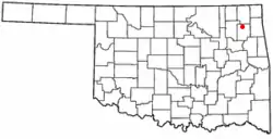 Location of Adair, Oklahoma | |
| Coordinates: 36°26′13″N 95°15′45″W | |
| Country | United States |
| State | Oklahoma |
| County | Mayes |
| Area | |
| • Total | 4.99 sq mi (12.91 km2) |
| • Land | 4.99 sq mi (12.91 km2) |
| • Water | 0.00 sq mi (0.00 km2) |
| Elevation | 682 ft (208 m) |
| Population | |
| • Total | 790 |
| • Estimate (2018)[3] | 818 |
| • Density | 164.06/sq mi (63.35/km2) |
| Time zone | UTC-6 (Central (CST)) |
| • Summer (DST) | UTC-5 (CDT) |
| ZIP code | 74330 |
| Area code(s) | 539/918 |
| FIPS code | 40-00250[4] |
| GNIS feature ID | 1089525[5] |
References
- "2018 U.S. Gazetteer Files". United States Census Bureau. Archived from the original on September 15, 2019. Retrieved February 12, 2020.
- "2010 City Population and Housing Occupancy Status". U.S. Census Bureau. Retrieved October 18, 2013.
- "Population and Housing Unit Estimates". Archived from the original on May 29, 2017. Retrieved June 4, 2019.
- "U.S. Census website". United States Census Bureau. Archived from the original on July 1, 2021. Retrieved January 31, 2008.
- "US Board on Geographic Names". United States Geological Survey. October 25, 2007. Archived from the original on February 26, 2012. Retrieved January 31, 2008.
Municipalities and communities of Mayes County, Oklahoma, United States | ||
|---|---|---|
| City |  Mayes County map | |
| Towns | ||
| CDPs |
| |
| Unincorporated communities |
| |
| Indian reservations |
| |
| Footnotes | ‡This populated place also has portions in an adjacent county or counties | |
This article is issued from Wikipedia. The text is licensed under Creative Commons - Attribution - Sharealike. Additional terms may apply for the media files.