Barnes, Kansas
Barnes is a city in Washington County, Kansas, United States. In 2010, 159 people lived there.[6]
Barnes, Kansas | |
|---|---|
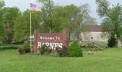 Welcome sign on Kansas Highway 148 | |
 Location within Washington County and Kansas | |
 KDOT map of Washington County (legend) | |
| Coordinates: 39°42′41″N 96°52′23″W | |
| Country | United States |
| State | Kansas |
| County | Washington |
| Founded | 1870 (Elm Grove) |
| Incorporated | 1897 |
| Named for | A.S. Barnes |
| Area | |
| • Total | 0.18 sq mi (0.47 km2) |
| • Land | 0.17 sq mi (0.44 km2) |
| • Water | 0.01 sq mi (0.03 km2) |
| Elevation | 1,332 ft (406 m) |
| Population | |
| • Total | 159 |
| • Estimate (2016)[3] | 152 |
| • Density | 880/sq mi (340/km2) |
| Time zone | UTC-6 (CST) |
| • Summer (DST) | UTC-5 (CDT) |
| ZIP code | 66933 |
| Area code | 785 |
| FIPS code | 20-04250 [4] |
| GNIS ID | 0473152 [5] |
| Website | barnesks.net |
History
Barnes was called Elm Grove when it was created in 1870.[7] It was renamed Barnes in 1876. It was named after A. S. Barnes, a stockholder of the Central Branch Union Pacific Railroad.[7][8]
Barnes was a station and shipping place on the Missouri Pacific Railroad.[9]
Geography
Barnes is at 39°42′41″N 96°52′23″W (39.711525, -96.873094).[10] The United States Census Bureau says that the city has a total area of 0.18 square miles (0.47 km2). Of that, 0.17 square miles (0.44 km2) is land and 0.01 square miles (0.03 km2) is water.[1]
People
| Historical population | |||
|---|---|---|---|
| Census | Pop. | %± | |
| 1880 | 32 | — | |
| 1900 | 383 | — | |
| 1910 | 454 | 18.5% | |
| 1920 | 395 | −13.0% | |
| 1930 | 361 | −8.6% | |
| 1940 | 391 | 8.3% | |
| 1950 | 308 | −21.2% | |
| 1960 | 247 | −19.8% | |
| 1970 | 209 | −15.4% | |
| 1980 | 257 | 23.0% | |
| 1990 | 167 | −35.0% | |
| 2000 | 152 | −9.0% | |
| 2010 | 159 | 4.6% | |
| 2016 (est.) | 152 | [3] | −4.4% |
| U.S. Decennial Census | |||
Education
Barnes is a part of USD 223 Barnes Hanover Linn.[11]
Barnes schools were closed in 1965 because of school unification. The Barnes High School mascot was the Bullets.[12]
Famous people
- Omar Knedlik, (1915–1989), inventor of the ICEE frozen drink.
References
- "US Gazetteer files 2010". United States Census Bureau. Archived from the original on January 12, 2012. Retrieved 2012-07-06.
- "American FactFinder". United States Census Bureau. Retrieved 2012-07-06.
- "Population and Housing Unit Estimates". Retrieved June 9, 2017.
- "American FactFinder". United States Census Bureau. Archived from the original on September 11, 2013. Retrieved 2008-01-31.
- "US Board on Geographic Names". United States Geological Survey. 2007-10-25. Retrieved 2008-01-31.
- "2010 City Population and Housing Occupancy Status". U.S. Census Bureau. Archived from the original on July 21, 2011. Retrieved November 3, 2011.
- Kansas State Historical Society (1916). Biennial Report of the Board of Directors of the Kansas State Historical Society. Kansas State Printing Plant. p. 312.
- Rydjord, John (1972). Kansas Place-Names. University of Oklahoma Press, Norman. p. 456. ISBN 0-8061-0994-7.
- Blackmar, Frank Wilson (1912). Kansas: A Cyclopedia of State History, Embracing Events, Institutions, Industries, Counties, Cities, Towns, Prominent Persons, Etc. Standard Publishing Company. p. 152. ISBN 9780722249055.
- "US Gazetteer files: 2010, 2000, and 1990". United States Census Bureau. 2011-02-12. Retrieved 2011-04-23.
- "USD". Retrieved 7 January 2017.
- "Barnes Wins Washington Meet", The Belleville Telescope, 20 February 1941, p.8.
Other websites
- City
- City of Barnes Archived 2019-12-07 at the Wayback Machine
- Barnes - Directory of Public Officials
- Schools
- USD 223, local school district
- Maps
- Barnes City Map, KDOT
Municipalities and communities of Washington County, Kansas, United States | ||
|---|---|---|
| Cities |  Map of Kansas highlighting Washington County | |
| Unincorporated communities |
| |
| Footnotes | ‡This populated place also has portions in an adjacent county or counties | |