Jasper County, Indiana
Jasper County is a county in the U.S. state of Indiana. As of 2010, 33,478 people lived there.[2] The county seat is Rensselaer.[3]
Jasper County, Indiana | |
|---|---|
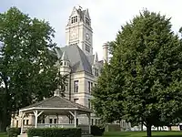 Jasper County Courthouse in Rensselaer | |
 Location in the state of Indiana | |
 Indiana's location in the U.S. | |
| Coordinates: 41°01′N 87°07′W | |
| Country | |
| State | |
| Region | Northwest Indiana |
| Metro area | Chicago Metropolitan |
| Established | February 7, 1835 |
| Named for | Sgt. William Jasper |
| County seat | Rensselaer |
| Largest city | Rensselaer (population and total area) |
| Incorporated Municipalities | Four cities and towns
|
| Government | |
| • Type | County |
| • Body | Board of Commissioners |
| • Commissioner | James A. Walstra (1st) |
| • Commissioner | Kendell Culp (2nd) |
| • Commissioner | Richard E. Maxwell (3rd) |
| Area | |
| • County | 561.39 sq mi (1,454.0 km2) |
| • Land | 559.62 sq mi (1,449.4 km2) |
| • Water | 1.76 sq mi (4.6 km2) |
| • Metro | 10,874 sq mi (28,160 km2) |
| Area rank | 3rd largest county in Indiana |
| • Region | 2,726 sq mi (7,060 km2) |
| Elevation | 696 ft (212 m) |
| Population (2010) | |
| • County | 33,478 |
| • Estimate (2018) | 33,270 |
| • Rank | 54th largest county in Indiana 1,341st largest county in U.S.[1] |
| • Density | 59.8/sq mi (23.1/km2) |
| • Metro | 9,522,434 |
| • Region | 819,537 |
| Time zone | UTC−6 (Central) |
| • Summer (DST) | UTC−5 (Central) |
| ZIP Codes | 46310, 46341, 46374, 46392, 47922, 47943, 47946, 47948, 47957, 47959, 47977-78, 47995 |
| Area code | 219 |
| Congressional district | 4th |
| Indiana Senate districts | 5th and 7th |
| Indiana House of Representatives districts | 4th, 16th and 20th |
| FIPS code | 18-073 |
| GNIS feature ID | 0450494 |
| Interstate and U.S. Route | |
| State Routes | |
| Airport | Jasper County
|
| Waterways | Iroquois River – Kankakee River
|
| Amtrak station | Rensselaer |
| Website | www.jaspercountyin.gov |
| |
History
Jasper County was created in 1838. It was named after Sgt. William Jasper, a famous scout for the Continental Army during the American Revolutionary War.[4]
Geography
According to the 2010 census, the county has a total area of 561.39 square miles (1,454.0 km2), of which 559.62 square miles (1,449.4 km2) (or 99.68%) is land and 1.76 square miles (4.6 km2) (or 0.31%) is water.[5]
Bordering counties
- Porter County (north)
- Lake County (northwest)
- Newton County (west)
- Benton County (south)
- LaPorte County (northeast)
- Starke County (east)
- Pulaski County (east)
- White County (southeast)
Municipalities
The municipalities in Jasper County, and their populations as of the 2010 census, are:
Cities
- Rensselaer – 5,859
Towns
- De Motte – 3,814
- Remington – 1,185
- Wheatfield – 853
Census-designated places
- Collegeville – 330
- Roselawn – 4,131
Townships
The 13 townships of Jasper County, with their populations as of the 2010 census, are:
- Barkley – 900
- Carpenter – 1,953
- Gillam – 640
- Hanging Grove – 230
- Jordan – 355
- Kankakee – 988
- Keener – 10,110
- Marion – 7,571
- Milroy – 276
- Newton – 811
- Union – 1,586
- Walker – 3,663
- Wheatfield – 4,395
References
- "USA Counties in Profile". STATS Indiana. Retrieved 2014-06-29.
- "Jasper County QuickFacts". United States Census Bureau. Archived from the original on 2011-06-07. Retrieved 2011-09-25.
- "Find a County". National Association of Counties. Archived from the original on 2011-05-31. Retrieved 2011-06-07.
- Gannett, Henry (1905). The Origin of Certain Place Names in the United States. Govt. Print. Off. p. 168.
- "Population, Housing Units, Area, and Density: 2010 - County". United States Census Bureau. Archived from the original on 2020-02-12. Retrieved 2015-07-10.
Other websites
Wikimedia Commons has media related to Jasper County, Indiana.
Places next to Jasper County, Indiana | ||||||||||
|---|---|---|---|---|---|---|---|---|---|---|
| ||||||||||
| Major city |  | |
|---|---|---|
| Cities (over 30,000 in 2010) | ||
| Towns and villages (over 30,000 in 2010) | ||
| Counties | ||
| Regions | ||

This article is issued from Wikipedia. The text is licensed under Creative Commons - Attribution - Sharealike. Additional terms may apply for the media files.