Jefferson City, Missouri
Jefferson City is the capital of the U.S. state of Missouri. It is also county seat of Cole County. (The Jefferson City metropolitan area includes all of Callaway and Cole counties.) As of the 2010 census, the population was 43,079.[6] Jefferson City was named after Thomas Jefferson, the third president of the United States.
Jefferson City, Missouri | |
|---|---|
State capital and city | |
| City of Jefferson | |
 | |
 Flag | |
| Nickname(s): Jeff[1] | |
| Motto(s): Jefferson City | |
 | |
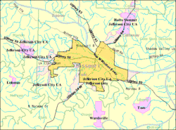 U.S. Census Map | |
| Coordinates: 38°34′36″N 92°10′25″W | |
| Country | United States |
| State | Missouri |
| Counties | Callaway, Cole |
| Founded | 1821 |
| Incorporated | 1825 |
| Named for | Thomas Jefferson, the third President of the United States |
| Government | |
| • Type | Mayor-council |
| • Mayor | Carrie Tergin |
| • Administrator | Steve Crowell |
| • City Clerk | Emily Donaldson |
| Area | |
| • State capital and city | 37.58 sq mi (97.33 km2) |
| • Land | 35.95 sq mi (93.11 km2) |
| • Water | 1.63 sq mi (4.22 km2) |
| Elevation | 630 ft (192 m) |
| Population | |
| • State capital and city | 43,079 |
| • Estimate (2017) | 42,895 |
| • Density | 1,100/sq mi (440/km2) |
| • Metro | 149,807 |
| Time zone | UTC-6 (CST) |
| • Summer (DST) | UTC-5 (CDT) |
| ZIP codes | 65101-65111 |
| Area code(s) | 573 |
| FIPS code | 29-37000[4] |
| GNIS feature ID | 0758233[5] |
| Website | http://www.jeffersoncitymo.gov/ |
Jefferson City is on the northern edge of the Ozark Plateau on the southern side of the Missouri River near the geographic center of the state, in a region known as Mid-Missouri. It is at the western edge of the Missouri Rhineland, one of the major wine-producing regions of the Midwest.
History
In pre-Columbian times, this region was home of an ancient people known only as the Mound Builders. By the time European settlers began arriving, the Mound Builders had vanished into history. The contemporary indigenous peoples were called the Osage Indians. When the Missouri Territory was organized in 1812, St. Louis was the seat of government. St. Charles next served as the capital.
The new state legislature decided to build a new capital city in the middle of the state in 1821. They named it after Thomas Jefferson, who was still alive. A village was already there called Lohman's Landing.[7] For years the village was little more than a trading post located in the wilderness about midway between St. Louis and Kansas City. In 1826 the Missouri legislature first met here and in 1839 the settlement was incorporated as a city.
Jefferson City was selected as the site for a state prison and, in 1836, the Missouri State Penitentiary was opened. The prison was home to a number of infamous Americans, including: former heavyweight champion Sonny Liston, assassin James Earl Ray, and bank robber Charles "Pretty Boy" Floyd.

During the American Civil War, Jefferson City was occupied by Union troops. Many of the people in the state supported the Union, although Missouri's Little Dixie section along the river in western counties was strongly Confederate.
German immigrants created vineyards in small towns on either side of the Missouri River, especially on the north from Jefferson City east to Marthasville outside St. Louis. Known as the Missouri Rhineland for its vineyards, first established by German immigrants in the mid-19th century, this area has become a part of the agricultural and tourist economy.
Geography
Jefferson City is located at 38°38′58″N 92°12′52″W (38.572954, -92.189283).[8] According to the United States Census Bureau, the city has a total area of 28.3 square miles (73 km2), of which, 27.2 square miles (70 km2) is land and 1.0 square mile (2.6 km2) (3.61%) is water.
Education
Jefferson City is served by the Jefferson City Public School District, which operates Jefferson City High School, Simonsen 9th Grade Center, Lewis and Clark Middle School and Thomas Jefferson Middle School, and eleven elementary schools. The district is currently considering building a second high school. There are 4 private elementary schools: St. Joseph's Cathedral, St. Peter Archived 2012-06-18 at the Wayback Machine, Immaculate Conception Archived 2012-04-20 at the Wayback Machine, and Trinity Lutheran.Calvary Lutheran, Helias Catholic, and Lighthouse Preparatory Academy are Jefferson City's private high schools.
Lincoln University is a public historically black university with open enrollment and certificate, associate, bachelor, and graduate programs. Columbia College, Linn State Technical College, William Woods University, Metro Business College, and Merrell University also have locations in Jefferson City with varying degree levels and options.
Transportation

Jefftran operates a public bus system year-round.[9] Jefferson City is one of four state capitols in United States that are not served by an interstate highway.[Note 1] Only four other state capitols nationwide share in this oddity. Interstate 70 passes by the city 30 miles (48 km) to the north, in Columbia. U.S. Highways in the city include U.S. Route 50, U.S. Route 54, and U.S. Route 63. Also Route 179 and Route 94 run through the city, giving it four highways that intersect with I-70. Jefferson City is also home to an Amtrak station.
Notable Citizens
- James T. Blair, Jr. was the mayor of Jefferson City in 1947 and then later a governor of Missouri.
- Lorenzo Greene Lincoln University faculty and civil rights pioneer
- Jack S. Kilby was born in Jefferson City.
- Cedric the Entertainer (Cedric Kyle) was born in Jefferson City.
- William Rose (screenwriter) was born in Jefferson City.
Notes
- Pierre, South Dakota; Dover, Delaware; and Juneau, Alaska are the other four state capitals without interstate highways.
References
- "Capital of Missouri – Jefferson City ***". www.spangledwithstars.com. Retrieved 9 June 2017.
- ""Contact the Mayor."". Archived from the original on May 7, 2006. Retrieved 2010-09-19.
{{cite web}}: CS1 maint: bot: original URL status unknown (link) City of Jefferson. Retrieved on May 21, 2010. - "Jefferson City — Departments". Archived from the original on 10 September 2014. Retrieved 9 June 2017.
- "American FactFinder". United States Census Bureau. Retrieved 2012-07-08.
- "US Board on Geographic Names". United States Geological Survey. 2007-10-25. Retrieved 2008-01-31.
- "Archived copy". Archived from the original on 2010-03-27. Retrieved 2017-12-05.
{{cite web}}: CS1 maint: archived copy as title (link) - McMillen, Margot Ford & Murphy, Dennis. A to Z: The Dictionary of Missouri Place Names. Columbia, MO. Pebble Publishing, 1996. ISBN 978-0-9646625-4-4.
- "US Gazetteer files: 2000 and 1990". United States Census Bureau. 2005-05-03. Retrieved 2008-01-31.
- "Archived copy" (PDF). Archived from the original (PDF) on 2010-02-15. Retrieved 2011-11-27.
{{cite web}}: CS1 maint: archived copy as title (link)
Other websites
- http://www.jeffcitymo.org/ Archived 2005-05-12 at the Wayback Machine Jefferson City, MO (Official Webpage)
- Jefferson City Convention and Visitor's Bureau
Municipalities and communities of Callaway County, Missouri, United States | ||
|---|---|---|
| Cities |  Map of Missouri highlighting Callaway County | |
| Villages |
| |
| Townships |
| |
| Unincorporated communities | ||
| Footnotes | ‡This populated place also has portions in an adjacent county or counties | |
Municipalities and communities of Cole County, Missouri, United States | ||
|---|---|---|
| Cities |  Map of Missouri highlighting Cole County | |
| Villages |
| |
| Townships |
| |
| CDP |
| |
| Other communities |
| |
| Ghost towns |
| |
| Footnotes | ‡This populated place also has portions in an adjacent county or counties | |