Joshua Tree, California
Joshua Tree is a census-designated place (CDP) in San Bernardino County, California, United States. The population was 7,414 at the 2010 census.
Joshua Tree, California | |
|---|---|
| Joshua Tree | |
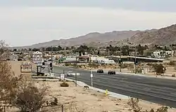 Central Joshua Tree | |
 Location in San Bernardino County and the state of California | |
 Joshua Tree, California Location in the United States | |
| Coordinates: 34°08′05″N 116°18′47″W | |
| Country | |
| State | |
| County | |
| Area | |
| • Total | 37.044 sq mi (95.943 km2) |
| • Land | 37.044 sq mi (95.943 km2) |
| • Water | 0 sq mi (0 km2) 0% |
| Elevation | 2,736 ft (834 m) |
| Population (2010) | |
| • Total | 7,414 |
| • Density | 200/sq mi (77/km2) |
| Time zone | UTC−08:00 (PST) |
| • Summer (DST) | UTC−07:00 (PDT) |
| ZIP Code | 92252 |
| Area codes | 442/760 |
| FIPS code | 06-37554 |
| GNIS feature ID | 1652731 |
| Website | Joshua Tree Chamber of Commerce |
References
Municipalities and communities of San Bernardino County, California, United States | ||
|---|---|---|
| Cities and towns |
|  San Bernardino County map |
| CDPs |
| |
| Unincorporated communities |
| |
| Indian reservations |
| |
| Ghost towns |
| |
| Footnotes | ‡This populated place also has portions in an adjacent county or counties | |
This article is issued from Wikipedia. The text is licensed under Creative Commons - Attribution - Sharealike. Additional terms may apply for the media files.