Martin County, North Carolina
Martin County is a county in the U.S. state of North Carolina. In 2010, 24,505 people lived there.[1] Its county seat is Williamston.[2]
Martin County | |
|---|---|
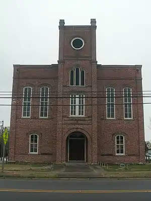 Historic Martin County Courthouse in Williamston | |
 Location within the U.S. state of North Carolina | |
 North Carolina's location within the U.S. | |
| Coordinates: 35°50′N 77°06′W | |
| Country | |
| State | |
| Founded | 1774 |
| Named for | Josiah Martin |
| Seat | Williamston |
| Largest town | Williamston |
| Area | |
| • Total | 462 sq mi (1,200 km2) |
| • Land | 461 sq mi (1,190 km2) |
| • Water | 0.3 sq mi (0.8 km2) 0.06%% |
| Population | |
| • Estimate (2018) | 22,671 |
| • Density | 53/sq mi (20/km2) |
| Time zone | UTC−5 (Eastern) |
| • Summer (DST) | UTC−4 (EDT) |
| Congressional district | 1st |
| Website | www |
Communities

Map of Martin County, North Carolina With Municipal and Township Labels
Towns
- Bear Grass
- Everetts
- Hamilton
- Hassell
- Jamesville
- Oak City
- Robersonville
- Williamston
Townships
- Bear Grass
- Cross Roads
- Goose Nest
- Griffins
- Hamilton
- Jamesville
- Poplar Point
- Robersonville
- Williams
- Williamston
References
- "State & County QuickFacts". United States Census Bureau. Archived from the original on July 21, 2011. Retrieved October 27, 2013.
- "Find a County". National Association of Counties. Retrieved 2011-06-07.
Other websites


This article is issued from Wikipedia. The text is licensed under Creative Commons - Attribution - Sharealike. Additional terms may apply for the media files.