Montecito, California
Montecito is a census-designated place (CDP) in Santa Barbara County, California. As of the 2000 census, the CDP population was approximately 10,000, although the boundaries are ill-defined. Montecito is among the richest communities in the United States and is home to many celebrities. It is east of, and directly adjacent to the city of Santa Barbara, occupying the eastern portion of the coastal plain south of the Santa Ynez Mountains. Portions of the town are built on the lower foothills of the range. Notable roads spanning the length of Montecito include Mountain Drive, Sycamore Canyon Road, and East Valley Road.
Montecito | |
|---|---|
.jpg.webp)  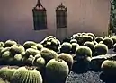 .jpg.webp)  Clockwise: View of the Pacific Ocean; the Santa Ynez Mountains; Lotusland botanical garden; El Fureidis; and the Arcady Estate. | |
 Location in Santa Barbara County and the state of California | |
 Montecito Location in the United States  Montecito Montecito (California)  Montecito Montecito (the United States) | |
| Coordinates: 34°26′1″N 119°37′55″W | |
| Country | United States |
| State | California |
| County | Santa Barbara |
| Government | |
| • State senator | Hannah-Beth Jackson (D)[1] |
| • Assemblymember | Monique Limón (D)[1] |
| • U. S. rep. | Salud Carbajal (D)[2] |
| Area | |
| • Total | 9.265 sq mi (23.994 km2) |
| • Land | 9.259 sq mi (23.979 km2) |
| • Water | 0.006 sq mi (0.014 km2) 0.06% |
| Elevation | 180 ft (55 m) |
| Population | |
| • Total | 8,965 |
| • Density | 970/sq mi (370/km2) |
| Time zone | UTC−8 (Pacific) |
| • Summer (DST) | UTC−7 (PDT) |
| ZIP Codes | 93108, 93150 |
| Area code | 805 |
| FIPS code | 06-48844 |
| GNIS feature IDs | 1661052, 2408861 |
References
- "Statewide Database". UC Regents. Archived from the original on February 1, 2015. Retrieved November 7, 2014.
- "California's 24th Congressional District - Representatives & District Map". Civic Impulse, LLC.
- "2010 Census U.S. Gazetteer Files – Places – California". United States Census Bureau.
- "Montecito". Geographic Names Information System. United States Geological Survey. Retrieved November 7, 2014.
California Central Coast | ||
|---|---|---|
| Counties |  | |
| Cities and towns 100k-250k | ||
| Cities and towns 25k-100k | ||
| Cities and towns 10k-25k |
| |
| Sub-regions |
| |
Counties in italics sometimes included in the definition of the Central Coast | ||
Municipalities and communities of Santa Barbara County, California, United States | ||
|---|---|---|
| Cities |
|  Santa Barbara County map |
| CDPs |
| |
| Unincorporated communities |
| |
| Indian reservation |
| |
| Ghost towns |
| |
This article is issued from Wikipedia. The text is licensed under Creative Commons - Attribution - Sharealike. Additional terms may apply for the media files.