Sierra County, California
Sierra County is a county in the U.S. state of California. As of the 2010 census, the population was 3,240[2] making it California's second-least populous county. The county seat is Downieville,[4] and the only incorporated city is Loyalton. The county is in the Sierra Nevada, northeast of Sacramento on the border with Nevada. Sierra County was founded in 1852. The county derives its name from the Sierra Nevada.
Sierra County, California | |
|---|---|
| County of Sierra | |
  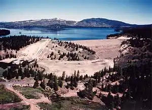 Images, from top down, left to right: Downieville, Conifer forest in the Tahoe National Forest, Stampede Dam | |
 Seal | |
 Location in the state of California | |
 California's location in the United States | |
| Country | |
| State | |
| Region | Sierra Nevada |
| Incorporated | 1852 |
| Named for | Sierra Nevada |
| County seat | Downieville |
| Largest city | Loyalton |
| Government | |
| • Board of Supervisors | Supervisors[1]
|
| • Assemblymember | Brian Dahle (R) |
| • State senator | Ted Gaines (R) |
| • U.S. rep. | Doug LaMalfa (R) |
| Area | |
| • Total | 962 sq mi (2,490 km2) |
| • Land | 953 sq mi (2,470 km2) |
| • Water | 9 sq mi (20 km2) |
| Population | |
| • Total | 3,240 |
| • Estimate (2016)[3] | 2,947 |
| • Density | 3.4/sq mi (1.3/km2) |
| Time zone | UTC-8 (Pacific Standard Time) |
| • Summer (DST) | UTC-7 (Pacific Daylight Time) |
| Area code(s) | 530 |
| Website | www |
Geography
The county has a total area of 962 square miles (2,490 km2).
Bordering counties
- Nevada County, California - south
- Yuba County, California - west
- Plumas County, California - north
- Lassen County, California - northeast
- Washoe County, Nevada - east
Communities
City
- Loyalton
Census-designated places
- Alleghany
- Calpine
- Downieville
- Goodyears Bar
- Pike
- Sattley
- Sierra Brooks
- Sierra City
- Sierraville
- Verdi
Unincorporated communities
- Forest
- Gibsonville
- Bassetts
Ghost towns
- Eureka City
- Howland Flat
- Pine Grove
- Poker Flat
- Potosi
- Shady Flat
References
- "Board of Supervisors". County of Sierra. Retrieved November 28, 2016.
- "State & County QuickFacts". United States Census Bureau. Archived from the original on July 18, 2011. Retrieved April 6, 2016.
- "Population and Housing Unit Estimates". Retrieved June 9, 2017.
- "Find a County". National Association of Counties. Retrieved 2011-06-07.
Other websites
Wikimedia Commons has media related to Sierra County, California.
Wikivoyage has a travel guide about: Sierra County
Municipalities and communities of Sierra County, California, United States | ||
|---|---|---|
| City |
| Sierra County map |
| CDPs |
| |
| Unincorporated communities |
| |
| Ghost towns |
| |
This article is issued from Wikipedia. The text is licensed under Creative Commons - Attribution - Sharealike. Additional terms may apply for the media files.