St. Francis, Kansas
St. Francis is a city in Cheyenne County, Kansas, United States.[6] It is also the county seat of Cheyenne County. In 2010, 1,329 people lived there.[7]
St. Francis, Kansas | |
|---|---|
City and County seat | |
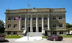 Cheyenne County Courthouse (2010) | |
 Location within Cheyenne County and Kansas | |
 KDOT map of Cheyenne County (legend) | |
| Coordinates: 39°46′17″N 101°48′3″W | |
| Country | United States |
| State | Kansas |
| County | Cheyenne |
| Founded | 1887 |
| Incorporated | 1903 |
| Named for | Francis Emerson |
| Area | |
| • Total | 0.87 sq mi (2.25 km2) |
| • Land | 0.87 sq mi (2.25 km2) |
| • Water | 0 sq mi (0 km2) |
| Elevation | 3,320 ft (1,010 m) |
| Population | |
| • Total | 1,329 |
| • Estimate (2016)[3] | 1,294 |
| • Density | 1,500/sq mi (590/km2) |
| Time zone | UTC-6 (CST) |
| • Summer (DST) | UTC-5 (CDT) |
| Area code | 785 |
| FIPS code | 20-62175 [4] |
| GNIS ID | 0470970 [5] |
| Website | stfranciskansas.com |
History
St. Francis was created in 1887.[8][9] The city may have been named for the wife of its founder.[10]
Geography
St. Francis is at 39°46′17″N 101°48′3″W (39.771389, -101.800717).[11] The United States Census Bureau says that the city has a total area of 0.87 square miles (2.25 km2). All of it is land.[1]
Weather
St. Francis has a semi-arid climate (Köppen BSk). It has cold, dry winters and hot, humid summers.
| Climate data for St. Francis, Kansas | |||||||||||||
|---|---|---|---|---|---|---|---|---|---|---|---|---|---|
| Month | Jan | Feb | Mar | Apr | May | Jun | Jul | Aug | Sep | Oct | Nov | Dec | Year |
| Record high °F (°C) | 81 (27) |
83 (28) |
92 (33) |
97 (36) |
103 (39) |
109 (43) |
111 (44) |
110 (43) |
105 (41) |
104 (40) |
89 (32) |
80 (27) |
111 (44) |
| Average high °F (°C) | 41.0 (5.0) |
47.1 (8.4) |
54.8 (12.7) |
64.4 (18.0) |
73.8 (23.2) |
85.7 (29.8) |
91.3 (32.9) |
89.3 (31.8) |
80.9 (27.2) |
69.2 (20.7) |
52.1 (11.2) |
43.5 (6.4) |
66.1 (18.9) |
| Daily mean °F (°C) | 27.2 (−2.7) |
32.4 (0.2) |
39.9 (4.4) |
49.2 (9.6) |
59.6 (15.3) |
70.8 (21.6) |
76.3 (24.6) |
74.2 (23.4) |
64.8 (18.2) |
52.2 (11.2) |
37.7 (3.2) |
29.5 (−1.4) |
51.2 (10.6) |
| Average low °F (°C) | 13.3 (−10.4) |
17.7 (−7.9) |
25.0 (−3.9) |
34.0 (1.1) |
45.3 (7.4) |
55.9 (13.3) |
61.3 (16.3) |
59.0 (15.0) |
48.6 (9.2) |
35.2 (1.8) |
23.3 (−4.8) |
15.5 (−9.2) |
36.2 (2.3) |
| Record low °F (°C) | −25 (−32) |
−25 (−32) |
−20 (−29) |
0 (−18) |
17 (−8) |
33 (1) |
41 (5) |
33 (1) |
18 (−8) |
3 (−16) |
−9 (−23) |
−31 (−35) |
−31 (−35) |
| Average precipitation inches (mm) | 0.51 (13) |
0.49 (12) |
1.17 (30) |
1.73 (44) |
3.14 (80) |
2.57 (65) |
2.97 (75) |
2.12 (54) |
1.16 (29) |
1.04 (26) |
0.76 (19) |
0.40 (10) |
18.06 (457) |
| Source 1: NOAA (normals, 1971–2000) [12] | |||||||||||||
| Source 2: The Weather Channel (Records) [13] | |||||||||||||
People
| Historical population | |||
|---|---|---|---|
| Census | Pop. | %± | |
| 1910 | 492 | — | |
| 1920 | 733 | 49.0% | |
| 1930 | 944 | 28.8% | |
| 1940 | 1,041 | 10.3% | |
| 1950 | 1,892 | 81.7% | |
| 1960 | 1,594 | −15.8% | |
| 1970 | 1,725 | 8.2% | |
| 1980 | 1,610 | −6.7% | |
| 1990 | 1,495 | −7.1% | |
| 2000 | 1,497 | 0.1% | |
| 2010 | 1,329 | −11.2% | |
| 2016 (est.) | 1,294 | [3] | −2.6% |
| U.S. Decennial Census | |||
Famous people
References
- "US Gazetteer files 2010". United States Census Bureau. Archived from the original on 2012-01-25. Retrieved 2012-07-06.
- "American FactFinder". United States Census Bureau. Retrieved 2012-07-06.
- "Population and Housing Unit Estimates". Retrieved June 9, 2017.
- "American FactFinder". United States Census Bureau. Retrieved 2008-01-31.
- "US Board on Geographic Names". United States Geological Survey. 2007-10-25. Retrieved 2008-01-31.
- "Find a County". National Association of Counties. Retrieved 2011-06-07.
- "2010 City Population and Housing Occupancy Status". U.S. Census Bureau. Archived from the original on July 26, 2011. Retrieved March 6, 2011.
- Kansas State Historical Society (1916). Biennial Report of the Board of Directors of the Kansas State Historical Society. Kansas State Printing Plant. p. 159.
- Blackmar, Frank Wilson (1912). Kansas: A Cyclopedia of State History, Volume 2. Standard Publishing Company. p. 619.
- "Profile for Saint Francis, Kansas". ePodunk. Archived from the original on 19 June 2017. Retrieved 6 June 2014.
- "US Gazetteer files: 2010, 2000, and 1990". United States Census Bureau. 2011-02-12. Retrieved 2011-04-23.
- "Climatography of the United States NO.81" (PDF). National Oceanic and Atmospheric Administration. Retrieved January 16, 2011.
- "Monthly Averages for St. Francis, KS". The Weather Channel. Archived from the original on October 23, 2012. Retrieved January 16, 2011.
Other websites
Wikimedia Commons has media related to St. Francis, Kansas.
- City
- Schools
- USD 297, local school district
- Maps
- St. Francis City Map, KDOT
Municipalities and communities of Cheyenne County, Kansas, United States | ||
|---|---|---|
| Cities |  Map of Kansas highlighting Cheyenne County | |
| Unincorporated communities |
| |
| Ghost towns |
| |
| Townships |
| |
This article is issued from Wikipedia. The text is licensed under Creative Commons - Attribution - Sharealike. Additional terms may apply for the media files.