Taylor County, Wisconsin
Taylor County is a county in the U.S. state of Wisconsin. As of 2010, 20,689 people lived there. Its county seat is Medford.[1]
Taylor County | |
|---|---|
 The Taylor County courthouse in Medford is on the National Register of Historic Places. | |
 Location within the U.S. state of Wisconsin | |
 Wisconsin's location within the U.S. | |
| Coordinates: 45°13′N 90°30′W | |
| Country | |
| State | |
| Founded | 1875 |
| Seat | Medford |
| Largest city | Medford |
| Area | |
| • Total | 984 sq mi (2,550 km2) |
| • Land | 975 sq mi (2,530 km2) |
| • Water | 9.5 sq mi (25 km2) 1.0%% |
| Population (2010) | |
| • Total | 20,689 |
| • Density | 21/sq mi (8/km2) |
| Time zone | UTC−6 (Central) |
| • Summer (DST) | UTC−5 (CDT) |
| Congressional district | 7th |
| Website | www |
Geography
| Historical population | |||
|---|---|---|---|
| Census | Pop. | %± | |
| 1900 | 11,262 | — | |
| 1910 | 13,641 | 21.1% | |
| 1920 | 18,045 | 32.3% | |
| 1930 | 17,685 | −2.0% | |
| 1940 | 20,105 | 13.7% | |
| 1950 | 18,456 | −8.2% | |
| 1960 | 17,843 | −3.3% | |
| 1970 | 16,958 | −5.0% | |
| 1980 | 18,817 | 11.0% | |
| 1990 | 18,901 | 0.4% | |
| 2000 | 19,680 | 4.1% | |
| 2010 | 20,689 | 5.1% | |
| WI Counties 1900-1990 | |||
The county has a total area of 984 square miles (2,550 km2). Of this, 975 square miles (2,530 km2) is land and 10 square miles (26 km2) (0.98%) is water.
Cities, villages, and towns
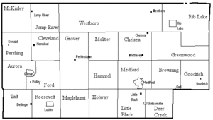
Taylor County: cities, villages, towns, etc.
|
|
|
Unincorporated communities
- Bellinger
- Chelsea
- Donald
- Gad (partial)
- Goodrich
- Hannibal
- Hughey
- Interwald
- Jump River
- Little Black
- Maplehurst
- Murat
- Perkinstown
- Polley
- Queenstown
- Westboro
- Whittlesey
References
- "Find a County". National Association of Counties. Retrieved 2008-01-31.
Other websites
- Reminiscences and Anecdotes of early Taylor County, Arthur J. Latton's early history, courtesy of the Wisconsin Historical Society.
- Taylor County official website
- Tannery, Dr. Loretta Kuse's page on early tanneries in Taylor County, with old photos.
- Map of Taylor County, Wisconsin, a plat map of the county from around 1900, showing owners, homes, sawmills, schools and churches at the time, courtesy of the Wisconsin Historical Society.
Places next to Taylor County, Wisconsin | ||||||||||
|---|---|---|---|---|---|---|---|---|---|---|
| ||||||||||
Madison (capital) | ||
| Topics |
|  |
| Society | ||
| Major metropolitan areas (pop. over 500,000) | ||
| Largest cities (pop. over 50,000) | ||
| Smaller cities (pop. 15,000 to 50,000) | ||
| Counties |
| |
This article is issued from Wikipedia. The text is licensed under Creative Commons - Attribution - Sharealike. Additional terms may apply for the media files.