Česká Kubice
Česká Kubice (German: Böhmisch Kubitzen) is a municipality and village in Domažlice District in the Plzeň Region of the Czech Republic. It has about 900 inhabitants.
Česká Kubice | |
|---|---|
 Centre of Česká Kubice | |
 Flag  Coat of arms | |
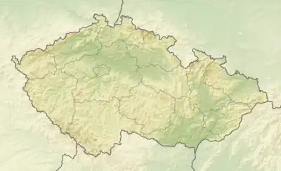 Česká Kubice Location in the Czech Republic | |
| Coordinates: 49°22′12″N 12°50′40″E | |
| Country | |
| Region | Plzeň |
| District | Domažlice |
| First mentioned | 1697 |
| Area | |
| • Total | 45.96 km2 (17.75 sq mi) |
| Elevation | 552 m (1,811 ft) |
| Population (2023-01-01)[1] | |
| • Total | 936 |
| • Density | 20/km2 (53/sq mi) |
| Time zone | UTC+1 (CET) |
| • Summer (DST) | UTC+2 (CEST) |
| Postal codes | 345 01, 345 32 |
| Website | www |
Administrative parts
The villages of Dolní Folmava, Horní Folmava, Nová Kubice, Nový Spálenec, Spáleneček and Starý Spálenec are administrative parts of Česká Kubice.
Etymology
The name Kubice is a diminutive of Kouba, which is the Czech name of the river Chamb and the German town Cham. Malá Kouba ('little Kouba') was probably name of a stream that originates here and then flows into the Chamb. The attribute Česká means 'Bohemian', which was used to distinguish from Německá ('German') Kubice (today Nová Kubice, a part of Česká Kubice).[2]
Geography
Česká Kubice is located about 9 kilometres (6 mi) southwest of Domažlice and 54 km (34 mi) southwest of Plzeň. The eastern part of the municipal territory lies in the Cham-Furth Depression, the western part lies in the Upper Palatinate Forest and borders Germany. The peak of the highest mountain of the Upper Palatinate Forest, Čerchov at 1,042 m (3,419 ft) above sea level, is situated on the northwestern municipal border.
History
The first written mention of Česká Kubice is from 1697.[2]
Demographics
|
|
| ||||||||||||||||||||||||||||||||||||||||||||||||||||||
| Source: Censuses[3][4] | ||||||||||||||||||||||||||||||||||||||||||||||||||||||||
Transport
There is the road border crossing Folmava / Furth im Wald-Schafberg to Germany. The I/26 road from Plzeň to the Czech-German border runs through the municipality.
Česká Kubice is located on the railway line Domažlice–Schwandorf. It is in operation only on weekends.[5]
Sights
The main historical landmark of the municipality is the Church of Saint Anthony of Padua, located in Horní Folmava. It was built in the late Baroque style in 1797.[6]
References
- "Population of Municipalities – 1 January 2023". Czech Statistical Office. 2023-05-23.
- Profous, Antonín (1949). Místní jména v Čechách II: CH–L (in Czech). pp. 434–435.
- "Historický lexikon obcí České republiky 1869–2011 – Okres Domažlice" (in Czech). Czech Statistical Office. 2015-12-21. pp. 3–4.
- "Population Census 2021: Population by sex". Public Database. Czech Statistical Office. 2021-03-27.
- "Detail stanice Blížejov" (in Czech). České dráhy. Retrieved 2024-03-11.
- "Kostel sv. Antonína Paduánského" (in Czech). National Heritage Institute. Retrieved 2024-03-11.