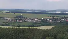
Šebířov
Šebířov is a municipality and village in Tábor District in the South Bohemian Region of the Czech Republic. It has about 400 inhabitants.
Šebířov | |
|---|---|
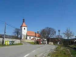 Church of Saint Gall | |
 Flag  Coat of arms | |
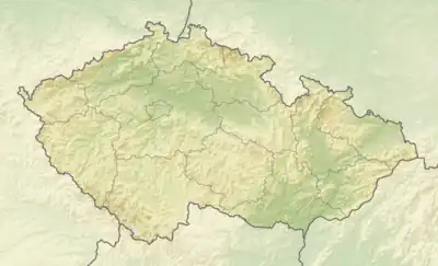 Šebířov Location in the Czech Republic | |
| Coordinates: 49°33′59″N 14°49′35″E | |
| Country | |
| Region | South Bohemian |
| District | Tábor |
| First mentioned | 1318 |
| Area | |
| • Total | 23.21 km2 (8.96 sq mi) |
| Elevation | 410 m (1,350 ft) |
| Population (2023-01-01)[1] | |
| • Total | 359 |
| • Density | 15/km2 (40/sq mi) |
| Time zone | UTC+1 (CET) |
| • Summer (DST) | UTC+2 (CEST) |
| Postal code | 391 43 |
| Website | www |
Administrative parts
The villages of Křekovice, Křekovická Lhota, Kříženec, Lhýšov, Popovice, Skrýšov, Vosná, Vrcholtovice, Vyšetice and Záříčí u Mladé Vožice are administrative parts of Šebířov.
Geography
Šebířov is located about 20 kilometres (12 mi) northeast of Tábor and 57 km (35 mi) southeast of Prague. It lies in the Vlašim Uplands. The highest point is the hill Vinná hora at 543 m (1,781 ft) above sea level. The Blanice River flows through the municipality.
History
The first written mention of Šebířov is from 1318. From 1678 until the establishemnt of an independent municipality, the village was owned by the Counts of Küenburg.[2]
Demographics
|
|
| ||||||||||||||||||||||||||||||||||||||||||||||||||||||
| Source: Censuses[3][4] | ||||||||||||||||||||||||||||||||||||||||||||||||||||||||
Transport
There are no railways or major roads passing through the municipality.
Sights
The main landmark of Šebířov is the Church of Saint Gall. It is originally a Gothic church from the 14th century, rebuilt in the Baroque style in 1886.[5]
References
- "Population of Municipalities – 1 January 2023". Czech Statistical Office. 2023-05-23.
- "Historie Obce" (in Czech). Obec Šebířov. Retrieved 2023-03-21.
- "Historický lexikon obcí České republiky 1869–2011 – Okres Tábor" (in Czech). Czech Statistical Office. 2015-12-21. pp. 19–20.
- "Population Census 2021: Population by sex". Public Database. Czech Statistical Office. 2021-03-27.
- "Kostel sv. Havla" (in Czech). National Heritage Institute. Retrieved 2023-03-21.