Andapa
Andapa is a town and commune (Malagasy: firaisana) in northern Madagascar. It belongs to the district of Andapa, which is a part of Sava Region. According to 2018 commune census the population of Andapa was 34,616.[2][3]
Andapa | |
|---|---|
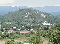 entrance of Andapa | |
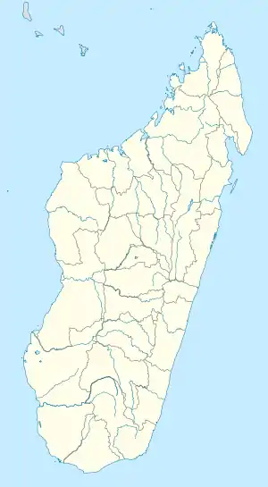 Andapa Location in Madagascar | |
| Coordinates: 14°39′S 49°39′E | |
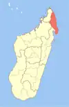
| Country | |
| Region | Sava |
| District | Andapa |
| Area | |
| • Total | 43.0 km2 (16.6 sq mi) |
| Elevation | 530 m (1,740 ft) |
| Population (2018 census) | |
| • Total | 34,616 |
| • Density | 810/km2 (2,100/sq mi) |
| Time zone | UTC3 (EAT) |
| Postal code | 205 |
| Website | http://andapa.marojejy.com |
Andapa is served by a local airport. It is also a site of industrial-scale mining. The majority 88% of the population are farmers, while an additional 0.5% receives their livelihood from raising livestock. The most important crop is rice, while other important products are beans, tomatoes and vanilla. Industry and services provide employment for 1.5% and 10% of the population, respectively.[2]
Geography
The capital of the Sava Region, Sambava is at a distance of 108 km.[4]
It is situated at the Lokoho River.
Nature
- Marojejy National Park
- The administration office of the Anjanaharibe-Sud Reserve is situated in Andapa. The reserve is at 25 km from this town.
References
- Estimated based on DEM data from Shuttle Radar Topography Mission
- "ILO census data". Cornell University. 2002. Retrieved 2008-02-15.
- "Madagascar: Regions, Cities & Urban Communes - Population Statistics, Maps, Charts, Weather and Web Information". www.citypopulation.de. Retrieved 2024-01-17.
- (Madagascar Parks - section: itenery Archived June 12, 2012, at the Wayback Machine
External links
Capital: Sambava | ||
| Andapa (17) |
|  |
| Antalaha (14) |
| |
| Sambava (25) |
| |
| Vohemar (19) |
| |
4 districts; 75 communes | ||
This article is issued from Wikipedia. The text is licensed under Creative Commons - Attribution - Sharealike. Additional terms may apply for the media files.