Augusta, West Virginia
Augusta is an unincorporated community in central Hampshire County, West Virginia, United States. It is located along the Northwestern Turnpike (U.S. Route 50) at the northern terminus of Augusta-Ford Hill Road (County Route 7) between Shanks and Pleasant Dale, east of Romney. According to the 2000 census, the Augusta community has a population of 4,728.[2]
Augusta, West Virginia | |
|---|---|
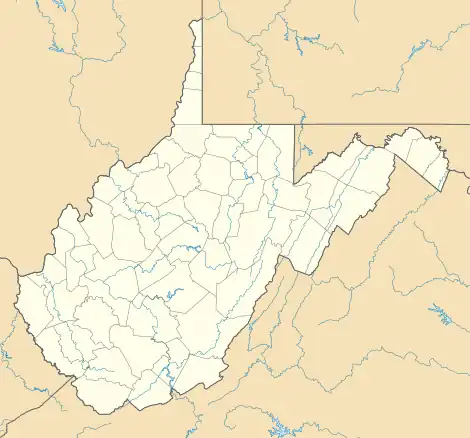 Location of Augusta in West Virginia  Augusta, West Virginia (the United States) | |
| Coordinates: 39°17.7′N 78°38.3′W | |
| Country | United States |
| State | West Virginia |
| County | Hampshire |
| Elevation | 1,299 ft (396 m) |
| Time zone | UTC-5 (Eastern (EST)) |
| • Summer (DST) | UTC-4 (EDT) |
| ZIP code | 26704 |
| Area code | 304 |
| GNIS feature ID | 1535081[1] |
Historic site
- French's Mill (1911), Augusta-Ford Hill Road (CR 7)
References
- U.S. Geological Survey Geographic Names Information System: Augusta, West Virginia. Retrieved on 2008-10-30.
- Augusta, West Virginia ZIP code profile Archived December 28, 2005, at the Wayback Machine, DownloadZIPCode.com Archived December 30, 2005, at the Wayback Machine. Accessed 2008-01-19.
External links
 Media related to Augusta, West Virginia at Wikimedia Commons
Municipalities and communities of Hampshire County, West Virginia, United States | ||
|---|---|---|
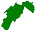
| City |  Map of West Virginia highlighting Hampshire County | |
| Town | ||
| CDPs | ||
| Unincorporated communities |
| |
| ||
This article is issued from Wikipedia. The text is licensed under Creative Commons - Attribution - Sharealike. Additional terms may apply for the media files.