Bélesta, Pyrénées-Orientales
Bélesta (French pronunciation: [belɛsta] ⓘ; Occitan: Bèl Estar; Catalan: Bellestar) is a commune in the Pyrénées-Orientales department in southern France.
Bélesta
Belhestar | |
|---|---|
.jpg.webp) A general view of Bélesta | |
.svg.png.webp) Coat of arms | |
Location of Bélesta | |
 Bélesta 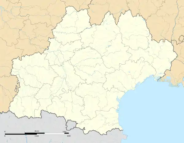 Bélesta | |
| Coordinates: 42°43′06″N 2°36′28″E | |
| Country | France |
| Region | Occitania |
| Department | Pyrénées-Orientales |
| Arrondissement | Prades |
| Canton | La Vallée de l'Agly |
| Intercommunality | Roussillon-Conflent |
| Government | |
| • Mayor (2020–2026) | Frédéric Bourniole[1] |
| Area 1 | 20.52 km2 (7.92 sq mi) |
| Population (2021)[2] | 212 |
| • Density | 10/km2 (27/sq mi) |
| Time zone | UTC+01:00 (CET) |
| • Summer (DST) | UTC+02:00 (CEST) |
| INSEE/Postal code | 66019 /66720 |
| Elevation | 122–561 m (400–1,841 ft) (avg. 380 m or 1,250 ft) |
| 1 French Land Register data, which excludes lakes, ponds, glaciers > 1 km2 (0.386 sq mi or 247 acres) and river estuaries. | |
Geography
Localisation
Bélesta is located in the canton of La Vallée de l'Agly and in the arrondissement of Perpignan.
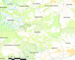
Map of Bélesta and its surrounding communes
Places adjacent to Bélesta, Pyrénées-Orientales | ||||||||||||||||
|---|---|---|---|---|---|---|---|---|---|---|---|---|---|---|---|---|
| ||||||||||||||||
Government and politics
- Mayors
| Mayor | Term start | Term end |
|---|---|---|
| Jacques Biles[3] | ? | June 1815 |
| Baptiste Pugnaud[3] | June 1815 | ? |
| Gilbert Bourniole | 2001 | 2007 |
| Roger Morin | 2007 | 2014 |
| Frédéric Bourniole | 2014 |
Population
| Year | Pop. | ±% p.a. |
|---|---|---|
| 1968 | 312 | — |
| 1975 | 262 | −2.46% |
| 1982 | 247 | −0.84% |
| 1990 | 223 | −1.27% |
| 1999 | 215 | −0.41% |
| 2007 | 214 | −0.06% |
| 2012 | 225 | +1.01% |
| 2017 | 221 | −0.36% |
| Source: INSEE[4] | ||
Sites of interest
- Prehistory museum
- Bélesta dolmen
- Bélesta cave
- Church of Saint Barthelemy in Bélesta
- Church of Saint Barthelemy in Jonqueroles
- Llébrès, an abandoned medieval hamlet
- Caladroy, hamlet with Château de Caladroy and an important winery
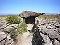 Bélesta dolmen
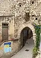 Medieval gate
.jpg.webp) Ancien fortification
Ancien fortification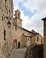 Church of Saint Barthelemy de Bélesta church (west)
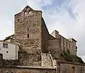 Church of Saint Barthelemy de Bélesta church (northeast)
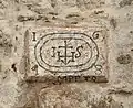 Inscription above the portal of Saint-Barthélemy de Bélesta church, dated 1648
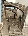 Museum of prehistory
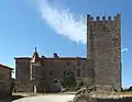 Château de Caladroy
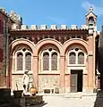 Chapel Sacré-Cœur de Jésus of château de Caladroy
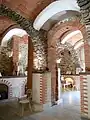 Chapel Saint-Michel of château de Caladroy
See also
- Communes of the Pyrénées-Orientales department
References
- "Répertoire national des élus: les maires". data.gouv.fr, Plateforme ouverte des données publiques françaises (in French). 2 December 2020.
- "Populations légales 2021". The National Institute of Statistics and Economic Studies. 28 December 2023.
- Fabricio Cardenas, Vieux papiers des Pyrénées-Orientales, Bélesta, le 21 juin 1815, 31 january 2014
- Population en historique depuis 1968, INSEE
Wikimedia Commons has media related to Bélesta (Pyrénées-Orientales).
Communes of the Pyrénées-Orientales department | |
|---|---|
| |
|
This article is issued from Wikipedia. The text is licensed under Creative Commons - Attribution - Sharealike. Additional terms may apply for the media files.