Borek (Pardubice District)
Borek is a municipality and village in Pardubice District in the Pardubice Region of the Czech Republic. It has about 300 inhabitants.
Borek | |
|---|---|
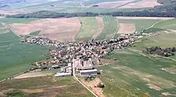 Aerial view | |
 Flag  Coat of arms | |
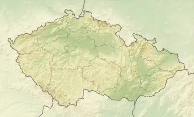 Borek Location in the Czech Republic | |
| Coordinates: 50°7′38″N 15°51′24″E | |
| Country | |
| Region | Pardubice |
| District | Pardubice |
| First mentioned | 1436 |
| Area | |
| • Total | 5.22 km2 (2.02 sq mi) |
| Elevation | 245 m (804 ft) |
| Population (2023-01-01)[1] | |
| • Total | 282 |
| • Density | 54/km2 (140/sq mi) |
| Time zone | UTC+1 (CET) |
| • Summer (DST) | UTC+2 (CEST) |
| Postal code | 534 01 |
| Website | www |
Geography
Borek is located about 11 kilometres (7 mi) north of Pardubice and 7 kilometres (4 mi) south of Hradec Králové. It lies mostly in the East Elbe Table, only the northern part of the municipality extends into the Orlice Table.
History
The first written mention of Borek is from 1436.[2]
Demographics
|
|
| ||||||||||||||||||||||||||||||||||||||||||||||||||||||
| Source: Censuses[3][4] | ||||||||||||||||||||||||||||||||||||||||||||||||||||||||
Transport
The D35 motorway passes through the municipality.
Sights
There are no protected cultural monuments in the municipality.[5]
References
- "Population of Municipalities – 1 January 2023". Czech Statistical Office. 2023-05-23.
- "O obci" (in Czech). Obec Borek. Retrieved 2024-02-16.
- "Historický lexikon obcí České republiky 1869–2011 – Okres Pardubice" (in Czech). Czech Statistical Office. 2015-12-21. pp. 1–2.
- "Population Census 2021: Population by sex". Public Database. Czech Statistical Office. 2021-03-27.
- "Výsledky vyhledávání: Kulturní památky, okres Pardubice". Ústřední seznam kulturních památek (in Czech). National Heritage Institute. Retrieved 2024-02-16.
This article is issued from Wikipedia. The text is licensed under Creative Commons - Attribution - Sharealike. Additional terms may apply for the media files.