Chotěšice
Chotěšice is a municipality and village in Nymburk District in the Central Bohemian Region of the Czech Republic. It has about 300 inhabitants.
Chotěšice | |
|---|---|
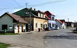 Main street | |
 Flag  Coat of arms | |
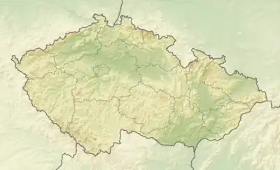 Chotěšice Location in the Czech Republic | |
| Coordinates: 50°16′43″N 15°16′23″E | |
| Country | |
| Region | Central Bohemian |
| District | Nymburk |
| First mentioned | 1199 |
| Area | |
| • Total | 22.51 km2 (8.69 sq mi) |
| Elevation | 213 m (699 ft) |
| Population (2023-01-01)[1] | |
| • Total | 330 |
| • Density | 15/km2 (38/sq mi) |
| Time zone | UTC+1 (CET) |
| • Summer (DST) | UTC+2 (CEST) |
| Postal code | 289 01 |
| Website | www |
Administrative parts
The villages of Břístev, Malá Strana, Nouzov and Nová Ves are administrative parts of Chotěšice.
Etymology
The name is derived from the personal name Chotěš, meaning "the village of Chotěš's people".[2]
Geography
Chotěšice is located about 19 kilometres (12 mi) northeast of Nymburk and 53 kilometres (33 mi) northeast of Prague. It lies in the Central Elbe Table. The stream Smíchovský potok flows through the municipality.
Demographics
|
|
| ||||||||||||||||||||||||||||||||||||||||||||||||||||||
| Source: Censuses[4][5] | ||||||||||||||||||||||||||||||||||||||||||||||||||||||||
Transport
The I/32 road, which connects the D11 motorway with Jičín, passes through the municipality.
Sights
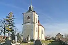
The main landmark of Chotěšice is the Church of the Sending of the Holy Apostles. It was first mentioned in the 14th century and rebuilt in the Renaissance style in 1599.[3]
References
- "Population of Municipalities – 1 January 2023". Czech Statistical Office. 2023-05-23.
- Profous, Antonín (1949). Místní jména v Čechách II: CH–L (in Czech). p. 39.
- "Obec Chotěšice" (in Czech). Obec Chotěšice. Retrieved 2022-08-25.
- "Historický lexikon obcí České republiky 1869–2011 – Okres Nymburk" (in Czech). Czech Statistical Office. 2015-12-21. pp. 3–4.
- "Population Census 2021: Population by sex". Public Database. Czech Statistical Office. 2021-03-27.