Civil parishes in Cheshire
A civil parish is a country subdivision, forming the lowest unit of local government in England. There are 333 civil parishes in the ceremonial county of Cheshire, most of the county being parished. Cheshire East unitary authority is entirely parished. At the 2001 census, there were 565,259 people living in 332 parishes, accounting for 57.5 per cent of the county's population.
History
Parishes arose from Church of England divisions, and were originally purely ecclesiastical divisions. Over time they acquired civil administration powers.[1]
The Highways Act 1555 made parishes responsible for the upkeep of roads. Every adult inhabitant of the parish was obliged to work four days a year on the roads, providing their own tools, carts and horses; the work was overseen by an unpaid local appointee, the Surveyor of Highways.[2]
The poor were looked after by the monasteries, until their dissolution. In 1572, magistrates were given power to 'survey the poor' and impose taxes for their relief. This system was made more formal by the Poor Law Act 1601, which made parishes responsible for administering the Poor Law; overseers were appointed to charge a rate to support the poor of the parish.[3] The 19th century saw an increase in the responsibility of parishes, although the Poor Law powers were transferred to Poor Law Unions.[4] The Public Health Act 1872 grouped parishes into Rural Sanitary Districts, based on the Poor Law Unions; these subsequently formed the basis for Rural Districts.[5]
Parishes were run by vestries, meeting annually to appoint officials, and were generally identical to ecclesiastical parishes,[6] although some townships in large parishes administered the Poor Law themselves; under the Divided Parishes and Poor Law Amendment Act 1882, all extra-parochial areas and townships that levied a separate rate became independent civil parishes.[7]
Civil parishes in their modern sense date from the Local Government Act 1894, which abolished vestries; established elected parish councils in all rural parishes with more than 300 electors; grouped rural parishes into Rural Districts; and aligned parish boundaries with county and borough boundaries.[7] Urban civil parishes continued to exist, and were generally coterminous with the Urban District, Municipal Borough or County Borough in which they were situated; many large towns contained a number of parishes, and these were usually merged into one. Parish councils were not formed in urban areas, and the only function of the parish was to elect guardians to Poor Law Unions; with the abolition of the Poor Law system in 1930 the parishes had only a nominal existence.[8]
The Local Government Act 1972 retained civil parishes in rural areas, and many former Urban Districts and Municipal Boroughs that were being abolished, were replaced by new successor parishes; urban areas that were considered too large to be single parishes became unparished areas.[9]
The current position
Recent governments have encouraged the formation of town and parish councils in unparished areas, and the Local Government and Rating Act 1997 gave local residents the right to demand the creation of a new civil parish.[10]
A parish council can become a town council unilaterally, simply by resolution;[9] and a civil parish can also gain city status, but only if that is granted by the Crown.[9] The chairman of a town or city council is called a mayor.[9] The Local Government and Public Involvement in Health Act 2007 introduced alternative names: a parish council can now choose to be called a community; village; or neighbourhood council.[11]
List of civil parishes and unparished areas
| Image | Name | Status | Population | District | Former local authority[12] | Refs |
|---|---|---|---|---|---|---|
 | Adlington | Civil parish | 1,081 | Cheshire East | Macclesfield Rural District | [13] [14] |
 | Alderley Edge | Civil parish | 4,409 | Cheshire East | Alderley Edge Urban District | [15] [14] |
 | Alpraham and Calveley | Civil parish | 642 | Cheshire East | Nantwich Rural District | [16] [17][18] |
 | Alsager | Town | 12,578 | Cheshire East | Alsager Urban District | [19] [20] |
 | Arclid | Civil parish | 199 | Cheshire East | Congleton Rural District | [21] [20] |
 | Ashley | Civil parish | 261 | Cheshire East | Bucklow Rural District | [22] [14] |
 | Aston by Budworth | Civil parish | 281 | Cheshire East | Bucklow Rural District | [22] [14] |
 | Aston juxta Mondrum | Civil parish | 133 | Cheshire East | Nantwich Rural District | [16] [17] |
 | Audlem | Civil parish | 1,790 | Cheshire East | Nantwich Rural District | [16] [17] |
 | Austerson | Civil parish | 145 | Cheshire East | Nantwich Rural District | [16] [17] |
 | Baddiley | Civil parish | 226 | Cheshire East | Nantwich Rural District | [16] [17] |
 | Baddington | Civil parish | 98 | Cheshire East | Nantwich Rural District | [16] [17] |
 | Barthomley | Civil parish | 202 | Cheshire East | Nantwich Rural District | [16] [17] |
 | Betchton | Civil parish | 620 | Cheshire East | Congleton Rural District | [21] [20] |
 | Bexton | Civil parish | 9 | Cheshire East | Bucklow Rural District | [22] [14] |
 | Bickerton | Civil parish | 234 | Cheshire East | Nantwich Rural District | [16] [17] |
 | Bollington | Town | 7,095 | Cheshire East | Bollington Urban District | [23] [14] |
 | Bosley | Civil parish | 406 | Cheshire East | Macclesfield Rural District | [13] [14] |
 | Bradwall | Civil parish | 166 | Cheshire East | Congleton Rural District | [21] [20] |
 | Brereton | Civil parish | 1,012 | Cheshire East | Congleton Rural District | [21] [20] |
 | Brindley | Civil parish | 134 | Cheshire East | Nantwich Rural District | [16] [17] |
 | Broomhall | Civil parish | 206 | Cheshire East | Nantwich Rural District | [16] [17] |
 | Buerton | Civil parish | 492 | Cheshire East | Nantwich Rural District | [16] [17] |
 | Bulkeley and Ridley | Civil parish | 360 | Cheshire East | Nantwich Rural District | [16] [17][24] |
 | Bunbury | Civil parish | 1,308 | Cheshire East | Nantwich Rural District | [16] [17] |
 | Burland and Acton | Civil parish | Cheshire East | Nantwich Rural District | [16] [17][25] | |
 | Chelford | Civil parish | 1,254 | Cheshire East | Macclesfield Rural District | [13] [14] |
 | Cholmondeley | Civil parish | 136 | Cheshire East | Nantwich Rural District | [16] [17] |
 | Cholmondeston | Civil parish | 153 | Cheshire East | Nantwich Rural District | [16] [17] |
 | Chorley | Civil parish | 100 | Cheshire East | Nantwich Rural District | [16] [17] |
 | Chorley | Civil parish | 399 | Cheshire East | Macclesfield Rural District | [13] [14] |
 | Church Lawton | Civil parish | 2,201 | Cheshire East | Congleton Rural District | [21] [20] |
 | Church Minshull | Civil parish | 431 | Cheshire East | Nantwich Rural District | [16] [17] |
 | Congleton | Town | 25,750 | Cheshire East | Congleton Municipal Borough | [26] [20] |
 | Coole Pilate | Civil parish | 60 | Cheshire East | Nantwich Rural District | [16] [17] |
 | Cranage | Civil parish | 1,130 | Cheshire East | Congleton Rural District | [21] [20] |
 | Crewe | Town | 48,592 | Cheshire East | Crewe Municipal Borough | [27] [28] [29] |
 | Disley | Civil parish | 4,301 | Cheshire East | Disley Rural District | [30] [14] |
 | Dodcott cum Wilkesley | Civil parish | 380 | Cheshire East | Nantwich Rural District | [16] [17] |
 | Doddington and District | Civil parish | Cheshire East | Nantwich Rural District | [16] [17] | |
 | Eaton | Civil parish | 289 | Cheshire East | Macclesfield Rural District | [13] [14] |
 | Egerton | Civil parish | 81 | Cheshire East | Nantwich Rural District | [16] [17] |
 | Faddiley | Civil parish | 163 | Cheshire East | Nantwich Rural District | [16] [17] |
 | Gawsworth | Civil parish | 1,673 | Cheshire East | Macclesfield Rural District | [13] [14] |
 | Goostrey | Civil parish | 2,201 | Cheshire East | Congleton Rural District | [21] [20] |
 | Great Warford | Civil parish | 615 | Cheshire East | Macclesfield Rural District | [13] [14] |
 | Handforth | Civil parish | 6,266 | Cheshire East | Wilmslow Urban District | [31] [32] |
 | Hankelow | Civil parish | 272 | Cheshire East | Nantwich Rural District | [16] [17] |
 | Haslington | Civil parish | 6,781 | Cheshire East | Nantwich Rural District | [16] [17] |
 | Hassall | Civil parish | 281 | Cheshire East | Congleton Rural District | [21] [20] |
 | Hatherton | Civil parish | 344 | Cheshire East | Nantwich Rural District | [16] [17] |
 | Haughton | Civil parish | 223 | Cheshire East | Nantwich Rural District | [16] [17] |
 | Henbury | Civil parish | 594 | Cheshire East | Macclesfield Rural District | [13] [14] |
 | High Legh | Civil parish | 1,632 | Cheshire East | Bucklow Rural District | [22] [14] |
 | Higher Hurdsfield | Civil parish | 688 | Cheshire East | Macclesfield Rural District | [13] [14] |
 | Holmes Chapel | Civil parish | 5,669 | Cheshire East | Congleton Rural District | [21] [20] |
 | Hough and Chorlton | Civil parish | Cheshire East | Nantwich Rural District | [16] [17] | |
 | Hulme Walfield | Civil parish | 140 | Cheshire East | Congleton Rural District | [21] [20] |
 | Kettleshulme and Lyme Handley | Civil parish | 466 | Cheshire East | Macclesfield Rural District | [13] [14] |
 | Knutsford | Town | 12,656 | Cheshire East | Knutsford Urban District | [33] [14] |
 | Leighton | Civil parish | 4,863 | Cheshire East | Nantwich Rural District | [16] [17] |
 | Little Bollington with Agden | Civil parish | Cheshire East | Bucklow Rural District | [22] [14] | |
 | Little Warford | Civil parish | 275 | Cheshire East | Bucklow Rural District | [22] [14] |
 | Lower Withington | Civil parish | 492 | Cheshire East | Macclesfield Rural District | [13] [14] |
 | Macclesfield | Town | 49,531 | Cheshire East | Macclesfield Municipal Borough | [34] [35] |
 | Macclesfield Forest and Wildboarclough | Civil parish | 201 | Cheshire East | Macclesfield Rural District | [13] [14] |
 | Marbury and District | Civil parish | 510 | Cheshire East | Nantwich Rural District | [16] [17] |
 | Marthall | Civil parish | 165 | Cheshire East | Bucklow Rural District | [22] [14] |
 | Marton | Civil parish | 222 | Cheshire East | Macclesfield Rural District | [13] [14] |
 | Mere | Civil parish | 601 | Cheshire East | Bucklow Rural District | [22] [14] |
 | Middlewich | Town | 13,101 | Cheshire East | Middlewich Urban District | [36] [20] |
 | Millington and Rostherne | Civil parish | 439 | Cheshire East | Bucklow Rural District | [22] [14] |
 | Minshull Vernon | Civil parish | 224 | Cheshire East | Nantwich Rural District | [16] [17] |
 | Mobberley | Civil parish | 2,546 | Cheshire East | Bucklow Rural District | [22] [14] |
 | Moreton cum Alcumlow | Civil parish | 150 | Cheshire East | Congleton Rural District | [21] [20] |
 | Moston | Civil parish | 375 | Cheshire East | Congleton Rural District | [21] [20] |
 | Mottram St Andrew | Civil parish | 629 | Cheshire East | Macclesfield Rural District | [13] [14] |
 | Nantwich | Town | 12,515 | Cheshire East | Nantwich Urban District | [37] [17] |
 | Nether Alderley | Civil parish | 571 | Cheshire East | Macclesfield Rural District | [13] [14] |
 | Newbold Astbury | Civil parish | 475 | Cheshire East | Congleton Rural District | [21] [20] |
 | Newhall | Civil parish | 669 | Cheshire East | Nantwich Rural District | [16] [17] |
 | North Rode | Civil parish | 178 | Cheshire East | Macclesfield Rural District | [13] [14] |
 | Odd Rode | Civil parish | 5,552 | Cheshire East | Congleton Rural District | [21] [20] |
 | Ollerton | Civil parish | 323 | Cheshire East | Bucklow Rural District | [22] [14] |
 | Over Alderley | Civil parish | 335 | Cheshire East | Macclesfield Rural District | [13] [14] |
 | Peckforton | Civil parish | 116 | Cheshire East | Nantwich Rural District | [16] [17] |
 | Peover Inferior | Civil parish | 102 | Cheshire East | Bucklow Rural District | [22] [14] |
 | Peover Superior and Snelson | Civil parish | 815 | Cheshire East | Bucklow Rural DistrictMacclesfield Rural District | [22] [14][13] [14] |
 | Pickmere | Civil parish | 541 | Cheshire East | Bucklow Rural District | [22] [14] |
 | Plumley | Civil parish | 649 | Cheshire East | Bucklow Rural District | [22] [14] |
 | Poole | Civil parish | 101 | Cheshire East | Nantwich Rural District | [16] [17] |
 | Pott Shrigley | Civil parish | 220 | Cheshire East | Macclesfield Rural District | [13] [14] |
 | Poynton-with-Worth | Town | 14,433 | Cheshire East | Macclesfield Rural District | [13] [14] |
 | Prestbury | Civil parish | 3,324 | Cheshire East | Macclesfield Rural District | [13] [14] |
 | Rainow | Civil parish | 1,282 | Cheshire East | Macclesfield Rural District | [13] [14] |
 | Rope | Civil parish | 2,155 | Cheshire East | Nantwich Rural District | [16] [17] |
 | Sandbach | Town | 17,630 | Cheshire East | Sandbach Urban District | [38] [20] |
 | Shavington cum Gresty | Civil parish | 4,849 | Cheshire East | Nantwich Rural District | [16] [17] |
| Siddington | Civil parish | 376 | Cheshire East | Macclesfield Rural District | [13] [14] | |
 | Smallwood | Civil parish | 491 | Cheshire East | Congleton Rural District | [21] [20] |
 | Somerford | Civil parish | 343 | Cheshire East | Congleton Rural District | [21] [20] |
 | Somerford Booths | Civil parish | 175 | Cheshire East | Congleton Rural District | [21] [20] |
 | Sound | Civil parish | 233 | Cheshire East | Nantwich Rural District | [16] [17] |
 | Spurstow | Civil parish | 394 | Cheshire East | Nantwich Rural District | [16] [17] |
 | Stapeley and District | Civil parish | 1,084 | Cheshire East | Nantwich Rural District | [16] [17] |
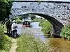
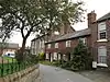
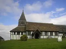
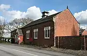
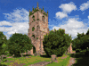
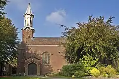
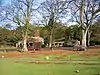
.jpg.webp) | Stoke and Hurleston | Civil parish | 357 | Cheshire East | Nantwich Rural District | [16] [17] |
 | Styal | Civil parish | 1,051 | Cheshire East | Wilmslow Urban District | [31] [39] |
 | Sutton | Civil parish | 2,464 | Cheshire East | Macclesfield Rural District | [13] [14] |
 | Swettenham | Civil parish | 248 | Cheshire East | Congleton Rural District | [21] [20] |
 | Tabley Inferior | Civil parish | 137 | Cheshire East | Bucklow Rural District | [22] [14] |
 | Tabley Superior | Civil parish | 316 | Cheshire East | Bucklow Rural District | [22] [14] |
 | Toft | Civil parish | 81 | Cheshire East | Bucklow Rural District | [22] [14] |
 | Twemlow | Civil parish | 168 | Cheshire East | Congleton Rural District | [21] [20] |
 | Walgherton | Civil parish | 121 | Cheshire East | Nantwich Rural District | [16] [17] |
 | Wardle | Civil parish | 181 | Cheshire East | Nantwich Rural District | [16] [17] |
 | Warmingham | Civil parish | 175 | Cheshire East | Nantwich Rural District | [16] [17] |
 | Weston and Crewe Green | Civil parish | Cheshire East | Nantwich Rural District | [16] [17] | |
 | Wettenhall | Civil parish | 135 | Cheshire East | Nantwich Rural District | [16] [17] |
 | Willaston | Civil parish | 2,973 | Cheshire East | Nantwich Rural District | [16] [17] |
 | Wilmslow | Town | 30,326 | Cheshire East | Wilmslow Urban District | [31] [40] |
 | Wincle | Civil parish | 164 | Cheshire East | Macclesfield Rural District | [13] [14] |
 | Wistaston | Civil parish | 8,222 | Cheshire East | Nantwich Rural District | [16] [17] |
 | Woolstanwood | Civil parish | 723 | Cheshire East | Nantwich Rural District | [16] [17] |
 | Worleston | Civil parish | 404 | Cheshire East | Nantwich Rural District | [16] [17] |
 | Wrenbury cum Frith | Civil parish | 1,060 | Cheshire East | Nantwich Rural District | [16] [17] |
 | Wybunbury | Civil parish | 1,474 | Cheshire East | Nantwich Rural District | [16] [17] |
 | Daresbury | Civil parish | 216 | Halton | Runcorn Rural District | [41] [42] |
 | Hale | Civil parish | 1,898 | Halton | Whiston Rural District | [43] [42] |
 | Halebank | Civil parish | 1,046 | Halton | Widnes Municipal Borough | [44] [45] [46] |
 | Moore | Civil parish | 807 | Halton | Runcorn Rural District | [41] [42] |
 | Preston Brook | Civil parish | 716 | Halton | Runcorn Rural District | [41] [42] |
 | Runcorn | Unparished area | 58,503 | Halton | Runcorn Urban District | [47] [48] |
 | Sandymoor | Civil parish | 1,761 | Halton | Runcorn Urban District | [47] [49] [46] |
| Widnes | Unparished area | 53,261 | Halton | Widnes Municipal Borough | [44] [50] | |
 | Appleton | Civil parish | 10,477 | Warrington | Runcorn Rural District | [41] [51] |
 | Birchwood | Town | 11,395 | Warrington | Warrington Rural District | [52] [51] |
 | Burtonwood and Westbrook | Civil parish | 11,265 | Warrington | Warrington Rural District | [52] [51] |
 | Croft | Civil parish | 2,920 | Warrington | Warrington Rural District | [52] [51] |
| Cuerdley | Civil parish | 105 | Warrington | Warrington Rural District | [52] [51] | |
 | Culcheth and Glazebury | Civil parish | 8,534 | Warrington | Golborne Urban District | [53] [51] |
 | Grappenhall and Thelwall | Civil parish | 9,377 | Warrington | Runcorn Rural District | [41] [51] |
 | Great Sankey | Civil parish | 24,211 | Warrington | Warrington Rural District | [52] [51] |
 | Hatton | Civil parish | 316 | Warrington | Runcorn Rural District | [41] [51] |
 | Lymm | Civil parish | 10,552 | Warrington | Lymm Urban District | [54] [51] |
 | Penketh | Civil parish | 8,699 | Warrington | Warrington Rural District | [52] [51] |
 | Poulton-with-Fearnhead | Civil parish | 17,019 | Warrington | Warrington Rural District | [52] [51] |
 | Rixton-with-Glazebrook | Civil parish | 1,884 | Warrington | Warrington Rural District | [52] [51] |
 | Stockton Heath | Civil parish | 6,396 | Warrington | Runcorn Rural District | [41] [51] |
 | Stretton | Civil parish | 1,009 | Warrington | Runcorn Rural District | [41] [51] |
 | Walton | Civil parish | 1,594 | Warrington | Runcorn Rural District | [41] [51] |
 | Warrington | Unparished area | 53,093 | Warrington | Warrington County Borough | [55] [56] |
 | Winwick | Civil parish | 4,366 | Warrington | Warrington Rural District | [52] [51] |
 | Woolston | Civil parish | 7,868 | Warrington | Warrington Rural District | [52] [51] |
Cheshire West and Chester
The former Chester County Borough and parts of the former Ellesmere Port Municipal Borough and Neston Urban District are unparished.
- Acton Bridge
- Agden
- Aldersey
- Aldford and Saighton
- Allostock
- Alvanley
- Anderton with Marbury
- Antrobus
- Ashton Hayes and Horton-cum-Peel
- Aston
- Bache
- Backford
- Barnton
- Barrow
- Barton
- Beeston
- Bostock
- Broxton
- Burwardsley
- Byley
- Capenhurst
- Carden
- Chester Castle
- Chidlow
- Chorlton
- Chowley
- Christleton
- Churton
- Clotton Hoofield
- Clutton
- Coddington
- Comberbach
- Croughton
- Crowton
- Cuddington
- Cuddington
- Darnhall
- Davenham
- Delamere and Oakmere
- Dodleston
- Duckington
- Duddon and Burton
- Dunham-on-the-Hill and Hapsford
- Dutton
- Eaton and Eccleston
- Elton
- Farndon
- Frodsham
- Golborne David
- Great Boughton
- Great Budworth
- Guilden Sutton
- Handley
- Hargrave and Huxley
- Hartford
- Harthill
- Helsby
- Huntington
- Ince
- Kelsall
- Kingsley
- Kingsmead
- Lach Dennis and Lostock Green[57]
- Lea-by-Backford
- Ledsham
- Little Budworth
- Little Leigh
- Little Stanney
- Littleton
- Lostock Gralam
- Malpas
- Manley
- Marston
- Mickle Trafford and District
- Mollington
- Moston
- Mouldsworth
- Moulton
- Neston
- Nether Peover
- No Man's Heath and District
- Norley
- Northwich
- Poulton and Pulford
- Puddington
- Rowton
- Rudheath
- Rushton
- Saughall and Shotwick Park
- Shocklach Oviatt and District
- Sproston
- Stanthorne and Wimboldsley
- Stoak
- Stretton
- Sutton Weaver
- Tarporley
- Tarvin
- Tattenhall and District
- Thornton-le-Moors
- Threapwood
- Tilston
- Tiverton and Tilstone Fearnall
- Tushingham-cum-Grindley, Macefen and Bradley
- Upton-by-Chester
- Utkinton and Cotebrook
- Waverton
- Weaverham
- Wervin
- Whitegate and Marton
- Whitley
- Wigland
- Willington
- Wincham
- Winsford[58]
See also
- List of civil parishes in England
References
- Angus Winchester, 2000, Discovering Parish Boundaries. Shire Publications. Princes Risborough, 96 pages ISBN 978-0-7478-0470-3
- RAC Foundation : What Went Wrong? British Highway Development Before Motorways Retrieved 2009-08-22
- The Victorian Web : The Poor Law : Introduction Retrieved 2009-08-22
- Staffordshire University : Poor Law Unions and Registration Districts Archived 2012-09-14 at archive.today Retrieved 2009-08-22
- A Vision of Britain Through Time : Status Details for Rural Sanitary District Retrieved 2009-08-22
- Robert Tittler, The Reformation and the Towns in England, 1998, Oxford University Press, 395 pages, ISBN 978-0-19-820718-4
- Modern British Surnames : Selected Events in the History of Civil Registration and Boundary Changes 1801-1996 Archived August 1, 2010, at the Wayback Machine Retrieved 2009-08-22
- Alex MacMorran and T R Colquhoun Dill, The Local Government Act 1894 and the Subsequent Statutes Affecting Parish Councils, 1907, Butterworth and Co, London, 626 pages
- Office of Public Sector Information : Local Government Act 1972 Archived 2012-12-05 at archive.today Retrieved 2009-08-22
- Office of Public Sector Information : Local Government and Rating Act 1997 Archived 2012-08-05 at archive.today Retrieved 2009-08-22
- Office of Public Sector Information : Local Government and Public Involvement in Health Act 2007 Archived 2012-08-05 at archive.today Retrieved 2009-08-22
- From 1974 to 2009 Cheshire East was divided into boroughs: Congleton, formed from Alsager Urban District, Congleton Municipal Borough, Congleton Rural District, Middlewich Urban District and Sandbach Urban District; Crewe and Nantwich, formed from Crewe Municipal Borough, Nantwich Rural District and Nantwich Urban District; and Macclesfield, formed from Alderley Edge Urban District, Bollington Urban District, Bucklow Rural District (part), Disley Rural District, Knutsford Urban District, Macclesfield Municipal Borough, Macclesfield Rural District and Wilmslow Urban District. Cheshire West and Chester was divided into Chester, formed from Chester County Borough, Chester Rural District and Tarvin Rural District; Ellesmere Port and Neston, formed from Ellesmere Port Municipal Borough and Neston Urban District; and Vale Royal, formed from Northwich Rural District, Northwich Urban District, Runcorn Rural District (part) and Winsford Urban District
- A Vision of Britain Through Time : Macclesfield Rural District Retrieved 2009-11-25
- Office for National Statistics : Census 2001 : Parish Headcounts : Macclesfield Archived 2011-06-13 at the Wayback Machine Retrieved 2009-11-25
- A Vision of Britain Through Time : Alderley Edge Urban District Retrieved 2009-11-25
- A Vision of Britain Through Time : Nantwich Rural District Retrieved 2009-11-25
- Office for National Statistics : Census 2001 : Parish Headcounts : Crewe and Nantwich Retrieved 2009-11-25
- "Alpraham and Calveley". Mapit. Retrieved 4 July 2023.
- A Vision of Britain Through Time : Alsager Urban District Retrieved 2009-11-25
- Office for National Statistics : Census 2001 : Parish Headcounts : Congleton Archived 2016-03-03 at the Wayback Machine Retrieved 2009-11-25
- A Vision of Britain Through Time : Congleton Rural District Retrieved 2009-11-25
- A Vision of Britain Through Time : Bucklow Rural District Archived 2012-10-25 at the Wayback Machine Retrieved 2009-11-25
- A Vision of Britain Through Time : Bollington Urban District Retrieved 2009-11-28
- "Bulkeley and Ridley". Mapit. Retrieved 4 July 2023.
- "Burland and Acton". Mapit. Retrieved 4 July 2023.
- A Vision of Britain Through Time : Congleton Municipal Borough Retrieved 2009-11-29
- A Vision of Britain Through Time : Crewe Municipal Borough Retrieved 2009-11-25
- Office for National Statistics : Census 2001 : Table KS01 : Usual Resident Population Archived 2015-04-22 at the Wayback Machine Alexandra (part); Coppenhall; Delamere; Grosvenor; Leighton (part); Maw Green; St Barnabas (part); St John's; Valley; Waldron; and Wistaston Green wards. Retrieved 2009-11-25
- "Public Notice: Outcome of the Crewe Community Governance Review". Cheshire East Council. Archived from the original on 29 March 2015. Retrieved 16 May 2013.
- A Vision of Britain Through Time : Disley Rural District Retrieved 2009-11-29
- A Vision of Britain Through Time : Wilmslow Urban District Retrieved 2009-11-25
- "The Cheshire East Borough Council (Reorganization of Community Governance) (Wilmslow, Handforth and Styal) Order 2011" (PDF). Lgbce. Archived from the original (PDF) on 3 March 2018. Retrieved 2 March 2018.
- A Vision of Britain Through Time : Knutsford Urban District Retrieved 2009-11-30
- A Vision of Britain Through Time : Macclesfield Municipal Borough Retrieved 2009-11-25
- Office for National Statistics : Census 2001 : Table KS01 : Usual Resident Population Archived 2015-04-22 at the Wayback Machine Macclesfield Bollinbrook; Macclesfield Broken Cross; Macclesfield Central; Macclesfield East; Macclesfield Hurdsfield; Macclesfield Ivy; Macclesfield Ryles; Macclesfield South (part); Macclesfield Tytherington; and Macclesfield West wards. Retrieved 2009-11-25
- A Vision of Britain Through Time : Middlewich Urban District Retrieved 2009-11-30
- A Vision of Britain Through Time : Nantwich Urban District Retrieved 2009-12-01
- A Vision of Britain Through Time : Sandbach Urban District Retrieved 2009-12-03
- "The Cheshire East Borough Council (Reorganization of Community Governance) (Wilmslow, Handforth and Styal) Order 2011" (PDF). Lgbce. Archived from the original (PDF) on 3 March 2018. Retrieved 2 March 2018.
- Office for National Statistics : Census 2001 : Table KS01 : Usual Resident Population Archived 2015-04-22 at the Wayback Machine Dean Row; Fulshaw; Handforth; Hough; Lacey Green; and Morley and Styal wards. Retrieved 2009-11-25
- A Vision of Britain Through Time : Runcorn Rural District Archived 2007-09-30 at the Wayback Machine Retrieved 2009-12-05
- Office for National Statistics : Census 2001 : Parish Headcounts : Halton Retrieved 2009-12-08
- A Vision of Britain Through Time : Whiston Rural District Archived 2007-09-30 at the Wayback Machine Retrieved 2009-12-08
- A Vision of Britain Through Time : Widnes Municipal Borough Retrieved 2009-12-08
- Office for National Statistics : Census 2001 : Table KS01 : Usual Resident Population Archived 2015-04-22 at the Wayback Machine Ditton ward (part). Retrieved 2009-12-08
- The Electoral Commission : The Halton (Parish Electoral Arrangements) Order 2008 Retrieved 2009-12-10
- A Vision of Britain Through Time : Runcorn Urban District Retrieved 2009-12-08
- Office for National Statistics : Census 2001 : Table KS01 : Usual Resident Population Archived 2015-04-22 at the Wayback Machine Beechwood; Daresbury (part); Grange; Halton Brook; Halton Castle; Halton Lea; Heath; Mersey; Norton North; Norton South; and Windmill Hill wards. Retrieved 2009-12-08
- Office for National Statistics : Census 2001 : Table KS01 : Usual Resident Population Archived 2015-04-22 at the Wayback Machine Daresbury ward (part). Retrieved 2009-12-08
- Office for National Statistics : Census 2001 : Table KS01 : Usual Resident Population Archived 2015-04-22 at the Wayback Machine Appleton; Birchfield; Broadheath; Ditton (part); Farnworth; Halton View; Hough Green; Kingsway; and Riverside wards. Retrieved 2009-12-08
- Office for National Statistics : Census 2001 : Parish Headcounts : Warrington Archived 2012-06-16 at the Wayback Machine Retrieved 2009-12-05
- A Vision of Britain Through Time : Warrington Rural District Archived 2007-10-01 at the Wayback Machine Retrieved 2009-12-05
- A Vision of Britain Through Time : Golborne Urban District Archived 2012-10-25 at the Wayback Machine Retrieved 2009-12-05
- A Vision of Britain Through Time : Lymm Urban District Retrieved 2009-12-06
- A Vision of Britain Through Time : Warrington County Borough Retrieved 2009-11-25
- Office for National Statistics : Census 2001 : Table KS01 : Usual Resident Population Archived 2015-04-22 at the Wayback Machine Bewsey and Whitecross; Fairfield and Howley; Latchford East; Latchford West; Orford; and Poplars and Hulme (part) wards. Retrieved 2009-11-25
- "Lach Dennis change of name notice" (PDF). Cheshire West and Chester Council. Retrieved 6 July 2023.
- "Children of Cheshire West and Chester Council". Mapit. Retrieved 23 March 2018.
External links
- Office for National Statistics : Geographical Area Listings
- Cheshire East Council : Clerks of Town Councils, Parish Councils and Parish Meetings
- Cheshire West and Chester Council : Contact Details for Local Council Clerks
- Halton Borough Council : Parish Councils
- Warrington Borough Council : Parish and Town Councils