Crveni Krst, Niš
Crveni Krst (Serbian Cyrillic: Црвени крст, pronounced [tsrʋɛni kř̩ːst]; translated: Red Cross) is one of five city municipalities which constitute the city of Niš. According to the 2011 census, the municipality has a population of 32,301 inhabitants.
Crveni Krst
Црвени крст | |
|---|---|
| City municipality of Crveni Krst Градска општина Црвени крст | |
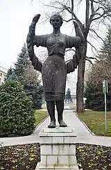 Sculpture in the courtyard of Philip Morris International tobacco factory | |
 Flag  Coat of arms | |
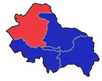 Location of the municipality of Crveni Krst within City of Niš | |
| Country | |
| Region | Southern and Eastern Serbia |
| District | Nišava |
| City | Niš |
| Settlements | 24 |
| Government | |
| • Mayor | Miroslav Milutinović (SNS) |
| Area | |
| • Municipality | 181.74 km2 (70.17 sq mi) |
| Population (2011 census)[2] | |
| • Urban | 12,516 |
| • Municipality | 32,301 |
| Time zone | UTC+1 (CET) |
| • Summer (DST) | UTC+2 (CEST) |
| Postal code | 18000 |
| Area code | +381(0)18 |
| Car plates | NI |
| Website | http://gocrvenikrst.rs/pocetna |
Geography
The municipality borders Aleksinac municipality in the north-west, Svrljig municipality in the north-east, Pantelej municipality in the east, Medijana municipality in the south-east, Palilula municipality in the south, and Merošina municipality in the south-west.
History
Crveni Krst Municipality was formed on 6 June 2002. It was the site of a concentration camp during World War II.
Demographics
According to the 2011 census, the municipality had a population of 32,301 inhabitants, with 12,516 in the eponymous settlement.
Settlements
The municipality consists of 24 settlements, all of which are classified as rural, except for Crveni Krst, which is a part of a larger urban settlement of Niš.[3]
|
|
|
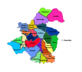
Neighborhoods
Neighborhoods of municipality of Crveni Krst include:
- Crveni Krst
- Beograd Mala
- Jagodin Mala (partly)
- Šljaka
- Komren (mostly)
- Ratko Jović
See also
References
- "Municipalities of Serbia, 2006". Statistical Office of Serbia. Retrieved 2010-11-28.
- "2011 Census of Population, Households and Dwellings in the Republic of Serbia: Comparative Overview of the Number of Population in 1948, 1953, 1961, 1971, 1981, 1991, 2002 and 2011, Data by settlements" (PDF). Statistical Office of Republic Of Serbia, Belgrade. 2014. ISBN 978-86-6161-109-4. Retrieved 2014-06-27.
- "Comparative overview of the number of population in 1948, 1953, 1961, 1971, 1981, 1991, 2002 and 2011" (PDF). Archived (PDF) from the original on 2014-07-14. Retrieved August 23, 2020.
External links
Municipalities and cities of Southern and Eastern Serbia | ||
|---|---|---|
| Cities | 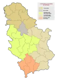 | |
| Municipalities |
| |