Dandenong Creek
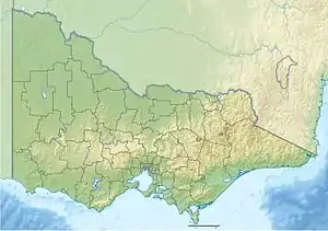
The Dandenong Creek (Aboriginal Bunwurrung: Narra Narrawong[1] or Dandinnong[2]) is an urban creek[3] of the Port Phillip catchment, located in the eastern and south-eastern Greater Melbourne region of the Australian east coast state of Victoria. The creek descends approximately 550 metres (1,800 ft) over its course of 53 kilometres (33 mi)[1] before joining the Eumemmerring Creek to form the Patterson River (of which it can be considered the de facto main stem) and eventually draining into the Beaumaris Bay.
| Dandenong Dand-y-non, Tanjenong[1] | |
|---|---|
 | |
| Etymology | Aboriginal Bunwurrung: "high" or "lofty"[1] |
| Native name | Narra Narrawong, Dandinnong[1][2] |
| Location | |
| Country | Australia |
| State | Victoria |
| Region | South East Coastal Plain (IBRA), Greater Melbourne |
| Local government area | City of Monash |
| Physical characteristics | |
| Source | Dandenong Ranges |
| 2nd source | Bungalook Creek |
| • location | near Heathmont |
| • coordinates | 37°50′8″S 145°15′25″E |
| • elevation | 556 m (1,824 ft) |
| Mouth | confluence with the Eumemmerring Creek to form the Patterson River |
• location | southwest of Bangholme |
• coordinates | 38°02′30″S 145°10′34″E |
• elevation | 6 m (20 ft) |
| Length | 53 km (33 mi) |
| Basin features | |
| River system | Port Phillip catchment |
| Tributaries | |
| • left | Corhanwarrabul Creek, Blind Creek, Old Joes Creek, Dobsons Creek |
| • right | Mordialloc Creek, Mile Creek, Heatherdale Creek, Bungalook Creek, Little Bungalook Creek |
| [3][4] | |
Together with its distributary Mordialloc Creek and the culvert-linked Kananook Creek and Elster Creek, the so-called "Dandenong Catchment" has an overall catchment of approximately 882 km2 (341 sq mi).[5]
Etymology
The traditional custodians of the land surrounding what is now known as the Dandenong Creek were the indigenous Bunurong people of the Kulin nation who referred to the creek as Narra Narrawong; while others gave the creek the name Dandenong, sometimes spelled as Dand-y-non or Tanjenong by early settlers, believed to mean "high" or "lofty".[1]
Course
The first European to see the creek near its source was in 1839 and is believed to be Daniel Bunce, a botanist.[1]
Dandenong Creek has its headwaters in the Dandenong Ranges near Olinda, sourced by a series of springs and small runoff streams within the Dandenong Ranges National Park. The creek can be roughly separated into three sections:
- The Upper Dandenong starts at the Olinda town center and first flows westwards between Mount Dandenong and The Basin, picking up its first significant tributary, the Dobson Creek, near a retarding basin just west of the junction among The Basin, Kilsyth, Kilsyth South and Boronia. It continues further west as the boundary between several adjacent suburbs, picking up Little Bungalook and Tarralla-Bungalook Creek before turning southwards at the junction between Ringwood, Vermont and Wantirna, roughly where EastLink crosses.
- The Middle Dandenong starts at the mouth of the small Heatherdale Creek just west of EastLink, and then flows meandrously to the south, joined by the Blind Creek (near Jells Park). It then crosses over to the east side of the EastLink, joined by the Corhanwarrabul Creek (at the Tirhatuan Wetlands), and then courses southeast towards the western edge of the Churchill National Park, crossing the namesaked Dandenong Valley Highway (Stud Road) in the process. After draining a series of greenspace reserves known as the Dandenong Valley Parklands, the creek reaches a former police paddock in Endeavour Hills and turns more southwardly again as the boundary between Dandenong North and Endeavour Hills. The riparian zones and associated runoff catchment surrounding the tri-suburban junction between Dandenong North, Dandenong and Doveton are known as the Dandenong Wetlands, which include a 0.8 km (0.5 mi) section of Heatherton Road just west of Monash Freeway that functions as a floodway. The creek then continues further south as the northern half of the boundary between Dandenong and Doveton.
- The Lower Dandenong starts just upstream of the Clow Street bridge in Dandenong East, where the creek becomes concrete-lined throughout almost its entire course within Dandenong. It first turns southwest at Dandenong Park, looping shortly northwest before crossing Princes Highway and the Pakenham/Cranbourne railway line, then continues further westwards south of the Dandenong town center until it picks up the Mile Creek (its last de jure tributary) about 350 m (380 yd) upstream of the Dandenong Bypass bridge. It then turns straight south again and courses alongside the EastLink's east side as the boundary between Dandenong South and Keysborough, crossing over to the west side of the EastLink again about 1 km (0.62 mi) before giving off Mordialloc Creek near the tri-suburban junction with Bangholme at the Perry Road bridge. It then flows southwest into Bangholme for another 1.4 km (0.87 mi) before reaching its confluence with the Eumemmerring Creek to form the partly man-made Patterson River, which continues southwest through Bangholme, Patterson Lakes, Bonbeach and Carrum and drains into the Beaumaris Bay, a small eastern bight of Port Phillip Bay north of the Mornington Peninsula.
Tributaries
- Dobson Creek (left) — headwaters in Sassafras, confluence in northern The Basin (near Liverpool Road Retarding Basin)
- Little Bungalook Creek (right) — headwaters in southern Kilsyth, confluence in southwestern Kilsyth South)
- Bungalook Creek (right) — headwaters in Montrose, joined by Tarralla Creek (headwaters in southern Croydon) in western Bayswater North, confluence in Heathmont
- Heatherdale Creek (right) — headwaters in southwestern Ringwood, confluence in eastern Vermont
- Blind Creek (left) — headwaters in Dandenong Ranges National Park, goes briefly underground in Ferntree Gully(around Belgrave line) and Wantirna South (under Westfield Knox), confluence in northwestern Scoresby (at Jells Park)
- Corhanwarrabul Creek (left) — headwaters in southern Ferny Creek (namesaked from the creek's upper section), joined by Monbulk Creek (headwaters in southern Kallista) between southern Knoxfield and northern Rowville, confluence in southwestern Rowville (at Tirhatuan Wetlands)
- Mile Creek (right) — headwaters from urban runoffs in northern Springvale, eastern Clayton and western Mulgrave, joined by Yarraman Creek (headwaters from two ponds/retarding basins in southern Noble Park North) in eastern Noble Park (near Yarraman railway station), confluence between southwestern Dandenong and eastern Keysborough
- Eumemmerring Creek (left) — headwaters in western Belgrave South, joined by numerous drains from the Lysterfield Lake, Hallam Main Drain (which drains parts of Berwick, Narre Warren, Narre Warren South, Hampton Park and Dandenong South) and Eastern Contour Drain (which drains parts of Sandhurst, Lyndhurst, Lynbrook and Dandenong South), confluence at Bangholme to form the Patterson River (near the Eastern Treatment Plant)
Distributary
- Mordialloc Creek — branching off the right bank of Dandenong Creek at the tri-suburban junction of Keysborough, Bangholme and Dandenong South (near Perry Road bridge), flowing west/northwest as the boundary between Keysborough, Bangholme, Waterways, Braeside and Aspendale Gardens, picking up the drainage runoff from the Smythes Drain, Waterways Lake and Lagoons, Dunlops Drain (formed from Old Dandenong Road Drain and Dingley Drain), Mordialloc Settlement Drain, Heatherton Drain and the Edithvale Wetlands Drain before emptying into Beaumaris Bay between Mordialloc and Aspendale.
Ecology
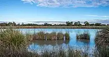
The series of open space reserves along the Dandenong Creek and its tributaries provide important habitat for many urban wildlife in the outer eastern/southeastern suburbs. The creek is also the home of one of the largest remaining populations of Yarra Gum,[6] and a series of linear parks, nature reserves and wetlands are located along it. A bike path known as the Dandenong Creek Trail runs alongside for a significant distance.
The health of the creek in these urban areas ranges from moderate to very poor and has been the focus of a number of clean-up campaigns in recent years.[7] An industrial wastewater stream known as Old Joes Creek flows into Dandenong Creek, with its confluence in Bayswater.[8] This drain runs underground for much of its course, running in a westerly direction and servicing several industrial estates in the catchment of Dandenong Creek.[9] The tributary is commonly contaminated with plastic litterings and heavy metals, and authorities have made several attempts to prevent pollution which spreads downstream into Dandenong Creek.[10][11]
Creek crossings
The list below notes current bridges that cross over the Dandenong Creek. Some are road and rail bridges, whilst others are pedestrian and equestrian crossings.
Patterson River to Dandenong Valley Parklands
| Crossing | Image | Coordinates | Built | Suburb | Description |
|---|---|---|---|---|---|
| Old Perry Road | Bangholme | Ruins of old Perry Road bridge over Dandenong Creek | |||
| Perry Road | |||||
| EastLink | 2008 | Dandenong South | |||
| Greens Road | |||||
| Unnamed creek crossing | Abandoned concrete-paved ford crossing | ||||
| Dandenong Bypass | 2008 | ||||
| EastLink Trail | 2008 | Dandenong | Low-water bridge | ||
| Allan Street | |||||
| Hammond Road | Has a closely adjacent pedestrian footbridge downstream of the main bridge | ||||
| Gippsland Railway bridge | Railway bridge carrying the Gippsland line | ||||
| Lonsdale Street pedestrian bridge | Beam footbridge parallel to Lonsdale Street | ||||
| Lonsdale Street | The crossing of the Princes Highway, locally named Lonsdale Street | ||||
| Dandenong Creek Trail | | Through arch footbridge | |||
| Dandenong Park footbridge | |||||
| McCrae Street | |||||
| Dandenong Workers Social Club footbridge | Footbridge between the Dandenong Workers Social Club and their golf course across the creek | ||||
| Kidds Road | |||||
| Heatherton Road | Dandenong North | Section west of Dandenong Creek also serves as floodway | |||
| Monash Freeway | |||||
| Brady Road | |||||
| Stud Road | |||||
| Police Road Retarding Basin | Mulgrave | Causeway atop the basin embankment and floodgate, enabling pedestrian crossing | |||
| EastLink | 2008 | ||||
| Wellington Road | Rowville |
Dandenong Valley Parklands
| Crossing | Image | Coordinates | Built | Suburb | Description |
|---|---|---|---|---|---|
| Dandenong Valley wetland trail | 2010 | Scoresby | Shared path over the creek | ||
| Ferntree Gully Road | |||||
| EastLink Trail | 2008 | ||||
| Dandenong Creek Trail | |||||
| Patterson's Bridge | Wantirna South | Part of Dandenong Creek Trail | |||
| High Street Road footbridge | Footbridge linking Napier Park with Nortons Park | ||||
| High Street | |||||
| Burwood Highway | Vermont South | ||||
| Dandenong Creek Trail | Koomba Park boardwalk |
Dandenong Valley Parklands to Mount Dandenong
| Crossing | Image | Coordinates | Built | Suburb | Description |
|---|---|---|---|---|---|
| Boronia Road | Vermont | ||||
| EastLink Trail | Section of the EastLink Trail linking Winton Wetlands with Campbells Croft Reserve | ||||
| EastLink | 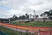 | 2008 | Ringwood | ||
| Wantirna Road | |||||
| Marlborough Road footbridge | Heathmont | Footbridge at the end of Marlborough Road | |||
| H.E. Parker Reserve footbridge | Footbridge connecting the Dandenong Creek Trail with H.E. Parker Reserve | ||||
| Belgrave railway line | Bayswater North | ||||
| Tarralla Creek Trail | |||||
| Bayswater Road | |||||
| Dorset Road | |||||
| Colchester Road | Kilsyth South | ||||
| Liverpool Road Retarding Basin wall | Boronia | Path along basin wall provides crossing over the creek | |||
| Liverpool Road Retarding Basin footbridge | Footbridge inside the retarding basin provides crossing over the creek | ||||
| Liverpool Road | The Basin | ||||
| Dobson Lane | Dobson Lane | ||||
| Pavitt Lane | Kilsyth | ||||
| Sheffield Road | |||||
| Edgar Track | Mount Dandenong | ||||
| Doongalla Forest access road | |||||
| Dandenong Creek Track | Olinda |
References
- "Snapshot of Dandenong Creek" (PDF). Fact sheet. Melbourne Water. Archived from the original (PDF) on 13 April 2014. Retrieved 11 April 2014.
- "Dandenong Creek: 13888: Historical information". Vicnames. Government of Victoria. 12 August 2011. Archived from the original on 13 April 2014. Retrieved 11 April 2014.
- "Dandenong Creek: 13888". Vicnames. Government of Victoria. 2 May 1966. Archived from the original on 11 April 2014. Retrieved 11 April 2014.
- "Map of Dandenong Creek, VIC". Bonzle Digital Atlas of Australia. Retrieved 11 April 2014.
- Dandenong Creek Snapshot, Melbourne Water 2017
- "Flora and Fauna: Significant Plant Species". Archived from the original on 28 August 2007. Retrieved 4 September 2007.
- "Dandenong Creek". Rivers and Creeks. Melbourne Water. Archived from the original on 5 September 2007. Retrieved 4 September 2007.
- "Old Joes Creek gets a makeover". BehaviourWorks Australia. Monash Sustainable Development Institute. 2015. Retrieved 19 July 2019.
- Frame, Joanna; Coleman, Rhys; Moore, Trivess (August 2005). "Waterway assessment in the Dandenong Valley Catchment: Water quality in Upper Dandenong Creek and associated tributaries". Melbourne Water Corporation.
- "EPA fines Bayswater company over $7500". Environment Protection Authority Victoria. 26 February 2016. Archived from the original on 19 July 2019. Retrieved 19 July 2019.
- "Pollution Detection and Prevention". Melbourne Water. Archived from the original on 19 July 2019. Retrieved 19 July 2019.
External links
- Returning Dandenong Creek project
- First Friends of Dandenong Creek website
- "Info sourced on place names in the area". Knox Historical Society. Archived from the original on 17 March 2012.
Waterways of the Melbourne Water catchment, Victoria, Australia | |
|---|---|
| Rivers |
|
| Creeks |
|
| Lakes |
|
| Drains | Bunyip Main Drain
Wylies Drain |
| Other | |
| |