Delduar Upazila
Delduar (Bengali: দেলদুয়ার) is an upazila of Tangail District[1] in the Division of Dhaka, Bangladesh.
Delduar
দেলদুয়ার | |
|---|---|
 | |
.svg.png.webp) | |
| Coordinates: 24°8.5′N 89°58′E | |
| Country | |
| Division | Dhaka |
| District | Tangail |
| Government | |
| • Upazila Chairman | Engineer Mahmudul Hasan Maroof |
| Area | |
| • Total | 184.54 km2 (71.25 sq mi) |
| Population (2011) | |
| • Total | 207,278 |
| • Density | 1,100/km2 (2,900/sq mi) |
| Time zone | UTC+6 (BST) |
| Website | delduar |
Geography
Delduar is located at 24.1417°N 89.9667°E. It has 48,227 households and total area 184.54 km2.
Demographics
According to the 2011 Bangladesh census, Delduar Upazila had 48,227 households and a population of 207,278. 41,018 (19.79%) were under 10 years of age. Delduar had a literacy rate (age 7 and over) of 51.57%, compared to the national average of 51.8%, and a sex ratio of 1060 females per 1000 males. 14,102 (6.80%) lived in urban areas.[2][3]
Administration
Delduar Upazila is divided into eight union parishads: Atia, Delduar, Deoli, Dubail, Elashin, Fazilhati, Lauhati, and Pathrail. The union parishads are subdivided into 123 mauzas and 162 villages.[2]
References
- Tapan Kumar De (2012), "Delduar Upazila", in Sirajul Islam; Ahmed A. Jamal (eds.), Banglapedia: National Encyclopedia of Bangladesh (Second ed.), Asiatic Society of Bangladesh
- "Bangladesh Population and Housing Census 2011 Zila Report – Tangail" (PDF). bbs.gov.bd. Bangladesh Bureau of Statistics.
- "Community Tables: Tangail district" (PDF). bbs.gov.bd. Bangladesh Bureau of Statistics. 2011.
| Upazila/Thana: | ||
|---|---|---|
Headquarters: Dhaka | ||
| Dhaka District | 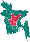 | |
| Faridpur District |
| |
| Gazipur District | ||
| Gopalganj District | ||
| Kishoreganj District |
| |
| Madaripur District | ||
| Manikganj District | ||
| Munshiganj District |
| |
| Narayanganj District |
| |
| Narsingdi District | ||
| Rajbari District |
| |
| Shariatpur District |
| |
| Tangail District | ||
This article is issued from Wikipedia. The text is licensed under Creative Commons - Attribution - Sharealike. Additional terms may apply for the media files.