Digul
The Digul River (Dutch: Digoel) is a major river in South Papua province, Indonesia, on the island of New Guinea. It is the fourth longest river in New Guinea after the Sepik River, Mamberamo River, and Fly River. With a total length of 853 km (530 mi) and a drainage basin of 45,900 km2 (17,700 sq mi).[6]
| Sungai Digul Oewamba Rivier, Digoel-rivier, Oewimboe, Digoel Oewimboe, Digoel-Kian, Uwimbu, Digul | |
|---|---|
 | |
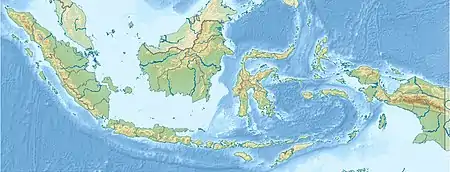 Location of river mouth 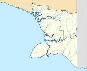 Digul (South Papua) | |
| Location | |
| Country | Indonesia |
| Province | Papua |
| Physical characteristics | |
| Source | Maoke Mountains |
| • coordinates | 4°53′33.4068″S 140°23′52.9512″E |
| • elevation | 3,700 m (12,100 ft) |
| Mouth | |
• location | Arafura Sea |
• coordinates | 7°7′S 138°42′E |
• elevation | 0 m (0 ft) |
| Length | 853 km (530 mi) |
| Basin size | 42,142.6 km2 (16,271.3 sq mi)[1] to 44,953.98 km2 (17,356.83 sq mi)[2] |
| Width | |
| • average | 300 m (980 ft)–900 m (3,000 ft) (Lower Digul)[3] |
| Depth | |
| • minimum | 6 m (20 ft) (Lower Digul)[3] |
| • maximum | 28 m (92 ft) (Lower Digul)[3] |
| Discharge | |
| • location | Digul Delta, Arafura Sea |
| • average | 3,867.2 m3/s (136,570 cu ft/s)[4]
(Period: 2015–2019)3,027.89 m3/s (106,929 cu ft/s)[2] (Period: 1971–2000)3,332.7 m3/s (117,690 cu ft/s)[1] |
| • minimum | 1,766.9 m3/s (62,400 cu ft/s)[4] |
| • maximum | 5,304 m3/s (187,300 cu ft/s)[4] 10,600 m3/s (370,000 cu ft/s) |
| Discharge | |
| • location | Before delta (Basin size: 25,597.9 km2 (9,883.4 sq mi)[1] |
| • average | (Period: 1979–2015)69.42 km3/a (2,200 m3/s)[5] (Period: 1971–2000)2,443.9 m3/s (86,310 cu ft/s)[1] |
| Discharge | |
| • location | Tanah Merah (320 km upstream of mouth; Basin size: 9,188.8 km2 (3,547.8 sq mi)[1] |
| • average | (Period: 1971–2000)1,140.7 m3/s (40,280 cu ft/s)[1] |
| Basin features | |
| River system | Digul River |
| Tributaries | |
| • left | Digul Timur, Takum, Murup, Anggarap, Mandobo, Uwimmerah |
| • right | Arup, Kia, Ederah, Mappi, Uwamba |
History
The swamplands upstream were known by the name "Boven-Digoel" (Above the Digul, in Dutch) and hosted a penal colony at Tanahmerah (Red Earth) in the early 20th century, when Indonesia was a colony of Holland. As a result of the abortive 1926 revolt by the Communist Party of Indonesia (PKI), the Dutch exiled 823 of the most troublesome revolutionaries here.[7]
Hydrology
Rising on the southern slopes of the Maoke Mountains, the Digul flows first south and then west to empty into the Arafura Sea. For much of its length, it travels across a low region of extensive swamps and creates a delta near Dolak (Yos Sudarso Island, formerly Frederik Hendrik) Island. The river has a length of 853 km (530 mi) and is navigable as far as Tanahmerah.
Geography
| Sungai Digul | ||||||||||||||||||||||||||||||||||||||||||||||||||||||||||||
|---|---|---|---|---|---|---|---|---|---|---|---|---|---|---|---|---|---|---|---|---|---|---|---|---|---|---|---|---|---|---|---|---|---|---|---|---|---|---|---|---|---|---|---|---|---|---|---|---|---|---|---|---|---|---|---|---|---|---|---|---|
| Climate chart (explanation) | ||||||||||||||||||||||||||||||||||||||||||||||||||||||||||||
| ||||||||||||||||||||||||||||||||||||||||||||||||||||||||||||
| ||||||||||||||||||||||||||||||||||||||||||||||||||||||||||||
The river flows in the southern area of Papua with predominantly tropical monsoon climate (designated as Am in the Köppen-Geiger climate classification).[9] The annual average temperature in the area is 22 °C. The warmest month is April, when the average temperature is around 24 °C, and the coldest is June, at 20 °C.[8] The average annual rainfall is 3,072 mm. The wettest month is January, with an average of 464 mm rainfall, and the driest is July, with 28 mm rainfall.[10] The average rainfall for the whole catchment area between 2002 and 2011 was 3,522 mm.[11]
Discharge
| Period | Average discharge | Ref |
|---|---|---|
| Digul delta | ||
| 3,867.2 m3/s (136,570 cu ft/s)* | [4] | |
| 1971–2000 | 3,332.7 m3/s (117,690 cu ft/s) | [1] |
| 2002–2011 | 2,760 m3/s (97,000 cu ft/s) | [11] |
| 2015–2019 | 3,027.89 m3/s (106,929 cu ft/s) | [2] |
| Before delta | ||
| 1971–2000 | 2,443.9 m3/s (86,310 cu ft/s) | [1] |
| 1979–2015 | 69.42 km3/a (2,200 m3/s) | [5] |
| 1996–2005 | 68.251 km3/a (2,162.7 m3/s) | [12] |
| 2002–2011 | 2,127 m3/s (75,100 cu ft/s) | [11] |
| 2003–2015 | 82.6 km3/a (2,620 m3/s) | [13] |
| 2015–2019 | 1,999.09 m3/s (70,597 cu ft/s)* | [2] |
| Tanah Merah | ||
| 1971–2000 | 1,140.7 m3/s (40,280 cu ft/s) | [1] |
*Monthly flow (m3/s):
| Month | Before
delta[2] |
Delta[4] |
|---|---|---|
| JAN | 2,066.8 | 4,077.8 |
| FEB | 2,401.4 | 5,137.5 |
| MAR | 2,463.6 | 5,072.1 |
| APR | 2,378.9 | 4,862.5 |
| MAY | 2,255.1 | 4,367.8 |
| JUN | 1,793.9 | 3,244.1 |
| JUL | 1,243 | 1,903.1 |
| AUG | 1,149.5 | 1,766.9 |
| SEP | 1,479.3 | 2,321.5 |
| OCT | 1,902.6 | 3,404.3 |
| NOV | 2,426.9 | 4,944.6 |
| DEC | 2,488.2 | 5,304 |
| Avg. | 1,999.1 | 3,867.2 |
Tributaries
The main tributaries from the mouth:[1][3]
| Left
tributary | Right
tributary | Length
(km) | Basin size
(km2) | Average discharge
(m3/s)* |
|---|---|---|---|---|
| Digul | 853 | 42,142.6 | 3,332.7 | |
| Uwamba | 1,268.3 | 98.8 | ||
| Mappi | 524.98 | 9,581.7 | 540.7 | |
| Ederah | 170 | 2,277.4 | 113.2 | |
| Kia | 1,272.3 | 68.7 | ||
| Uwimmerah | 6,437.4 | 777.4 | ||
| Mandobo | 1,397.6 | 118.9 | ||
| Anggarap | 562.2 | 55.5 | ||
| Murup | 440.7 | 50.9 | ||
| Takum | 543.3 | 60.3 | ||
| Arup | 1,077.8 | 104.2 | ||
| Digul Timur | 196.06 | 3,166 | 541.2 | |
*Period: 1971–2000
See also
- List of drainage basins of Indonesia
- List of rivers of Indonesia
References
- "Bulaka".
- PENGELOLAAN SUMBER DAYA AIR WILAYAH SUNGAI EINLANDEN-DIGUL-BIKUMA (PDF). 2021.
- "Pemerintah Provinsi Papua".
- Firmansyah, Rendy. "Grafik Neraca Air Pulau Papua".
- "GEF TWAP - Transboundary Waters Assessment Programme — GEF TWAP".
- Sungai Digul - Geonames.org.
- Brackman, A.C., Indonesian Communism: A History, 1963, Praeger Press
- "NASA Earth Observations Data Set Index". NASA. 30 January 2016. Archived from the original on 7 April 2019. Retrieved 29 November 2018.
- Peel, M C; Finlayson, B L; McMahon, T A (2007). "Updated world map of the Köppen-Geiger climate classification". Hydrology and Earth System Sciences. 11 (5): 1633–1644. Bibcode:2007HESS...11.1633P. doi:10.5194/hess-11-1633-2007.
- "NASA Earth Observations: Rainfall (1 month - TRMM)". NASA/Tropical Rainfall Monitoring Mission. 30 January 2016. Archived from the original on 11 May 2020. Retrieved 29 November 2018.
- van Beek, E.; Bons, K.; Brinkman, J. (2013). "Final report Einlanden-Digul-Bikuma basin IWRM case study".
- A.Y., Hoekstra; M.M., Mekonnen (Sep 2011). "GLOBAL WATER SCARCITY: THE MONTHLY BLUE WATER FOOTPRINT COMPARED TO BLUE WATER AVAILABILITY FOR THE WORLD'S MAJOR RIVER BASINS-VALUE OF WATER RESEARCH REPORT SERIES NO.53" (PDF).
- Radhika, Radhika; Firmansyah, Rendy; Hatmoko, Waluyo (Nov 2017). "Computation of surface water availability in Indonesia based on satellite data". Jurnal Sumber Daya Air. 13 (2): 115–130. doi:10.32679/jsda.v13i2.206.