East Hereford
East Hereford is a municipality of about 260 people in southeastern Quebec, Canada, in Coaticook Regional County Municipality in the Estrie region.
East Hereford | |
|---|---|
 | |
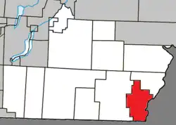 Location within Coaticook RCM | |
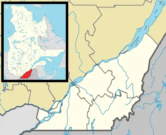 East Hereford Location in southern Quebec | |
| Coordinates: 45°05′N 71°30′W[1] | |
| Country | |
| Province | |
| Region | Estrie |
| RCM | Coaticook |
| Constituted | July 1, 1855 |
| Government | |
| • Mayor | Benoit Lavoie |
| • Federal riding | Compton—Stanstead |
| • Prov. riding | Saint-François |
| Area | |
| • Total | 73.30 km2 (28.30 sq mi) |
| • Land | 72.19 km2 (27.87 sq mi) |
| Population | |
| • Total | 269 |
| • Density | 3.7/km2 (10/sq mi) |
| • Pop 2011-2016 | |
| • Dwellings | 145 |
| Time zone | UTC−5 (EST) |
| • Summer (DST) | UTC−4 (EDT) |
| Postal code(s) | J0B 1S0 |
| Area code | 819 |
| Highways | |
| Website | www |
East Hereford is located just north of Beecher Falls, Vermont, and on the east side of East Hereford it is bordered by New Hampshire. Halls Stream, a south-flowing tributary of the Connecticut River, forms the eastern boundary of the municipality and the Canada–United States border. Dairy farming and lumber products are the main sources of income in the area.
The nearby Mont Hereford has a developed trail network for the sport of mountain biking.
Demographics
Population
Population trend:[4]
| Census | Population | Change (%) |
|---|---|---|
| 2016 | 269 | |
| 2011 | 306 | |
| 2006 | 349 | |
| 2001 | 323 | |
| 1996 | 317 | |
| 1991 | 345 | N/A |
See also
- List of anglophone communities in Quebec
References
- "Banque de noms de lieux du Québec: Reference number 177280". toponymie.gouv.qc.ca (in French). Commission de toponymie du Québec.
- "Répertoire des municipalités: Geographic code 44010". www.mamh.gouv.qc.ca (in French). Ministère des Affaires municipales et de l'Habitation.
- "Census Profile, 2016 Census - East Hereford, Municipalité [Census subdivision], Quebec and Brome-Missisquoi, Municipalité régionale de comté [Census division], Quebec". 8 February 2017.
- Statistics Canada: 1996, 2001, 2006, 2011, 2016 census
External links
![]() Media related to East Hereford at Wikimedia Commons
Media related to East Hereford at Wikimedia Commons
Places adjacent to East Hereford | ||||||||||||||||
|---|---|---|---|---|---|---|---|---|---|---|---|---|---|---|---|---|
| ||||||||||||||||
| Cities | |
|---|---|
| Municipalities |
|
| Townships | |
| Communities |
|
| |
This article is issued from Wikipedia. The text is licensed under Creative Commons - Attribution - Sharealike. Additional terms may apply for the media files.