East Sumba Regency
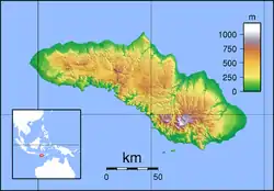
East Sumba Regency (Indonesian: Kabupaten Sumba Timur) is geographically the largest of the four regencies which divide the island of Sumba, within East Nusa Tenggara Province of Indonesia. It occupies 62% (nearly two-thirds) of the entire island, being much less densely populated than the western third. The town of Waingapu is the capital of East Sumba Regency (its urban area comprises the kecamatan of Kota Waingapu and Kambera). The population of East Sumba Regency was 227,732 at the 2010 Census[2] and 244,820 at the 2020 Census;[3] the official estimate as at mid 2022 was 255,498 (comprising 131,082 males and 124,416 females).[1]
East Sumba Regency
Kabupaten Sumba Timur | |
|---|---|
 Coat of arms | |
 Location within East Nusa Tenggara | |
 East Sumba Regency 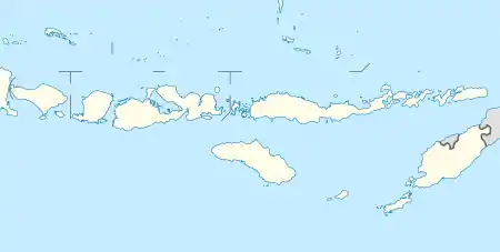 East Sumba Regency East Sumba Regency (Lesser Sunda Islands) 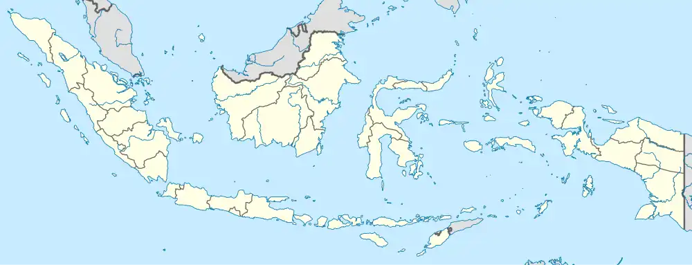 East Sumba Regency East Sumba Regency (Indonesia) | |
| Coordinates: 9.8833°S 120.2500°E | |
| Country | |
| Region | Lesser Sunda Islands |
| Province | |
| Capital | Waingapu |
| Government | |
| • Regent | Gidion Mbilijora |
| • Vice Regent | Umbu Lili Pekuwali |
| Area | |
| • Total | 7,000.5 km2 (2,702.9 sq mi) |
| Population (mid 2023 estimate) | |
| • Total | 255,498 |
| • Density | 36/km2 (95/sq mi) |
| [1] | |
| Time zone | UTC+8 (ICST) |
| Area code | (+62) 387 |
| Website | sumbatimurkab |
Administrative Districts
The East Sumba Regency is composed of twenty-two districts (kecamatan), whose areas (in km2) and populations at the 2010 Census[2] and 2020 Census[3] are listed below, together with the official estimates as at mid 2023.[1] The table also includes the locations of the district headquarters, the number of administrative villages in each district (totaling 140 rural desa and 16 urban kelurahan), and its postal code.
| Kode Wilayah | Name of District (kecamatan) | Area in km2 | Pop'n Census 2010 | Pop'n Census 2020 | Pop'n Estimate mid 2023 | Admin centre | No. of villages | Post code |
|---|---|---|---|---|---|---|---|---|
| 53.11.03 | Lewa | 281.1 | 15,423 | 15,404 | 15,736 | Pamati Karata | 8 (a) | 87150 |
| 53.11.04 | Nggaha Oriangu | 286.4 | 8,614 | 9,611 | 10,408 | Karipidita | 8 | 87155 |
| 53.11.18 | Lewa Tidahu | 322.1 | 6,129 | 6,826 | 7,195 | Laikeri | 6 | 87151 |
| 53.11.19 | Katala Hamu Lingu | 453.1 | 3,699 | 4,043 | 4,238 | Kombapari | 5 | 87152 |
| 53.11.05 | Tabandung | 514.4 | 8,301 | 9,051 | 9,481 | Malahar | 10 | 87160 |
| 53.11.06 | Pinupahar | 246.6 | 6,410 | 6,855 | 7,141 | Tawui | 6 | 87161 |
| 53.11.12 | Paberiwai | 199.7 | 5,619 | 6,221 | 6,546 | Kananggar | 7 | 87175 |
| 53.11.13 | Karera (b) | 334.6 | 7,365 | 7,668 | 7,925 | Nggongi | 7 | 87172 |
| 53.11.15 | Matawai La Pawu | 405.4 | 5,786 | 6,092 | 6,317 | Tanarara | 6 | 87174 |
| 53.11.14 | Kahaungu Eti | 475.1 | 8,214 | 8,725 | 9,071 | Kamanggih | 9 | 87171 |
| 53.11.22 | Mahu | 196.6 | 3,922 | 4,119 | 4,268 | Wairara | 6 | 87170 |
| 53.11.21 | Ngadu Ngala | 207.9 | 4,787 | 5,047 | 5,236 | Praiwitu | 5 | 87172 |
| 53.11.10 | Pahunga Lodu | 349.8 | 12,247 | 13,066 | 13,601 | Ngala | 8 | 87182 |
| 53.11.11 | Wula Waijelu | 221.3 | 6,902 | 7,636 | 8,033 | Wula | 7 | 87183 |
| 53.11.09 | Rindi | 366.5 | 9,070 | 9,628 | 10,007 | Tanaraing | 8 | 87181 |
| 53.11.08 | Umalulu | 307.9 | 16,251 | 17,667 | 17,987 | Melolo | 10 (c) | 87180 |
| 53.11.07 | Pandawai | 412.6 | 14,776 | 17,298 | 18,498 | Kawangu | 7 (d) | 87176 |
| 53.11.17 | Kambata Mapambuhang | 412.7 | 3,434 | 3,822 | 4,028 | Lukuwingir | 8 | 87171 (e) |
| 53.11.01 | Kota Waingapu | 73.8 | 35,142 | 35,856 | 36,841 | Waingapu | 7 (f) | 87111-87116 |
| 53.11.16 | Kambera | 52.0 | 31,137 | 33,466 | 34,911 | Pakukinjara | 8 (g) | 87113-87116 |
| 53.11.02 | Haharu | 601.5 | 5,586 | 6,248 | 6,594 | Rambangaru | 10 | 87153 |
| 53.11.20 | Kanatang | 279.4 | 8,918 | 10,271 | 10,932 | Temu | 7 (h) | 87154 |
| Totals | 7,000.5 | 227,732 | 244,820 | 255,498 | Waingapu | 156 |
Note: (a) includes the kelurahan of Lewa Paku. (b) includes islands off the south of Sumba Island, the largest being Pulau Halura, Pulau Manggudu and Pulau Koatak. (c) includes the kelurahan of Lumbukore.
(d) includes the 2 kelurahan of Kawangu and Watumbaka. (e) except village of Lukuwingir (which has a postcode of 87116).
(f) comprises 4 kelurahan (Hambala, Kamalaputi, Kambajawa and Matawai) and 3 desa.
(g) comprises 7 kelurahan (Kambaniru, Lai Mbonga, Lambanapu, Malumbi, Mau Hau, Prailiu and Wangga) and 1 desa.
(h) includes the kelurahan of Temu.
Airport
Umbu Mehang Kunda Airport, formerly known as Mau Hau Airport, is situated east of Waingapu near the mouth of the Kambaniru River. It has a 6,070-ft (1,850 metres) long runway with 98-ft (30 metres) width, which can accommodate Boeing 737-300 aircraft. The airport inaugurated a new terminal in 2016 which has been able to improve the passenger services compared with the previous old terminal.
References
- Badan Pusat Statistik, Jakarta, 28 February 2024, Kabupaten Sumba Timur Dalam Angka 2024 (Katalog-BPS 1102001.5311)
- Biro Pusat Statistik, Jakarta, 2011.
- Badan Pusat Statistik, Jakarta, 2021.
Regencies and cities of East Nusa Tenggara | ||
|---|---|---|
Capital: Kupang | ||
| Regencies |
|  |
| Cities | ||