Escautpont
Escautpont (French pronunciation: [ekopɔ̃]; West Flemish: Schledebrug[3]) is a commune in the Nord department in northern France.[4]
Escautpont | |
|---|---|
 The church square in Escautpont | |
_Nord-France.svg.png.webp) Coat of arms | |
Location of Escautpont | |
 Escautpont 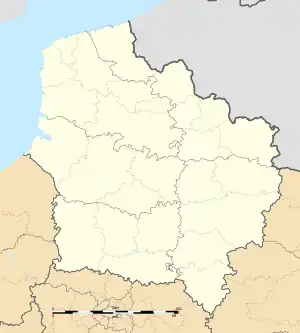 Escautpont | |
| Coordinates: 50°25′30″N 3°33′32″E | |
| Country | France |
| Region | Hauts-de-France |
| Department | Nord |
| Arrondissement | Valenciennes |
| Canton | Anzin |
| Intercommunality | CA Porte du Hainaut |
| Government | |
| • Mayor (2020–2026) | Joëlle Legrand[1] |
| Area 1 | 5.78 km2 (2.23 sq mi) |
| Population (2021)[2] | 4,152 |
| • Density | 720/km2 (1,900/sq mi) |
| Time zone | UTC+01:00 (CET) |
| • Summer (DST) | UTC+02:00 (CEST) |
| INSEE/Postal code | 59207 /59278 |
| Elevation | 17–41 m (56–135 ft) (avg. 28 m or 92 ft) |
| 1 French Land Register data, which excludes lakes, ponds, glaciers > 1 km2 (0.386 sq mi or 247 acres) and river estuaries. | |
Name
Escautpont is the bridge (pont in French) over the Escaut (Scheldt river). Named in antiquity Scaldis Pons (same meaning in Latin) because there was, at this place, the only bridge on the Scheldt.
Population
| Year | Pop. | ±% p.a. |
|---|---|---|
| 1968 | 5,757 | — |
| 1975 | 5,234 | −1.35% |
| 1982 | 4,742 | −1.40% |
| 1990 | 4,327 | −1.14% |
| 1999 | 4,202 | −0.33% |
| 2007 | 4,210 | +0.02% |
| 2012 | 4,186 | −0.11% |
| 2017 | 4,192 | +0.03% |
| Source: INSEE[5] | ||
Heraldry
Arms of Escautpont |
The arms of Escautpont are blazoned : Azure, semy de lys Or. = France Ancient (Ansacq, Brillon, Escaudain, Escautpont, Hélesmes, Hérin, Lecelles, Lieu-Saint-Amand, Lourches, Neuville-sur-Escaut, Rosult, Rumegies and Wignehies use the same arms.)
|
See also
References
- "Répertoire national des élus: les maires" (in French). data.gouv.fr, Plateforme ouverte des données publiques françaises. 13 September 2022.
- "Populations légales 2021". The National Institute of Statistics and Economic Studies. 28 December 2023.
- "Villes et villages | CRGFA".
- INSEE commune file
- Population en historique depuis 1968, INSEE
Wikimedia Commons has media related to Escautpont.
This article is issued from Wikipedia. The text is licensed under Creative Commons - Attribution - Sharealike. Additional terms may apply for the media files.