European route E105
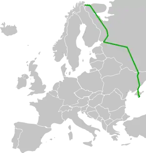
E105 is part of the International E-road network, which is a series of main roads in Europe. It is a north–south reference road, meaning it crosses Europe from north to south, and other E-road numbers have been calculated based on these reference roads.
 | |
|---|---|
 | |
| Route information | |
| Length | 3,770 km (2,340 mi) |
| Major junctions | |
| North end | Kirkenes, Norway |
| South end | Yalta, Crimea (disputed) |
| Location | |
| Countries | |
| Highway system | |
Description
E105 starts from Hesseng, (just south of Kirkenes), Norway and runs along Russia's R21, M10, M2: Ukraine's M20, M29, and M18 to Yalta, Crimea (Russian-occupied territory of Ukraine). Russians call this the Crimea Highway (Крымское шоссе), and de facto officially marked Republic of Crimea section as 35А-002.
Route
 R 21: border with Norway - Pechenga - Murmansk - Petrozavodsk - Saint Petersburg
 M 10: Saint Petersburg - Veliky Novgorod - Tver - Moscow
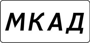 MKAD: within Moscow
 M 2: Moscow - Tula - Oryol - Kursk - Belgorod - border with Ukraine
 M 20: border with Russia - Kharkiv (
 E40)
E40) M 18: Kharkiv - Hubynykha - Zaporizhia - Melitopol
![]() Crimea (disputed between
Crimea (disputed between ![]() Russia/
Russia/![]() Ukraine)
Ukraine)
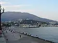
- 35A-002/ M 18: Dzhankoy (
 E97) - Simferopol - Alushta - Yalta
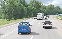
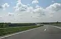
On the way from Saint Petersburg to Moscow, in the suburbs of Veliky Novgorod. Except near the big cities, the highway is basically a two-lane highway (one lane for each direction), with an occasional third center lane for passing or left turn near the crossing.
Gallery
External links
Wikimedia Commons has media related to E 105.
|  | |
| ||
This article is issued from Wikipedia. The text is licensed under Creative Commons - Attribution - Sharealike. Additional terms may apply for the media files.