Fournet-Blancheroche
Fournet-Blancheroche (French pronunciation: [fuʁnɛ blɑ̃ʃʁɔʃ]) is a commune in the Doubs department in the Bourgogne-Franche-Comté region in eastern France.
Fournet-Blancheroche | |
|---|---|
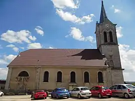 The church in Fournet-Blancheroche | |
Location of Fournet-Blancheroche | |
 Fournet-Blancheroche 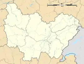 Fournet-Blancheroche | |
| Coordinates: 47°10′07″N 6°49′36″E | |
| Country | France |
| Region | Bourgogne-Franche-Comté |
| Department | Doubs |
| Arrondissement | Montbéliard |
| Canton | Maîche |
| Government | |
| • Mayor (2020–2026) | Pierre-Jean Wycart[1] |
| Area 1 | 13.08 km2 (5.05 sq mi) |
| Population (2021)[2] | 350 |
| • Density | 27/km2 (69/sq mi) |
| Time zone | UTC+01:00 (CET) |
| • Summer (DST) | UTC+02:00 (CEST) |
| INSEE/Postal code | 25255 /25140 |
| Elevation | 574–1,031 m (1,883–3,383 ft) |
| 1 French Land Register data, which excludes lakes, ponds, glaciers > 1 km2 (0.386 sq mi or 247 acres) and river estuaries. | |
Population
| Year | Pop. | ±% |
|---|---|---|
| 1962 | 174 | — |
| 1968 | 232 | +33.3% |
| 1975 | 223 | −3.9% |
| 1982 | 215 | −3.6% |
| 1990 | 224 | +4.2% |
| 1999 | 256 | +14.3% |
| 2008 | 338 | +32.0% |
| 2012 | 347 | +2.7% |
See also
References
- "Répertoire national des élus: les maires". data.gouv.fr, Plateforme ouverte des données publiques françaises (in French). 2 December 2020.
- "Populations légales 2021". The National Institute of Statistics and Economic Studies. 28 December 2023.
Wikimedia Commons has media related to Fournet-Blancheroche.
This article is issued from Wikipedia. The text is licensed under Creative Commons - Attribution - Sharealike. Additional terms may apply for the media files.